Assessing stability before and during a tornadic outbreak
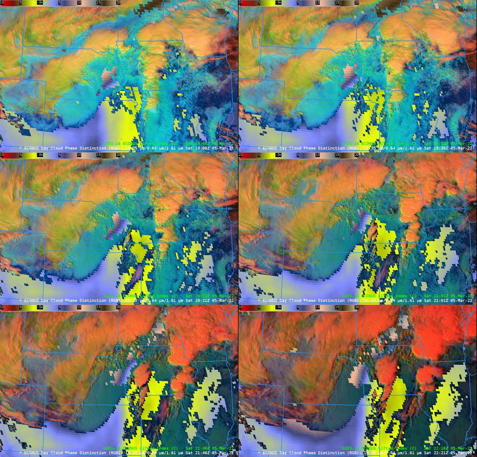
SPC (The Storm Prediction Center) issued a Convective Outlooks on 5 March 2022 (1630 UTC; 2000 UTC) showing an Enhanced Risk of Severe Weather over portions of southern Iowa. Preliminary Storm Reports for the day (link) showed tornadoes south of a line from southwestern Iowa to near Des Moines, starting near 2100 UTC. The animation above shows the Day Cloud Phase Distinction RGB and the derive Lifted Index as very strong convection (ultimately tornadic) develops over southwestern Iowa in a region where Lifted Index values are near -4.
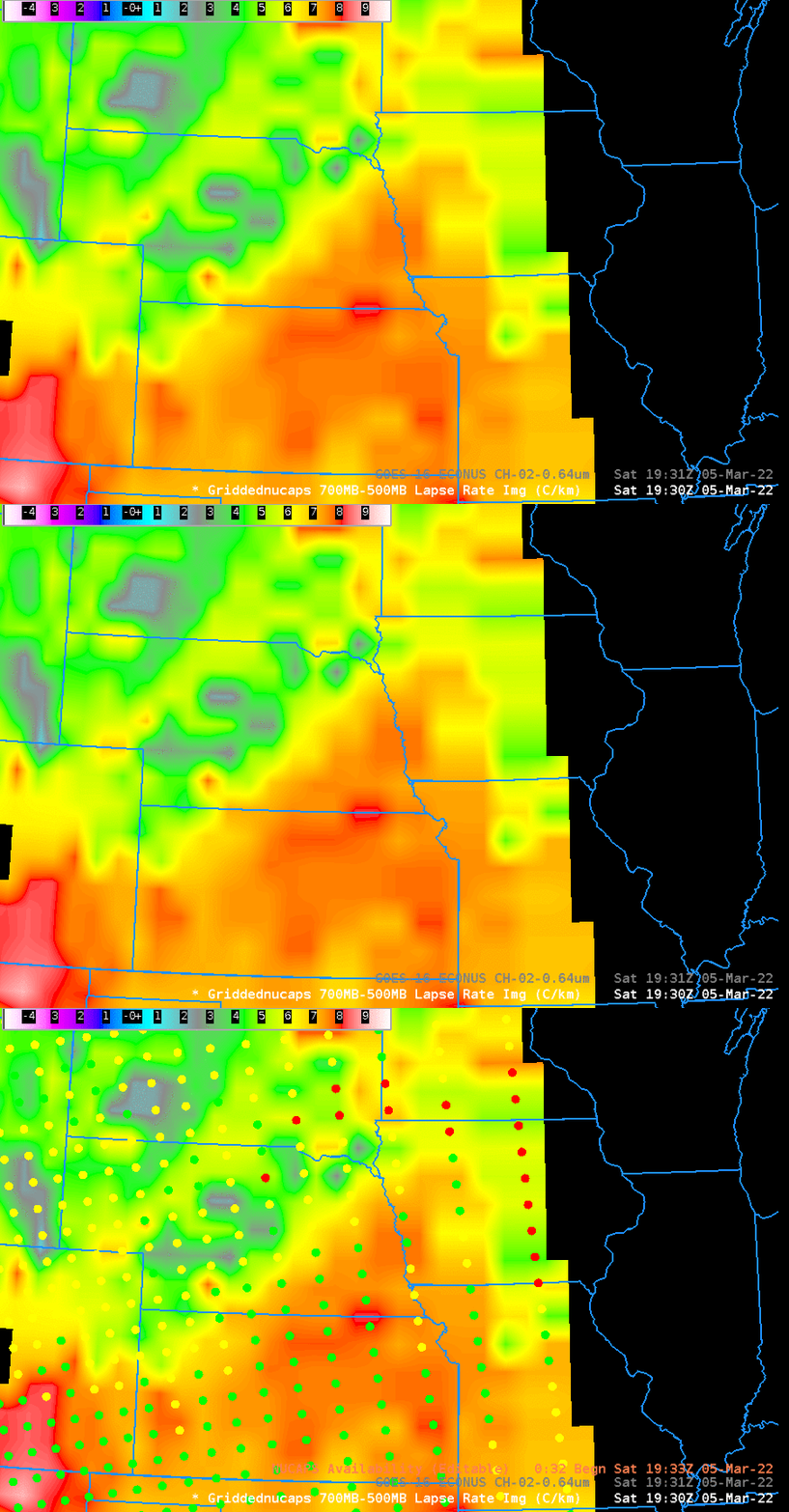
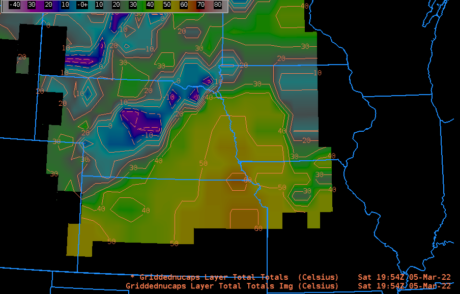
NOAA-20 overflew the region of convective initiation at around 1930 UTC. Mid-tropospheric lapse rates (700-500 mb) are below. The stability diagnosis shows an unstable atmosphere. A diagnosis of the Total Totals index shows very large values — >50 — over southwestern Iowa and eastern Kansas. Convection in this airmass is likely to be strong.
The instability over eastern Kansas was also measured with a special radionsonde launch from Topeka at 2000 UTC, and that radiosonde is compared to a NUCAPS profile (close to Topeka in space and in time) below. Some aspects of the two profiles are similar.

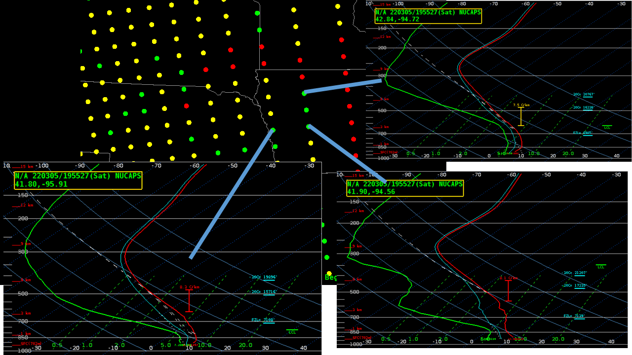
What do other NUCAPS profiles look like over Iowa? The image below shows NUCAPS sounding availability points, and also 3 profiles at the points indicated. Steepest mid-tropospheric lapse rates are in the southern part of the domain. Recall that tornadoes were south of a line from the southwest corner of Iowa to Des Moines.
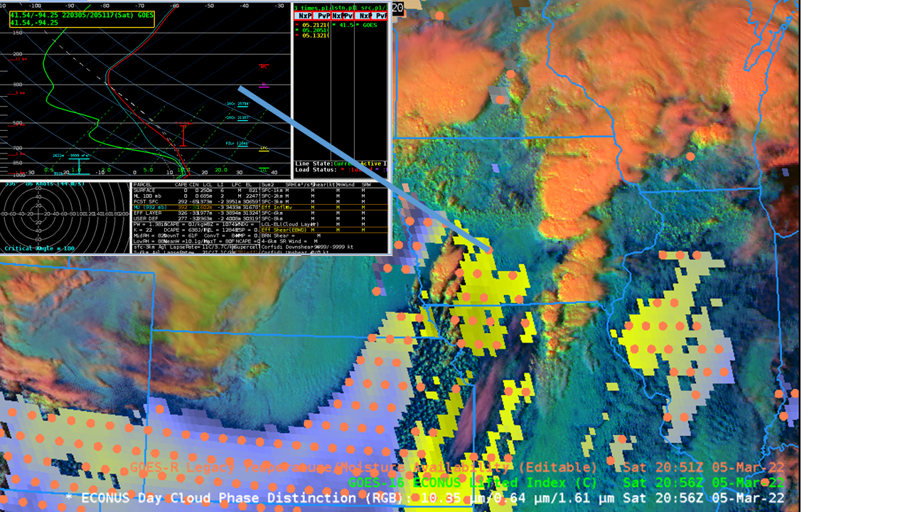
Legacy Atmospheric Profiles from GOES-16 are available at points, and a benefit is that they are produced every 30 minutes, so that changes in atmospheric stability with time can be monitored. (This profiling capability will be greatly enhanced with the sounder instrument scheduled to fly on GEO-XO). The single profile above documents a very steep mid-tropospheric lapse rate just to the south of Des Moines. That same profile (2051 UTC) and one at the same point 30 minutes later (2121 UTC) are shown below.

AWIPS imagery in this blog post was created using the NOAA/NESDIS TOWR-S AWIPS Cloud Instance.

