NUCAPS sounding associated with strong winds over the central United States
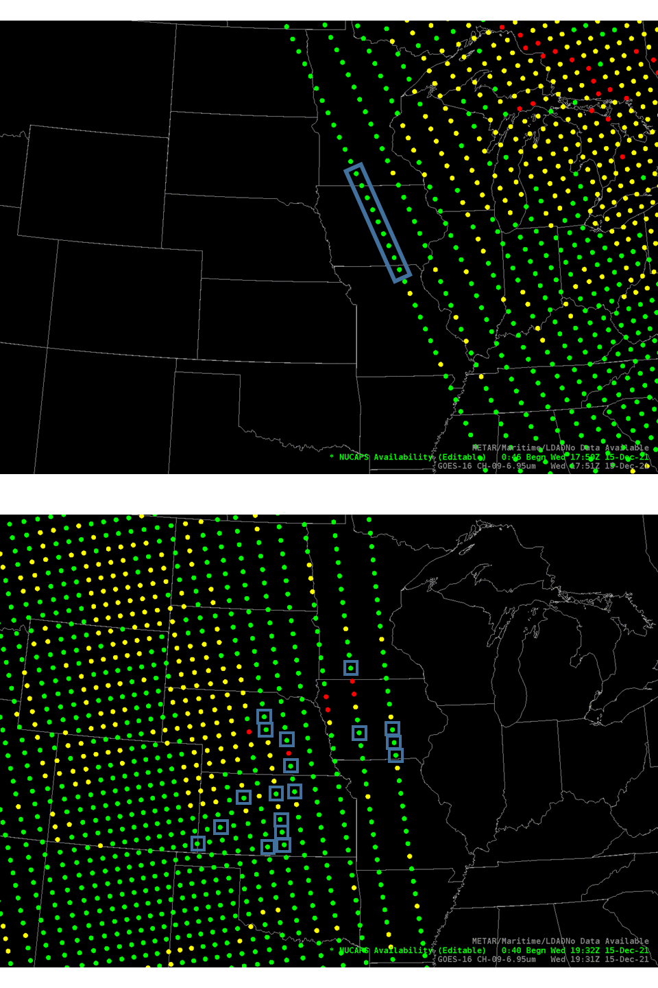
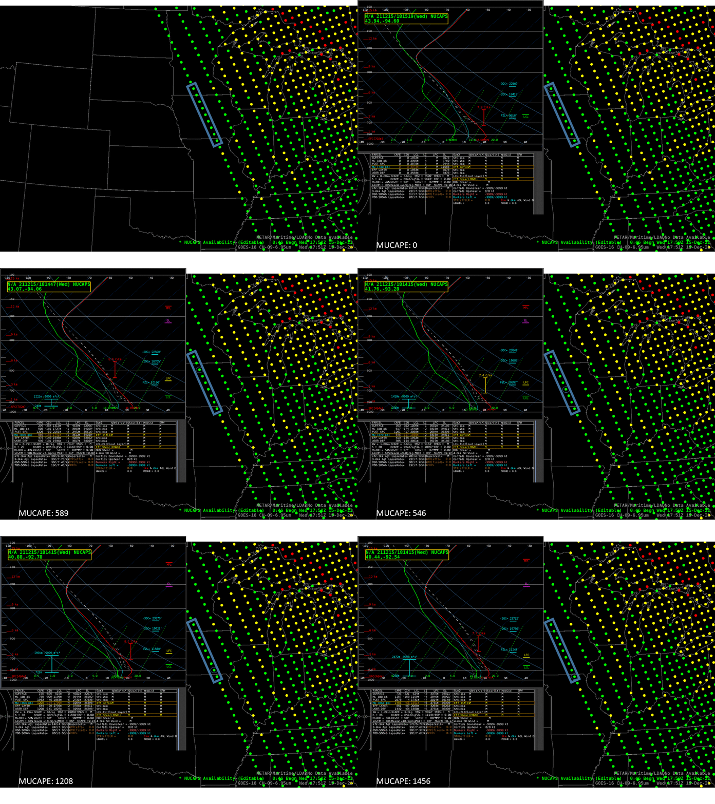
NOAA-20 overflew the central United States twice in the afternoon of 15 December 2021 (NOAA-20 orbits that day shown here, from this website) as a potent weather system moved through. SPC‘s Convective Outlook showed a Moderate Risk of severe weather (link); There was widespread wind damage on this day (link). How could NUCAPS soundings (available in AWIPS as demonstrated here) on that day assist in understanding the state of the atmosphere? The toggle above shows where NUCAPS profiles were available. Blue boxes highlight profiles that are shown below. Note right away that the NOAA-20 orbits on the 15th allowed for multiple samplings of the atmosphere at the northern edge of the Moderate Risk. The soundings along the western edge of the ca. 1800 UTC NOAA-20 NUCAPS pass, below, show steep mid-level lapse rates, and MUCAPE values (as diagnosed by NSharp in AWIPS) increasing to the south.
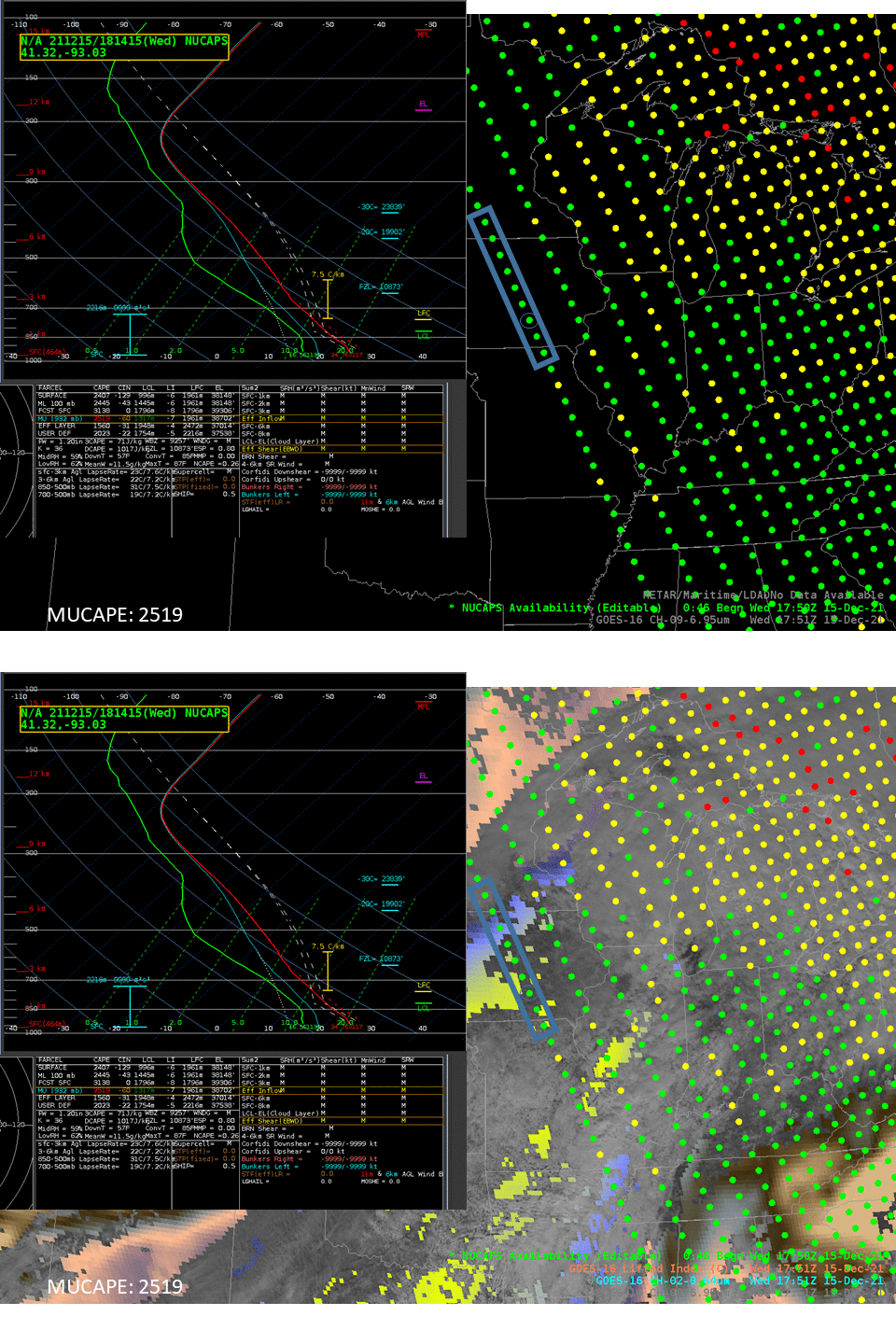
GOES-16 data can also be used to diagnose instability, and the Level 2 Product (Derived Stability Index) Lifted Index at 1751 UTC is shown below. The Level 2 product also shows stability decreasing to the south in Iowa. Keep in mind that southerly surface winds at this time (as shown in this visible image with surface observations in a toggle with the Dust RGB and NUCAPS Sounding Availability) were very strong with this dynamic system: advection could be very large.
Select vertical profiles from the subsequent NUCAPS swath shortly before 2000 UTC are shown below.

Several profiles in the animation above deserve special mention. The first two comparisons, below, compare profiles from the two overpasses.
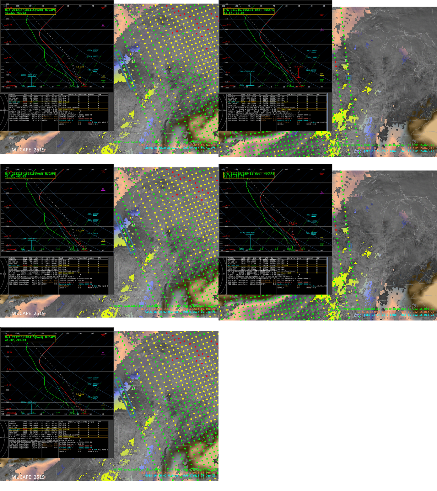
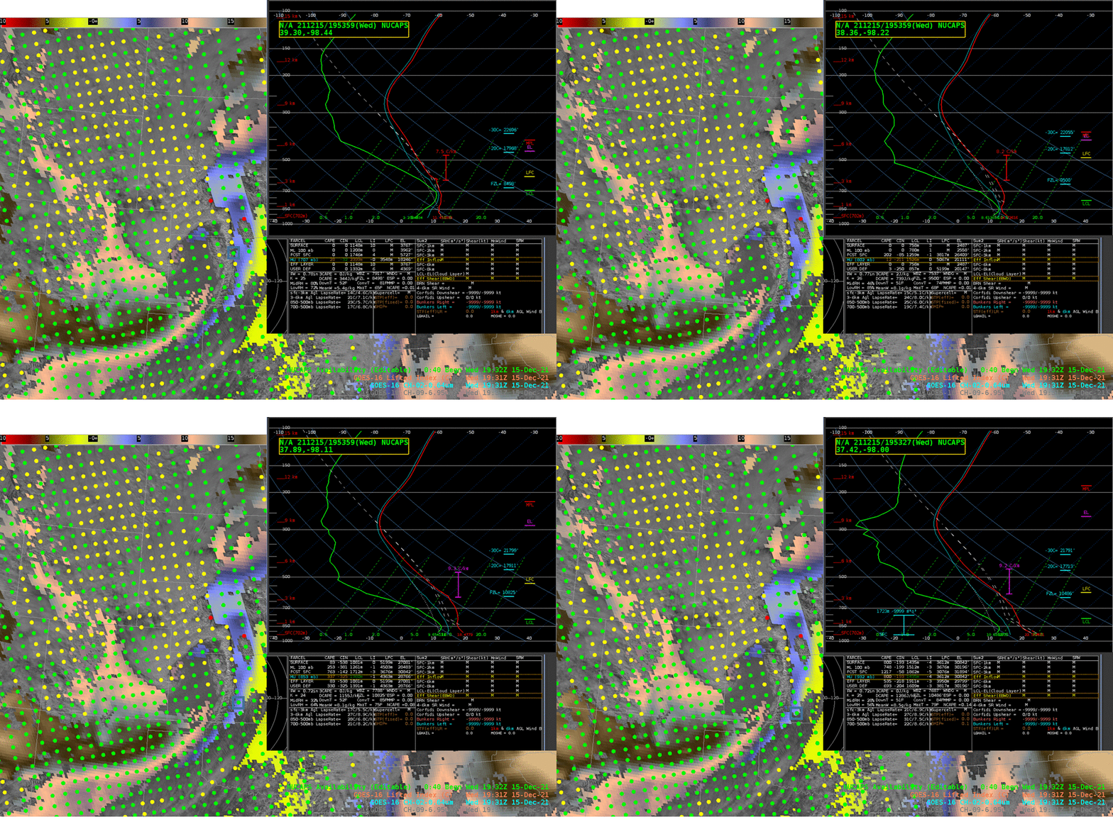
The sounding in southern Minnesota samples a region very close to a sounding location from 90 minutes earlier. The toggle below of sequential profiles shows a change in stability as diagnosed by NUCAPS. The mid-level lapse rate has steepened, and mid-level moisture has increased. Observations from sequential passes do not happen every day, but forecasters (north of about 41 N) can (and should!) take advantage of them, time permitting, when they do happen.

A similar comparison over southern Iowa is shown below, showing the ca. 1815 UTC profile first (the one with the highest diagnosed MUCAPE) toggled with two later adjacent profiles. Note how the mid-level lapse rates have destabilized in the later profiles
NUCAPS soundings that are in the moist air ahead of developing convection and within dry, dusty air behind the convective line at around 1953 UTC in Kansas are shown below. As with other soundings in the moist air, mid-level lapse rates show weak stability. The sounding closest to the developing convection shows abundant moisture in the lower troposphere. Soundings in the dusty air are very very dry : diagnosed total precipitable water is less than 0.3″. Visible imagery in the background image below shows the dusty air over western Kansas, it’s far more apparent in this toggle of visible imagery and the dust RGB at 1931 UTC!
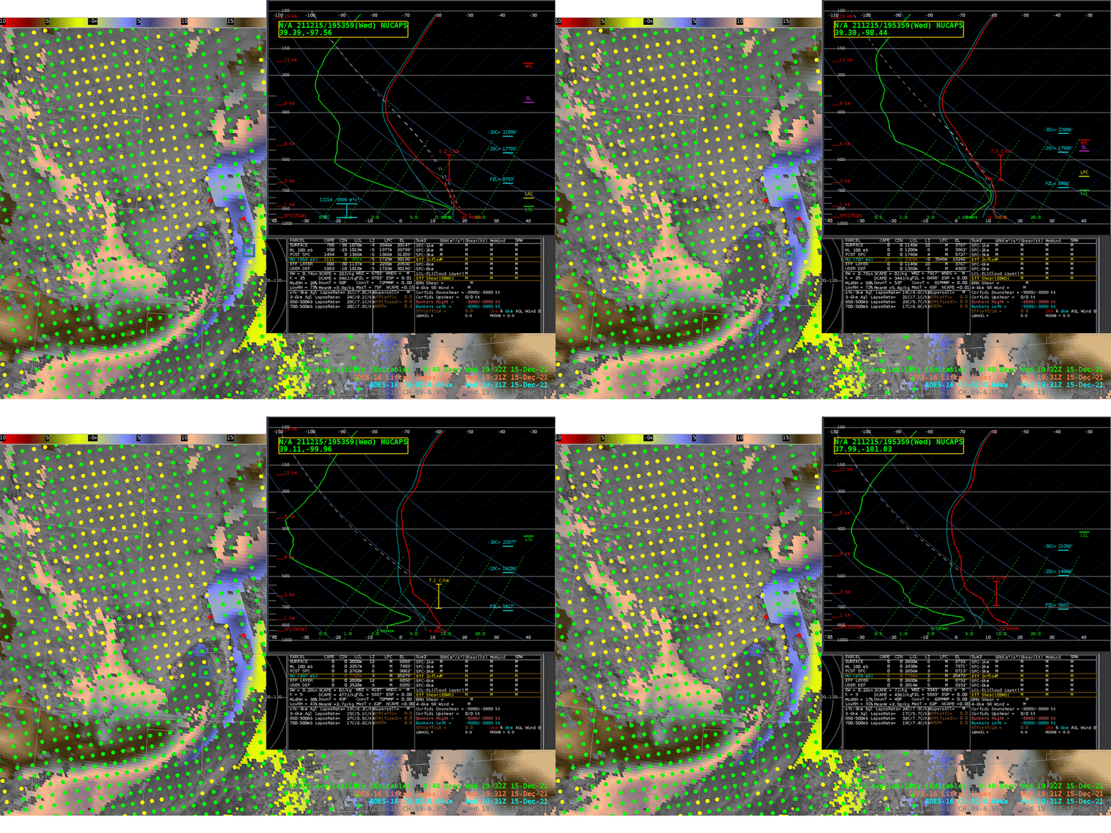
NUCAPS profiles over Kansas in front of the developing convection, below, show very steep lapse rates in the mid-troposphere! (Among the largest values this blogger has seen!) This suggests explosive development is possible if convection develops.
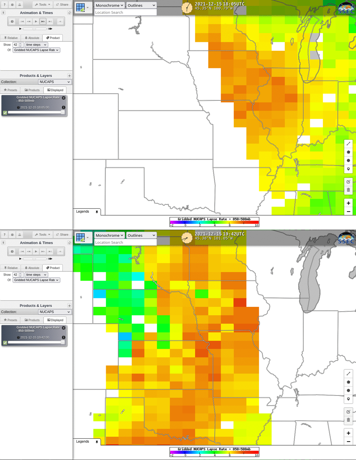
Gridded values of NUCAPS temperature and moisture (and of values derived from those fields) are available at this website. In addition, those values will shortly be available in RealEarth. Gridded 850-500 mb Lapse Rates derived from the two sequential NOAA-20 NUCAPS profiles are shown below. Much of the central/southern Plains has very low mid-tropospheric stability.
NUCAPS profiles give timely and independent estimates of atmospheric temperature and moisture in the mid-afternoon over the central United States; thus they are frequently useful for estimating convective potential.

