Antecedent lake-effect snow conditions over the Great Lakes

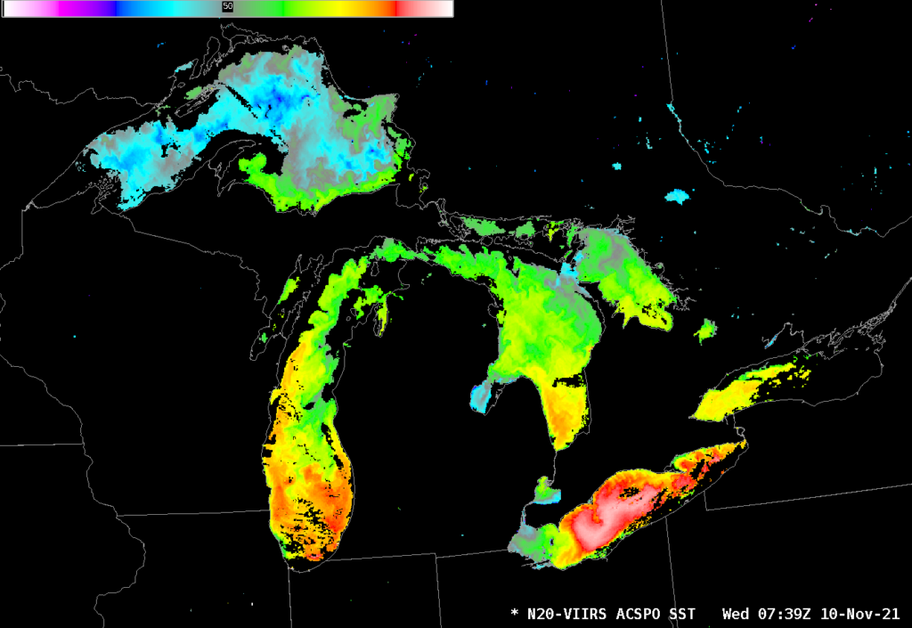
Clear skies in the early morning of 10 November 2021 allowed mapping of lake surface temperatures (LSTs) over the Great Lakes using the Advanced Clear-Sky Processor for Oceans (ACSPO) algorithm with VIIRS data acquired at the direct broadcast site at CIMSS. Surface values over Lake Superior, for example, were in the mid-40s (º Fahrenheit; the color bar ranges from 41º F to 59º F — 5º to 15º C); much of central Lake Erie is in the upper-50s! What do temperatures in the airmass poised to move over the Lakes look like?
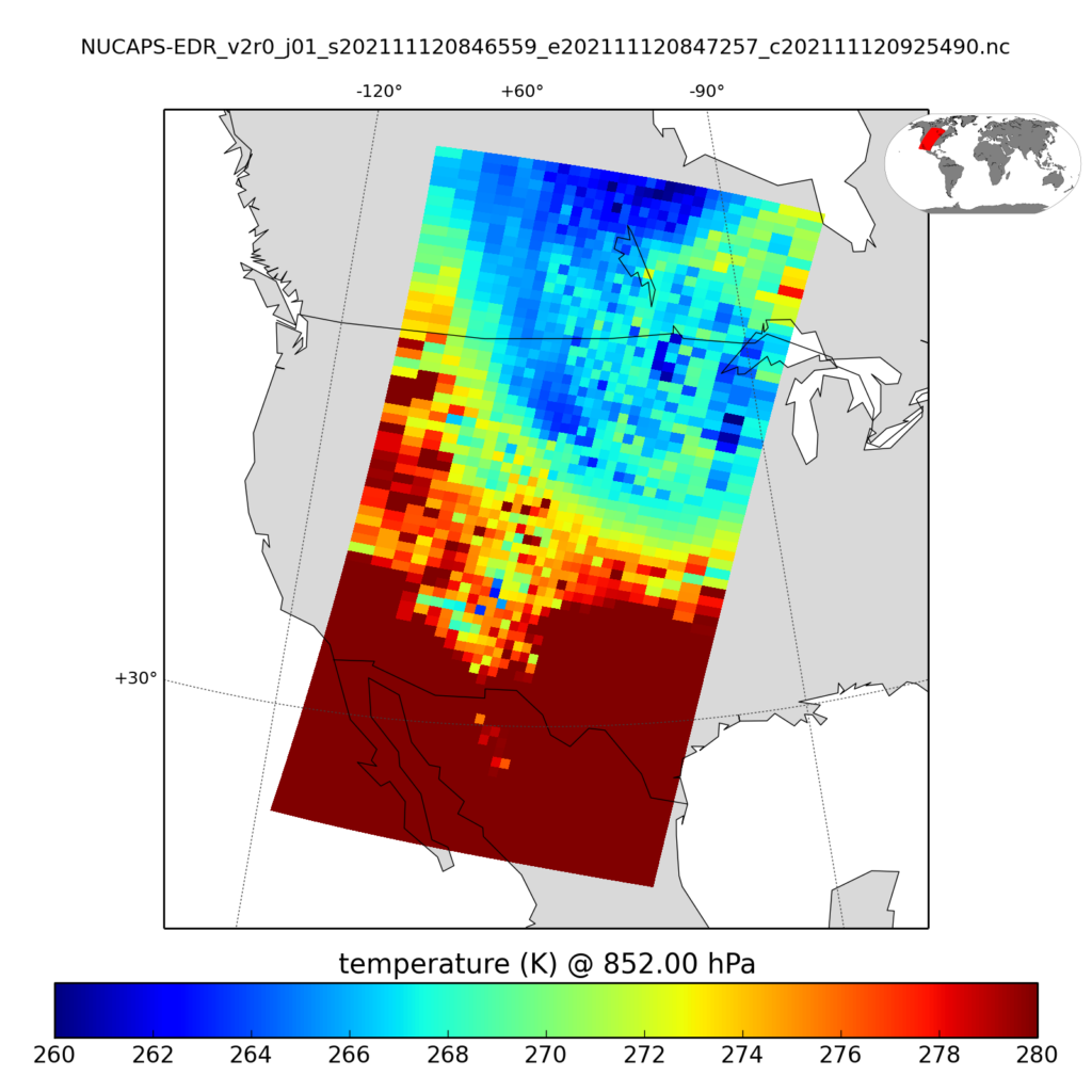
QuickLook software (from this site, with use described in this blog post) can be used with Direct Broadcast output of NUCAPS EDR data (in this directory, for example) to produce 852-mb temperature fields, as shown below. (You can routinely view fields of dewpoint, relative humidity and mixing ratio at 247, 496, 753 and 904 mb here, for example, as well). Minimum 850-mb temperatures as diagnosed by NUCAPS are around -10º to -13º C. A common-cited minimum temperature difference threshold between lake and 850 mb is 13º (Celsius) (as noted here and in many other places); certainly that is satisfied based on the ACSPO SSTs and the NUCAPS temperatures!

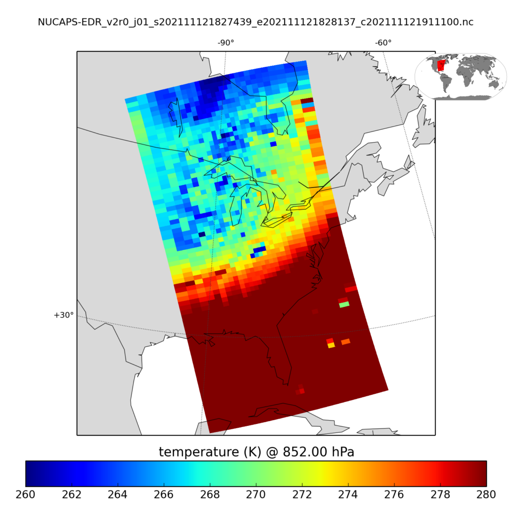
A similar image, below (produced about 90 minutes after the NOAA-20 overpass) also shows the cold air ready to overspread the Great Lakes.

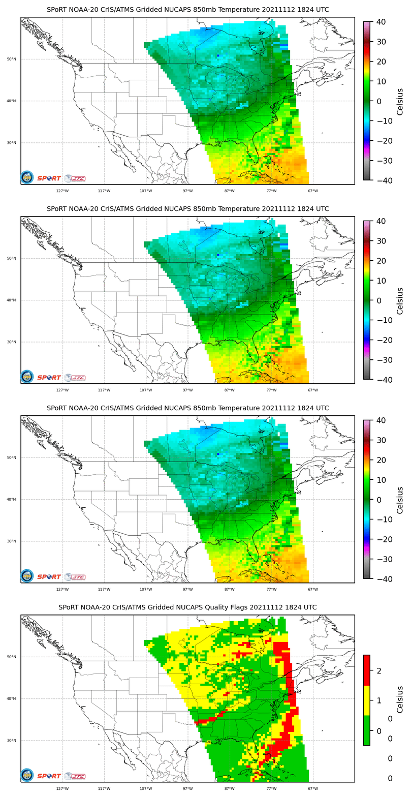
Gridded NUCAPS fields at 850 mb are also available at this site maintained by NASA SPoRT. The toggle below shows temperature at 850 mb and Quality Control Flags (yellow corresponds to regions where the infrared retrieval did not converge to a solution — but the microwave retrieval did) from the same afternoon overpass from NOAA-20 as shown above.

AWIPS-ready ACSPO SST fields are available to National Weather Service offices via LDM. Contact the blog author for details.

