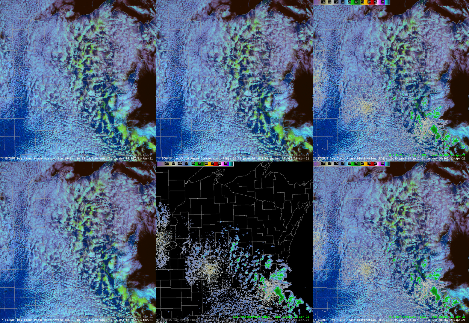
Showers over Wisconsin as viewed by GOES-16 Day Cloud Phase Distinction and Radar

GOES-16 Day Cloud Phase Distinction RGB with 0.5 Reflectivity (Great Lakes Mosaic), 1836 UTC on 21 April 2021 (Click to enlarge)
The animation above toggles through the 1836 UTC GOES-16 Day Cloud Phase Distinction RGB with and without a Great Lakes Radar Mosaic of 0.5-degree Reflectivity. There is an excellent correlation between green-tinted clouds in the RGB (signifying glaciated clouds) and radar echoes, so much so that it should be easy to say that clouds with the same color where radar data are missing, over north-central Wisconsin and the western Upper Peninsula, are also precipitating. This relationship between the RGB and radar echoes has been noted before (here, very notably; see Figure 6!), and is most useful in cases of convective development without overlaying cirrus clouds.
(Added: Some of the snow showers in the Fox River Valley of Wisconsin were high-impact, as shown in this video)
.@NWSMilwaukee #GOES16 Day Cloud Phase Distinction RGB images provided a nice display of the glaciating cloud tops producing the snow showers, as well as a NW-to-SE oriented band of fresh-but-quickly-melting snow cover (brighter shades of green): https://t.co/1Z94MniHWN #WIwx pic.twitter.com/6jaq92lxkn
— Scott Bachmeier (@CIMSS_Satellite) April 21, 2021

