Winter over the Great Lakes as viewed by VIIRS

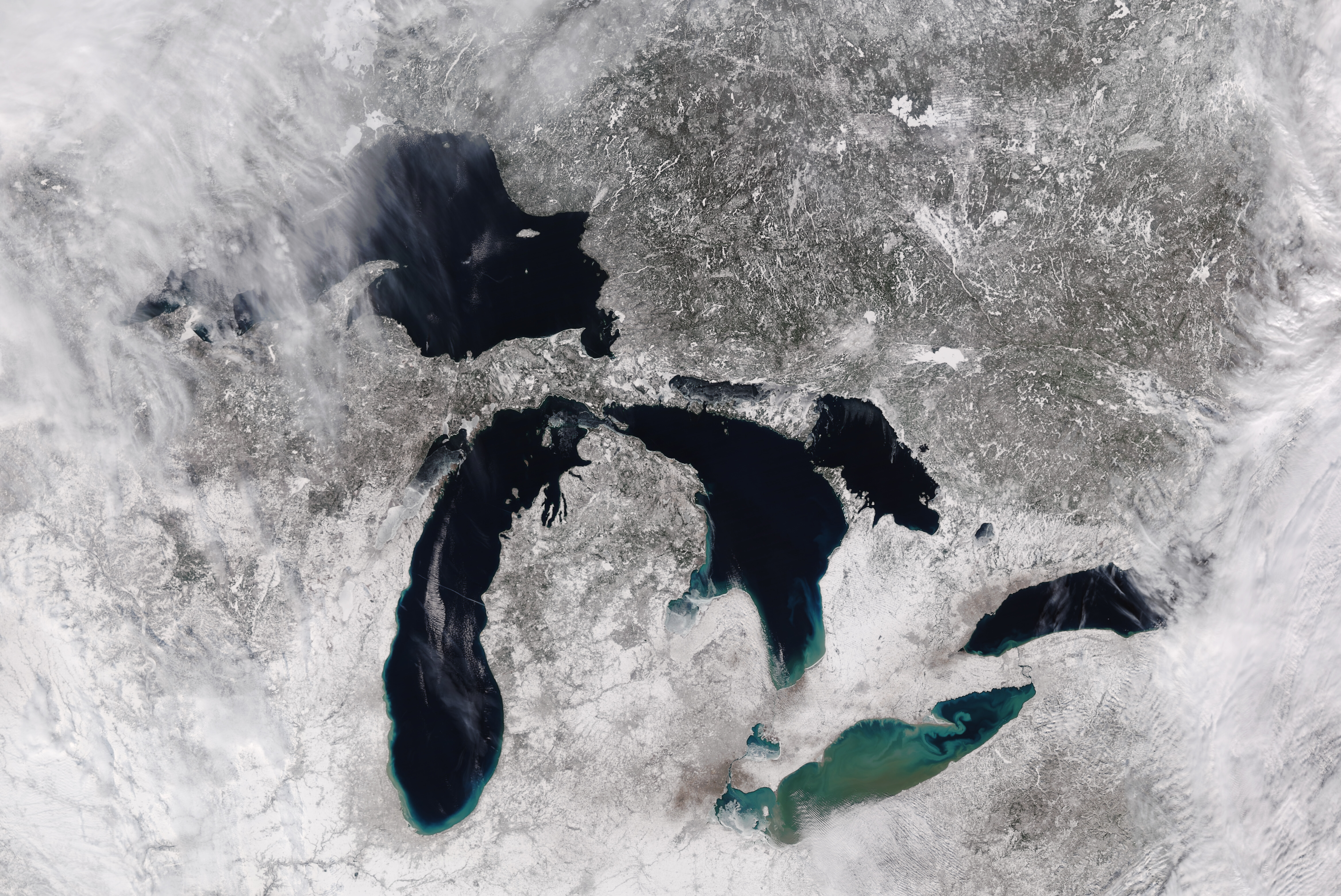
NOAA-20 VIIRS True-Color imagery over the Great Lakes, 1809 UTC on 3 February 2021 (Click to enlarge)
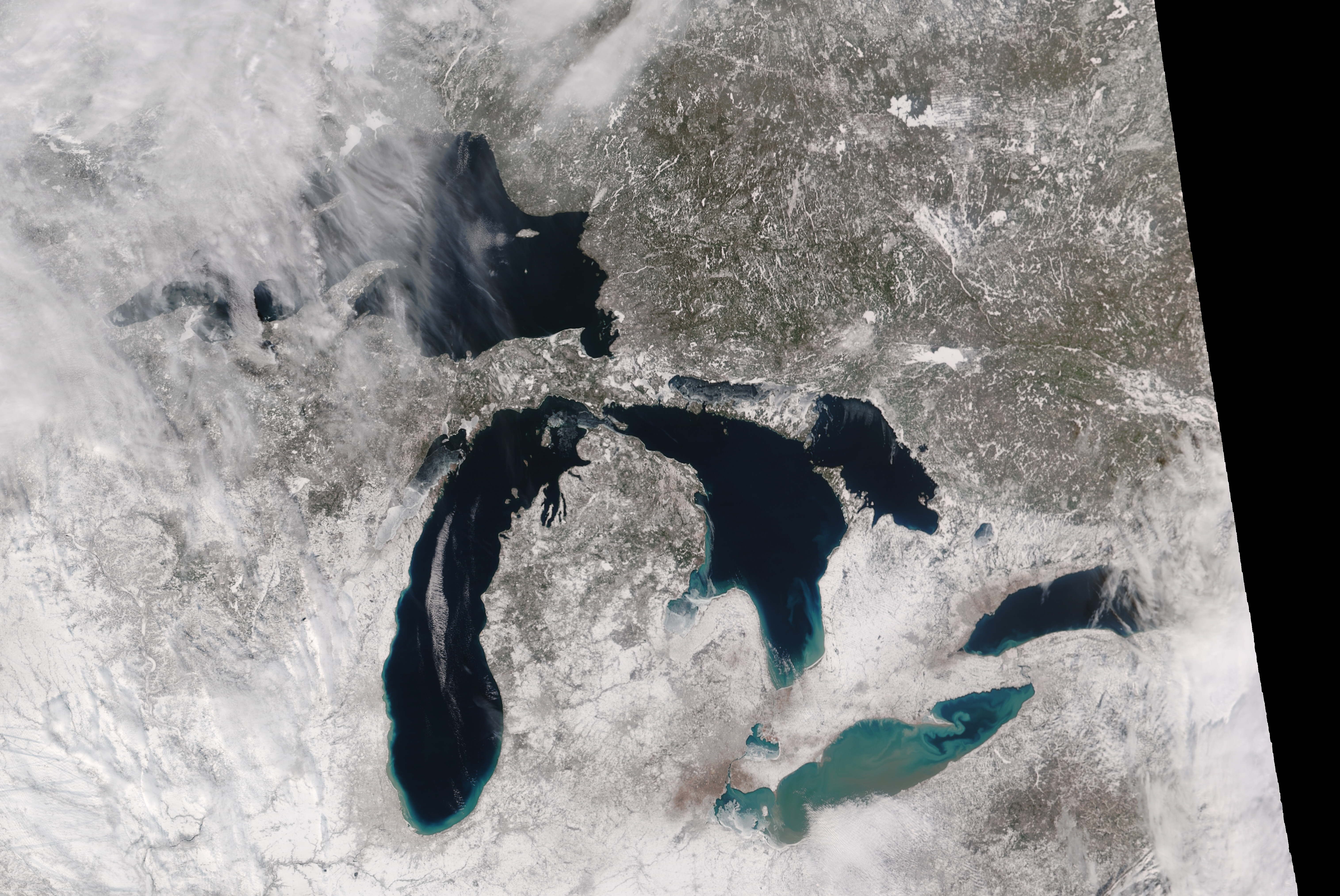
A rare, mostly clear day over the Great Lakes (and favorable orbital geometry) allowed NOAA-20, above, and Suomi-NPP, below, to image all 5 Great Lakes in one scene. These images were produced from data that were downloaded at the Direct Broadcast site at CIMSS and processed with CSPP and Polar2Grid; imagery is available at this link: ftp://ftp.ssec.wisc.edu/pub/eosdb. Although many bays appear ice covered (Green Bay in Lake Michigan, Saginaw Bay in Lake Huron, Chequamegon Bay in Lake Superior, there is otherwise a notable lack of ice in the lakes (the feature in central Lake Michigan is cloud). Current forecasts of sub-zero weather over the western Great Lakes by this coming weekend suggest an increase in ice cover is likely.

Suomi-NPP VIIRS True-Color imagery over the Great Lakes, 1859 UTC on 3 February 2021 (Click to enlarge)
The biggest difference between Lake Erie and the other lakes is color. Why is Lake Erie not a dark blue? Part of this is depth: Lake Erie is the shallowest of the Great Lakes. The browns and lighter blues are the result of sediment from both rivers and from white clay minerals along the northern shore of Lake Erie. Phytoplankton is also affecting the water color; not in the sense of an algal bloom, but a persistent algal presence (Click here for an estimate of Chlorophyll from 21 January, from this website). (Thanks to scientists at the Great Lakes node of NOAA’s Coast Watch — part of GLERL — for this explanation).
The (mostly) clear skies over the Lakes allowed for an estimate of Lake Surface Temperatures using VIIRS data and the ACSPO (Advanced Clear Sky Processor for Oceans) algorithm, shown below with colors representing temperatures from 32 to 41ºF (0 to 5º C). Portions of Lakes Michigan, Huron and Ontario (red and white in the color enhancement) show surface temperatures near 41ºF. Lakes Superior and Erie are relatively cooler. Much of central Lake Erie is near 35ºF (cyan in the enhancement); values in eastern Lake Erie are closer to 38ºF (yellow in the enhancement). Eastern Lake Superior also shows values in the upper 30s.


