VIIRS Today Website is live

VIIRS Today imagery from 3 August (Daytime, left, True Color [Bands 1, 4, 3 from VIIRS] and False Color [Bands 7, 2, 1 from VIIRS] from Suomi NPP; Day Night Band imagery from NOAA-20, right)
As with MODIS today, the USA is subdivided into 8 sectors, and imagery on a 2-km, 1-km and 250-m grid is provided, even though VIIRS’ best resolution at nadir is 375 m (and 750 m for the Day Night Band).
The images above show True-Color and False Color imagery from Suomi NPP on shortly after noon on 3 August over the northeast United States, along with Day Night Band Imagery from NOAA-20, also from (the early morning of) 3 August, shortly before the Full Moon.
VIIRS Today does have an archive going back several years. The website allows you to choose either Suomi-NPP or NOAA-20 data (links at the page will also show you today’s Suomi-NPP and NOAA-20 orbital passes), and you can view True Color Imagery (combining channels only in the visible part of the electromagnetic spectrum), False-Color Imagery (combining visible and near-infrared information) or (unique to VIIRS) Day Night Band Imagery. There is also a link to a webpage showing the Moon Phase.
The image below, downloaded from VIIRS Today, shows the NOAA-20 Day Night Band composite from the morning of 4 August 2020 (link).
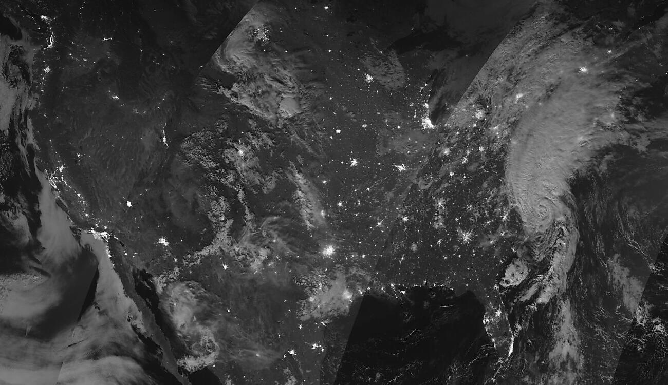
NOAA-20 Day Night Band image composite, 4 August 2020 (Click to enlarge)