The 3.9 µm channel at night over very cold cloud tops
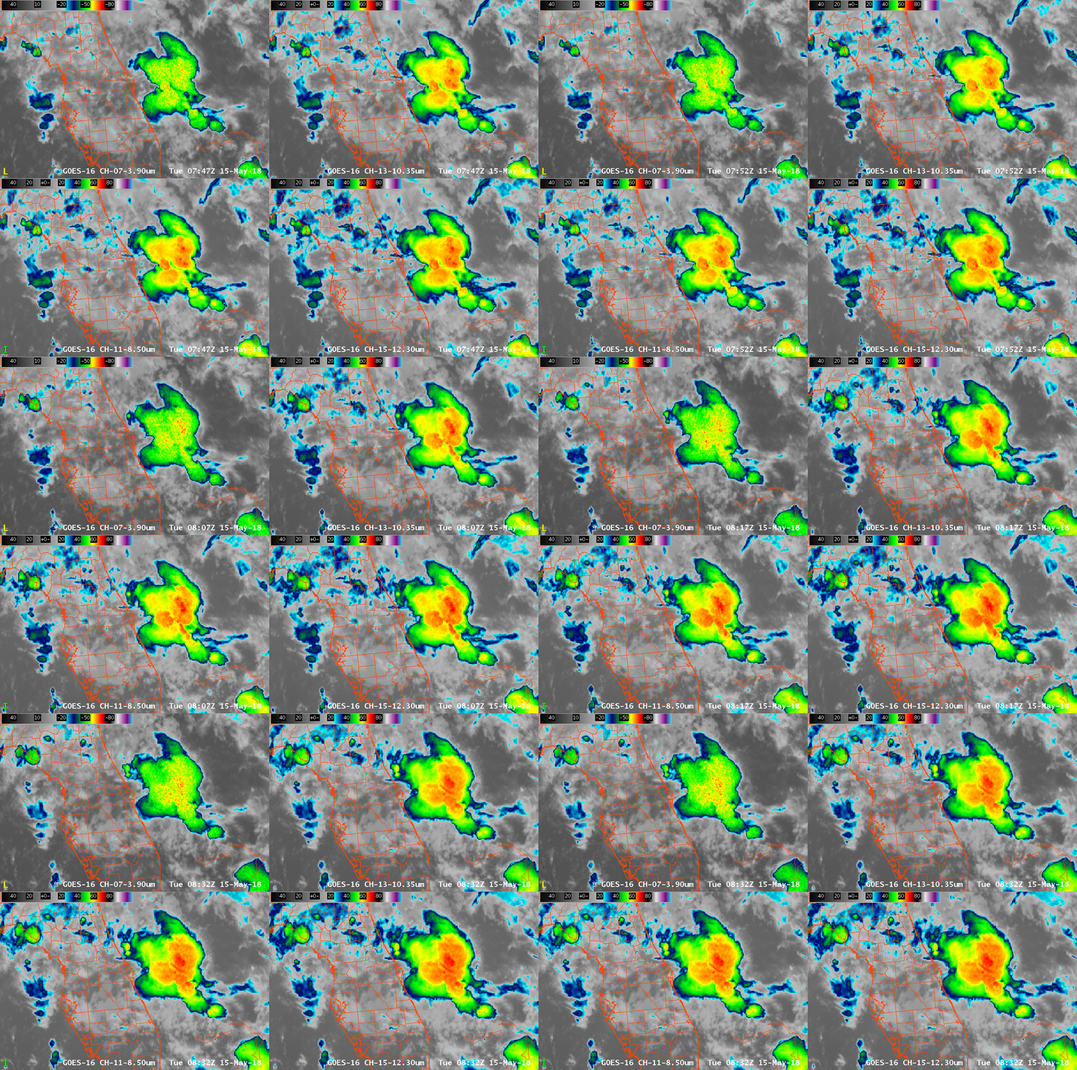
GOES-16 ABI Infrared Imagery from 3.9 µm (Upper Left), 10.3 µm (Upper Right), 8.5 µm (Lower Left) and 12.3 µm (Lower Right), 0747 – 0832 UTC on 15 May 2018 (Click to enlarge)
When cloud top temperatures are very cold, the 3.9 µm imagery will have characteristics that suggest a noisy signal. The 45-minute animation above shows a cold cloud top east of Florida in 4 different infrared channels: 3.9 µm (Upper Left), 10.3 µm (Upper Right), 8.5 µm (Lower Left) and 12.3 µm (Lower Right). That the 3.9 µm image shows noise is not a new problem, as it was present in legacy GOES imagery as explained here. At very cold temperatures the relationship between radiance (detected by the satellite) and temperature is highly non-linear, because of the character of the Planck function for that wavelength, meaning a very small change in radiance — within the noise — causes a large change in temperature (Compare the first two figures at this link for legacy GOES, for example).
Examine the two figures for GOES-16 below. They show the Planck curves for Band 14 (11.2 µm) and Band 7 (3.9 µm). Two things are apparent. Band 7 (3.9 µm), by design, covers a larger range of temperatures. In addition, very small changes in detected radiance (“counts”) at cold temperatures cause very big changes in the 3.9 µm brightness temperature. The relationship between detected radiance and very cold temperatures is much smoother at 11.2 µm. The 3.9 µm band lacks precision compared to the other window channels, such as the 11.2 µm, for very cold temperatures.
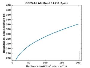
Plot of discrete values of Radiance vs. 11.2 µm brightness temperatures (190 K to 420 K) according to the Planck Relationship (Click to enlarge)
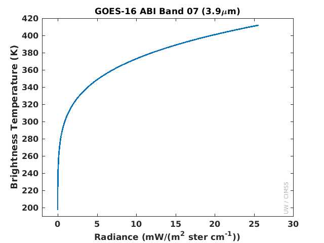
Plot of discrete values of Radiance vs. 3.9 µm brightness temperatures (190 K to 420 K) according to the Planck Relationship (Click to enlarge)
A zoomed-in view for cold brightness temperatures between 190 and 230 K (-83.15º C to -43.15º C) is shown below. If a true temperature of 208 K is being sensed by the satellite at the two wavelengths, it will be well-resolved at 11.2 µm, but the 3.9 µm detection will jump between 205 K and 210 K: the nature of the relationship between radiance and brightness temperature is such that there is less precision at the colder end at 3.9 µm. In the 30 K range from 197-227 K, just 12 possible bits are available in the 3.9 µm band (12 out of 2^14 — 16,384; recall that Band 7 on ABI has the highest bit depth of all the channels). A change of just one count is a large difference in 3.9 µm brightness temperature.
Users need smarter ways to enhance the coldest 3.9 µm to prevent the flashing pixels evident in common traditional color and black-and-white enhancements. Consider creating a color enhancement that shows only one color at temperatures colder than, say, -40º C, because the detector does not precisely distinguish between the coldest temperatures. In other words, don’t highlight the noise! Conversely, don’t use the 3.9 µm imagery at night to discern cloud-top features. During the day, solar radiation at 3.9 µm reflected off cloud tops causes an increase in apparent brightness temperature so this quantization noise does not occur.
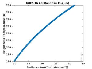
Plot of discrete values of Radiance vs. 11.2 µm brightness temperatures (190 K to 230 K) according to the Planck Relationship (Click to enlarge)
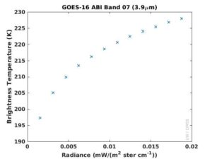
Plot of discrete values of Radiance vs. 3.9 µm brightness temperatures (190 K to 230 K) according to the Planck Relationship (Click to enlarge)
As noted above, this is not a new problem. An image (produced using McIDAS-X) of an Mesoscale Complex over the Great Plains of the United States from GOES-16 is here at 10.3 µm and here at 3.9 µm; the same image from GOES-15 is shown here at 10.7 µm and here at 3.9 µm. In both shortwave images, speckling at very cold cloud top temperatures is apparent.
(Thanks to Mat Gunshor, CIMSS, and Tim Schmit, NOAA, for figures and comments on this entry)

