GOES-16 views Thunderstorms in northern Minnesota
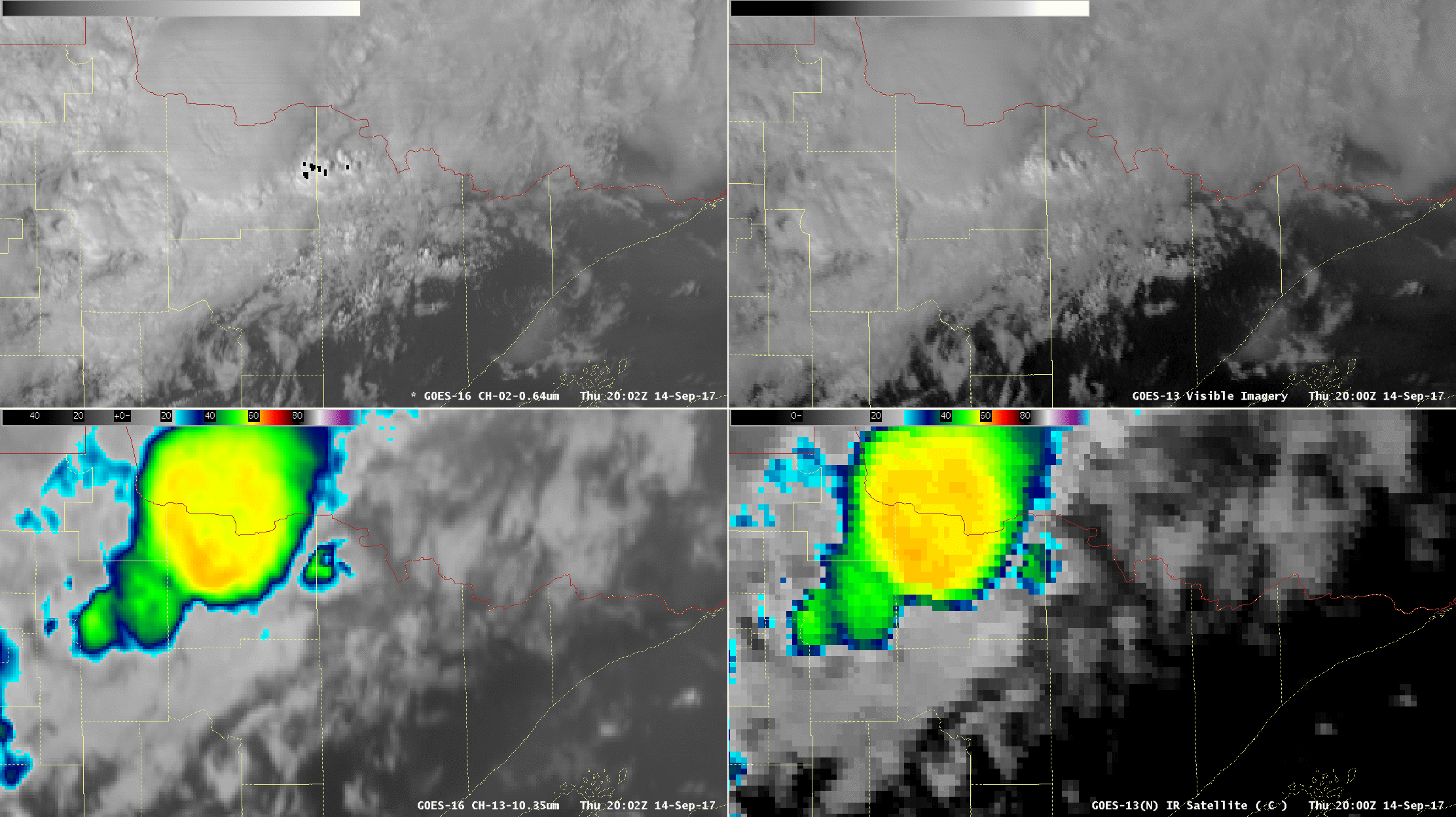
GOES-16 (left) and GOES-13 (right) views of thunderstorms over northern Minnesota. Top: Visible (0.64 µm) ; bottom (10.3 µm , left; 10.7 µm , right), 2000 UTC – 2350 UTC on 14 September (Click to animate)
GOES-16 data posted on this page are preliminary, non-operational and are undergoing testing
GOES-16 and GOES-13 animations of thunderstorms over northern Minnesota, above, courtesy Science and Operations Officer (SOO) Dan Miller from the Duluth National Weather Service Office, show how the superior spatial and temporal resolution of GOES-16 enhances the ability to monitor the evolution of storms. Not only are the individual cold overshooting tops much more apparent in the nominal 2-km resolution Infrared imagery of GOES-16 (lower left) (vs. 4-km for GOES-13 in the lower right), but their evolution is better captured by the 5-minute temporal cadence for GOES-16 (vs. 15-minute for GOES-13).
Visible (0.64 µm) imagery from GOES-16 (upper left) also has better spatial (nominally 0.5 km) resolution than GOES-13 (upper right, nominally 1 km). Note that the black points at the start of the animation in GOES-16 are regions of very high reflectivity that — for now — are incorrectly set to missing in AWIPS. Consider, for example, the visible signatures of the overshooting tops in GOES-13: are you certain you are tracking the same feature with the 15-minute time step? GOES-16 data show that overshoots can emerge and decay much more quickly than every 15 minutes!