Using GOES-16 Baseline Products to anticipate where heavy rain might fall

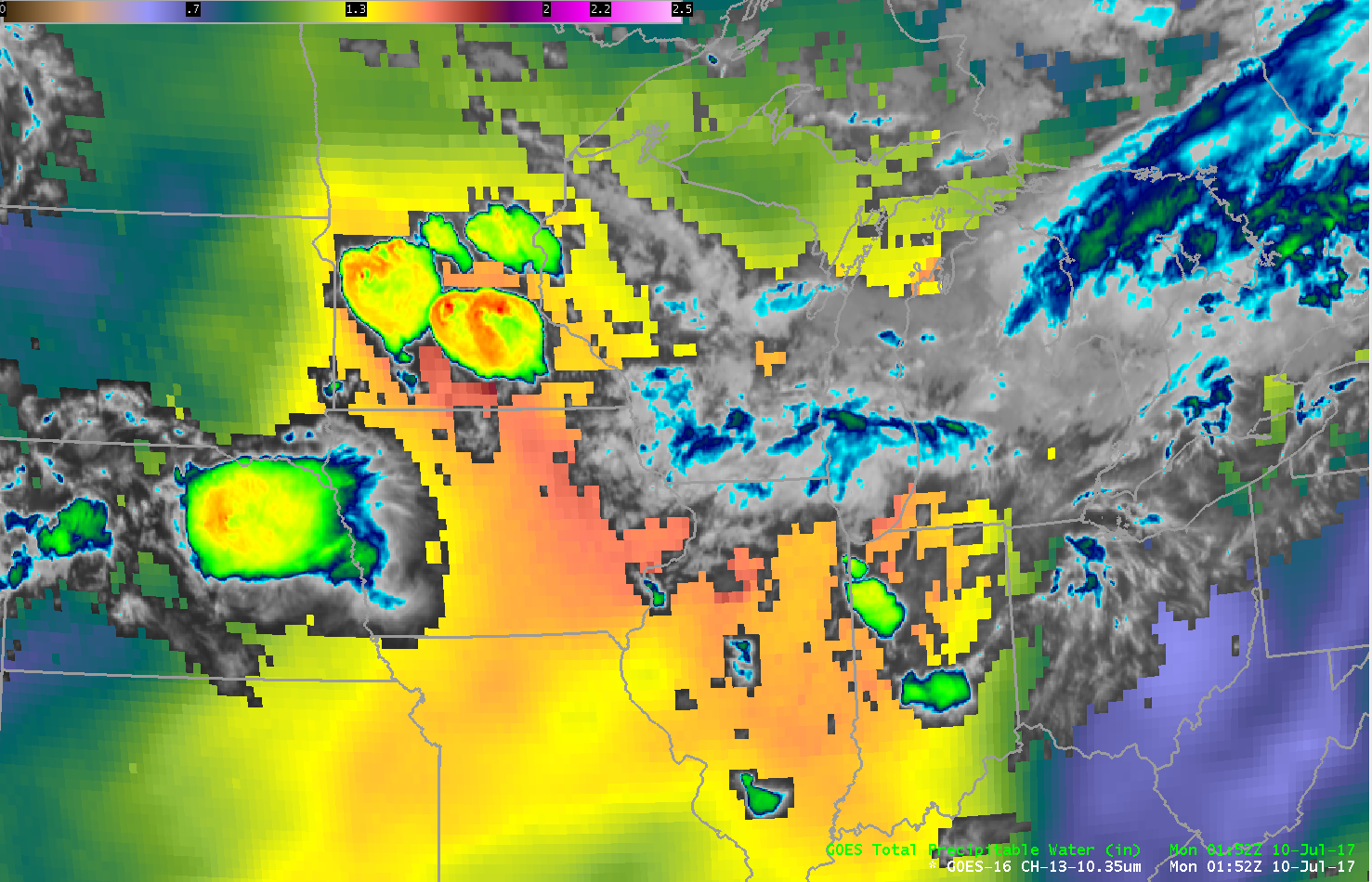
GOES-16 10.3 µm “Clean Window” Superimposed on the Clear-Sky Baseline Total Precipitable Water Product, 0107 – 1337 UTC on 10 July (Click to play large animated gif)
GOES-16 data posted on this page are preliminary, non-operational and are undergoing testing
Very heavy rain (4-5″) fell over parts of southwestern Wisconsin early on 10 July 2017 as a Mesoscale Convective System traversed the Upper Midwest (0831 UTC VIIRS Infrared vs Day/Night Band). The animation above blends the Clean Window (10.3 µm) from GOES-16 with the Total Precipitable Water Baseline Product (This product is available online — with a time delay — here). Note that the largest values of Precipitable Water are diagnosed to be over southern and western of Wisconsin. Looking at the animation of the 10.3 µm imagery, can you decide where the heaviest rain fell?
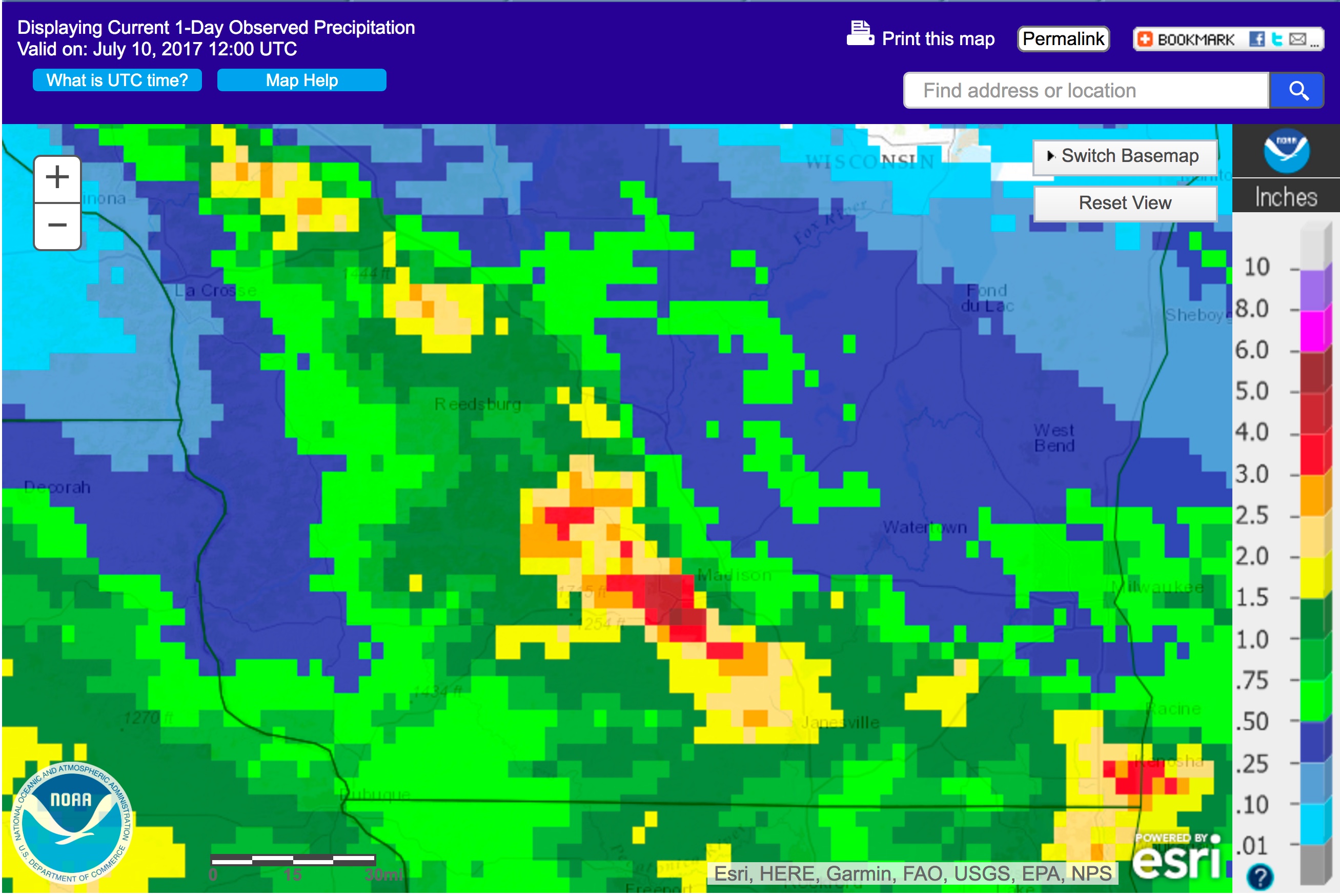
A screen capture from this website, below, shows 24-hour precipitation over the Upper Midwest, with a northwest-to-southeast oriented maximum near the northwest-to-southeast gradient of diagnosed total precipitable water field shown in the animation above. (This summary from the National Weather Service in Milwaukee shows accumulated precipitation ending at 0900 Central Time).
The Hazardous Weather Testbed at the Storm Prediction Center evaluates GOES-16 (and other satellites, such as Suomi NPP) products. There have been many instances that noted convection was most intense along the gradient of the moisture (See this summary, for example, or this one.) When GOES-16 Baseline Products indicate a gradient, pay close attention when strong convection develops upstream.
Added: One day later, again, convection initiated (and/or persisted) north of the diagnosed Total Precipitable Water maximum over Illinois and Iowa (link), i.e., in the gradient of Total Precipitable Water.


