GOES-16 Resolution in southern Canada with AWIPS
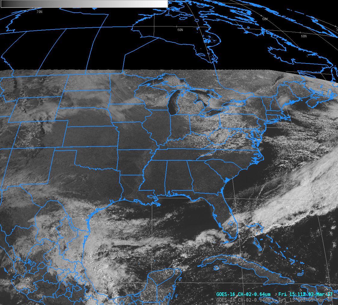
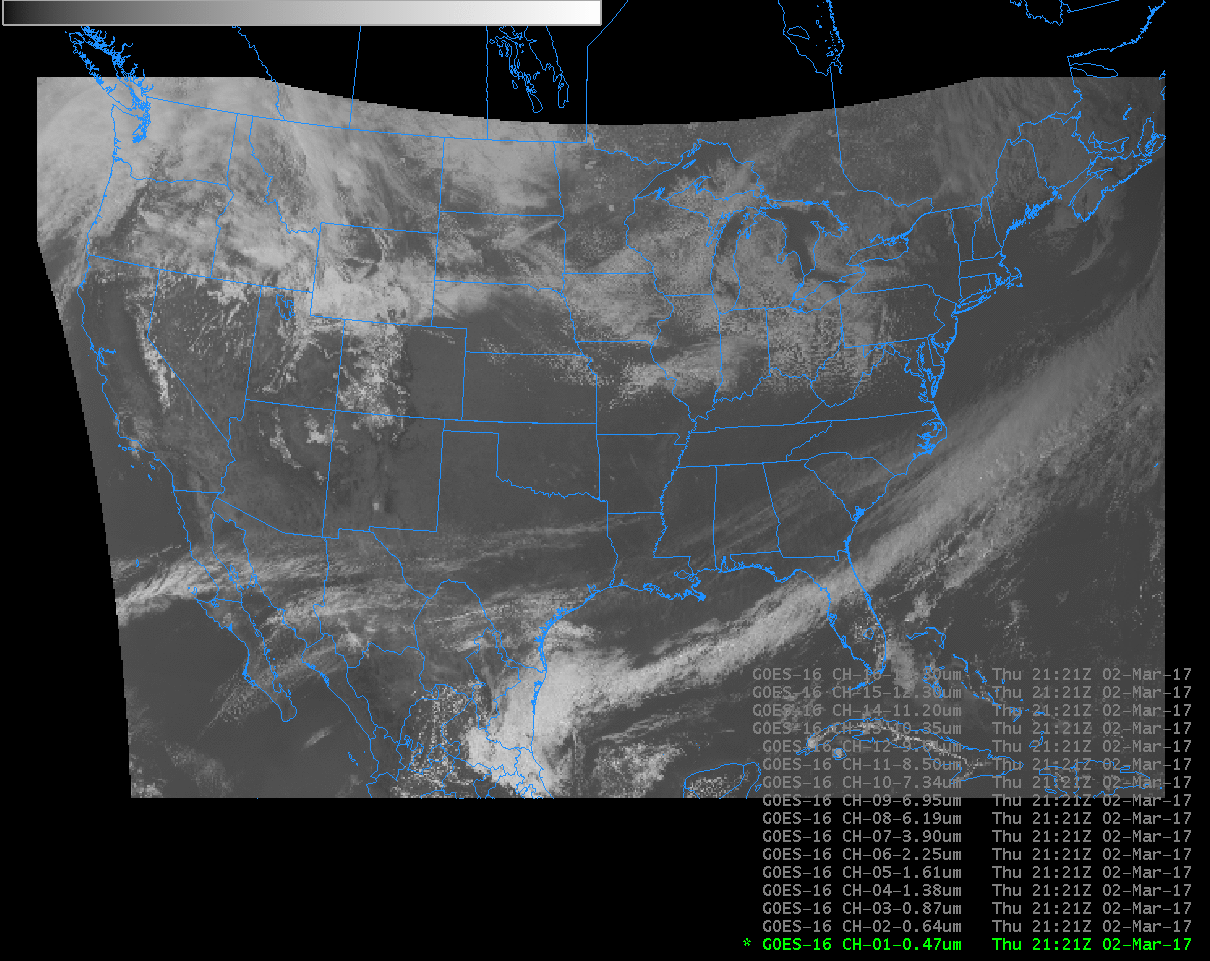
AWIPS Displays of GOES-16 Visible (0.64 µm) imagery at 1511 UTC (CONUS) and 1510 UTC (Full Disk) (Click to enlarge)
Note: GOES-16 data shown on this page are preliminary, non-operational data and are undergoing on-orbit testing.
GOES-16 data that flow into AWIPS for Full Disk display are not at Full Resolution; rather, they are degraded to approximately 6-km resolution. The northern boundary of the GOES-16 ‘CONUS’ domain (GOES-16 data do flow into AWIPS at full resolution for this domain) is very close to the US-Canada border (as shown in this animation of all 16 bands from this blog post, and also in the animation above). When zoomed out, there is little apparent difference in the two images. If you zoom in, however, as shown below with Band 2 (0.64 µm) imagery, the seam between the two resolutions is very noticeable.
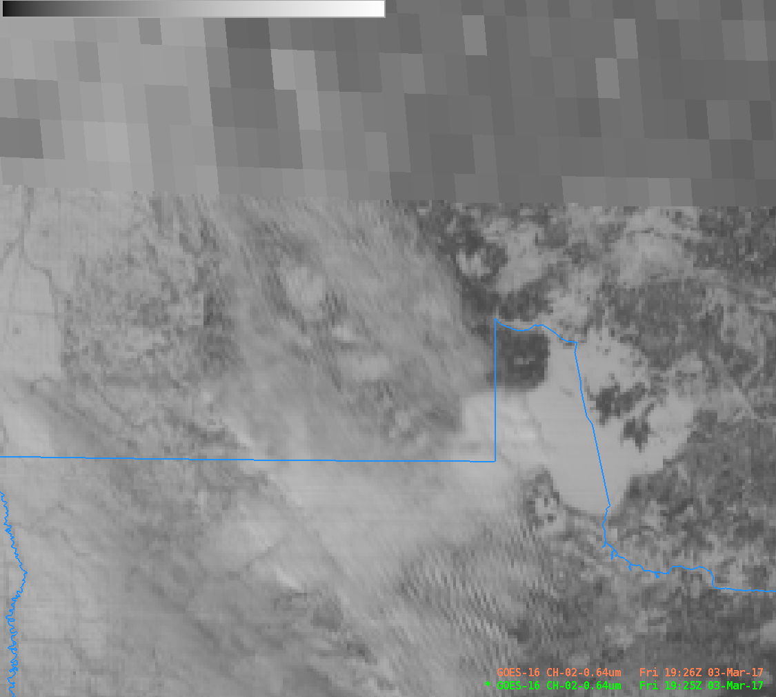
GOES-16 Visible Imagery, 1925 UTC, over southern Canada and northern Minnesota/North Dakota (Click to enlarge)
The change in resolution occurs for all bands. The 10.3 µm imagery, below, shows the change north of Montana, Idaho and Washington.

ABI Band 13 (10.3 µm) Imagery at 1510 UTC in the AWIPS CONUS domain (full resolution) and in the AWIPS Full Disk Domain (reduced resolution). (Click to enlarge)