Sequential NUCAPS Profiles at Higher Latitudes

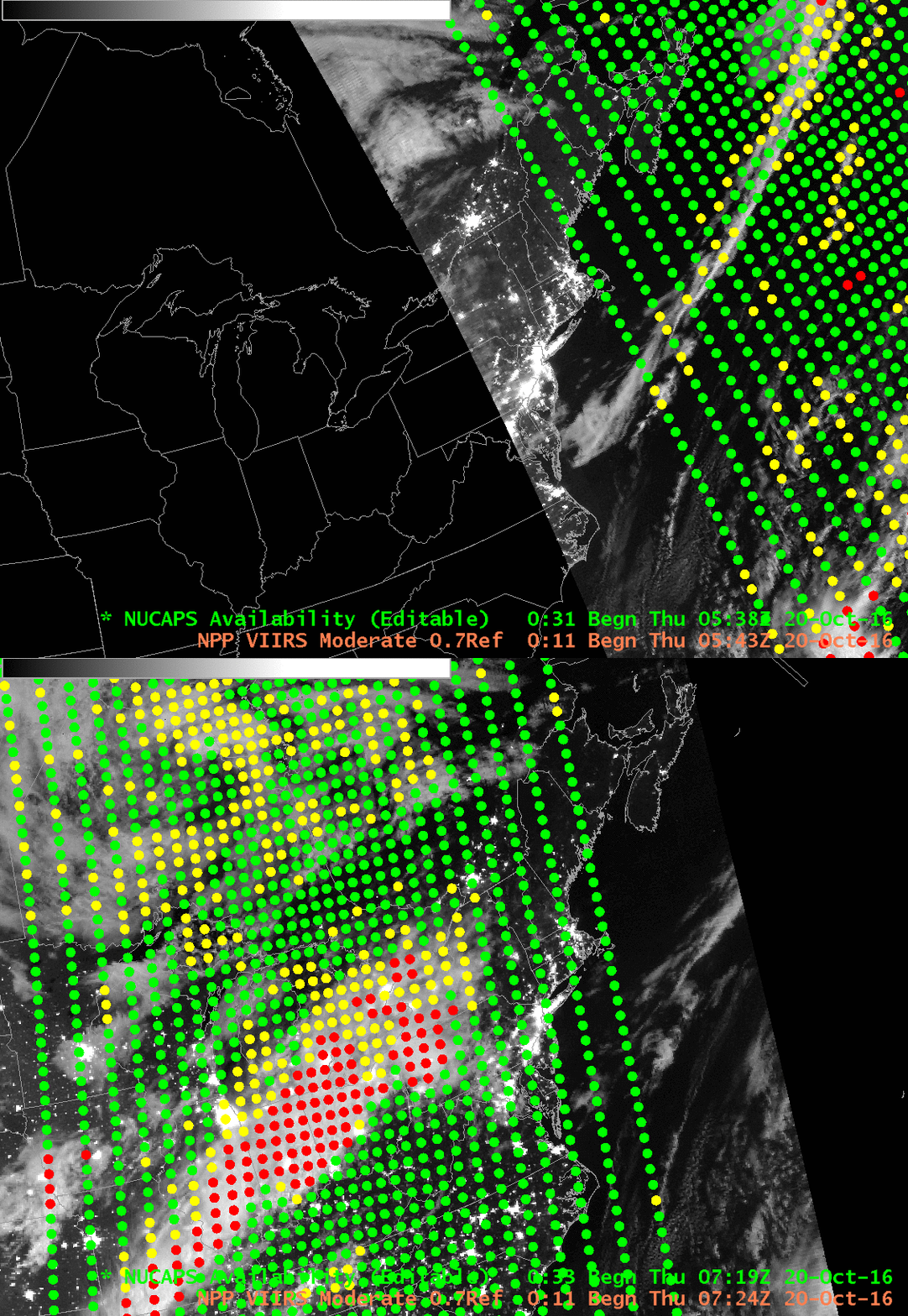
Suomi NPP Day/Night Band (0.70 µm) and NUCAPS Sounding Locations, 0538 and 0724 UTC on 20 October 2016. Green Dots represent soundings that have passed quality control; Yellow Dots represent soundings for which the infrared retrieval failed; Red dots represent soundings for which both infrared and microwave retrievals failed (Click to enlarge)
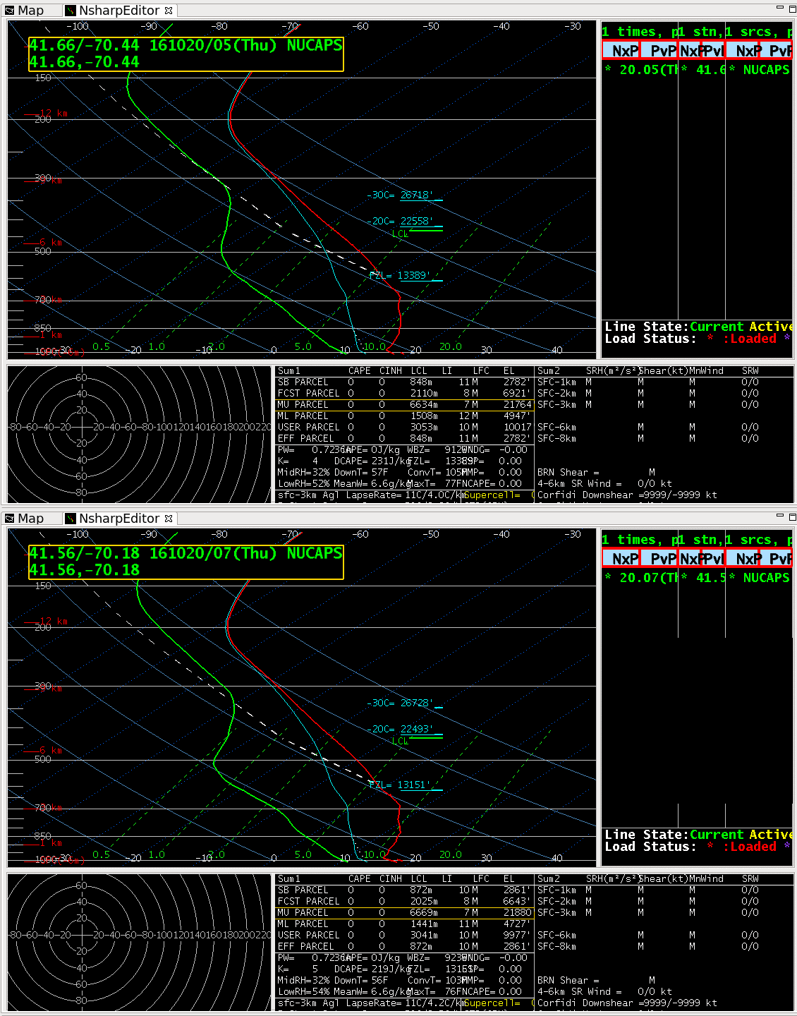
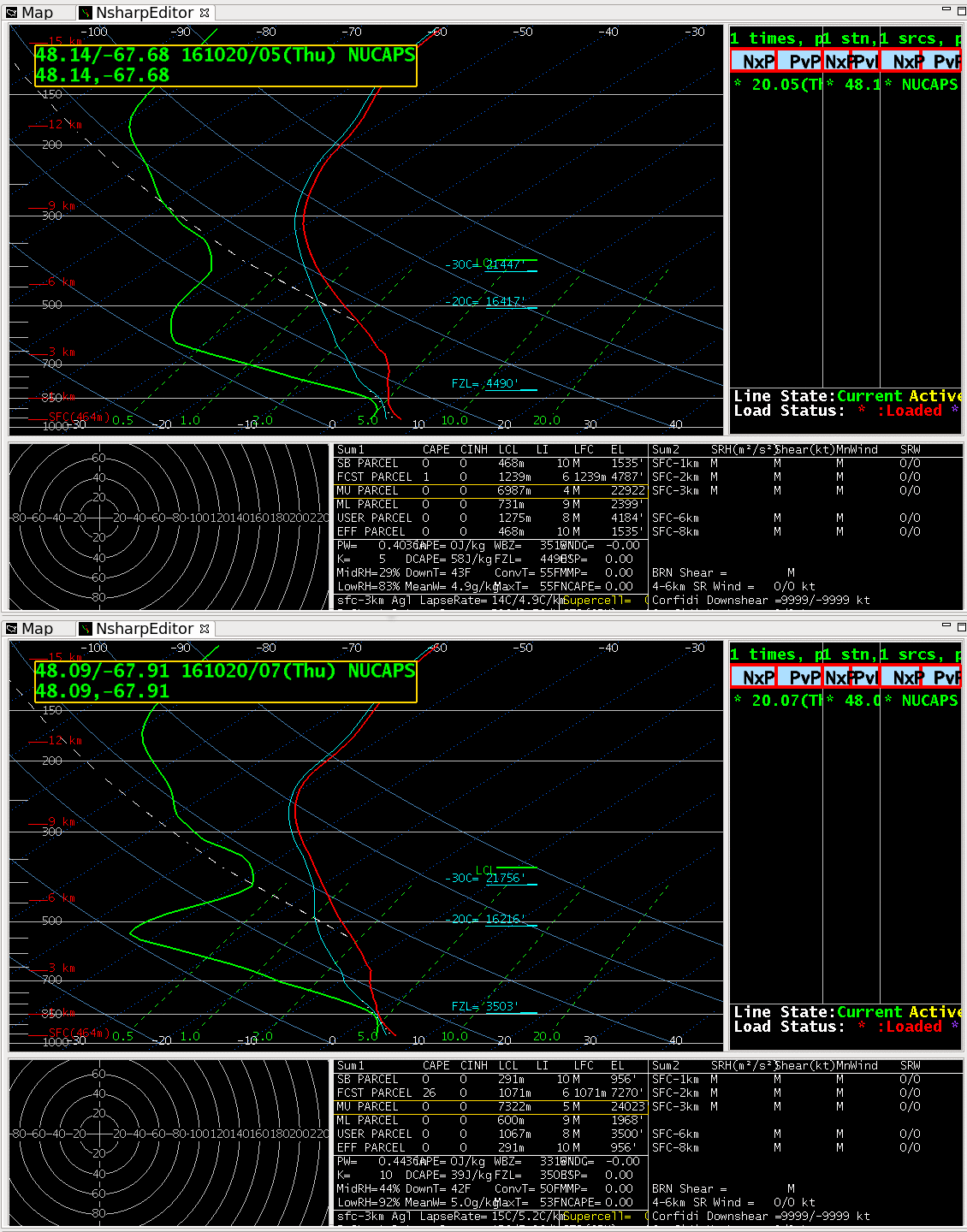
The orbital geometry of Suomi NPP is such that regions north of about 43º N latitude can occasionally receive NUCAPS (NOAA-Unique Combined Atmospheric Processing System) Vertical Profiles of moisture and temperature on sequential orbital passes, meaning a given location could have vertical profiles separated by less than 2 hours. This occurred early on 20 October 2016 over Maine and Cape Cod, as shown above: Suomi NPP NUCAPS Vertical Profile locations are indicated over Day/Night Band Visible imagery. Two soundings at approximately the same location are circled in cyan in this small image and are shown below. There are two sequential profiles over Cape Cod, and then the two sequential profiles north of Maine. The atmosphere over Cape Cod was quiescent on this date, and little change between soundings is evident. In contrast, slight cold air advection was occurring north of Maine (Surface analysis from 0900 UTC, 500-mb analysis from 00 UTC), and the NUCAPS Sounding shows mid-level cooling.

NSharp depictions of NUCAPS Vertical Profiles near 42N, 70W at 0500 and 0700 UTC on 20 October 2016 (Click to enlarge)

NSharp Depictions of NUCAPS Vertical Profiles near 48 N, 68 W at 0500 and 0700 UTC on 20 October 2016 (Click to enlarge)
For stations in the northern Plains, or in Canada, sequential soundings overnight or perhaps more importantly in the mid-afternoon (Suomi NPP typically overflies the Plains a bit after Noon local time) could give important information about destabilization.
Previous CIMSS Satellite Blog Entries referencing NUCAPS Vertical Profiles are available here.
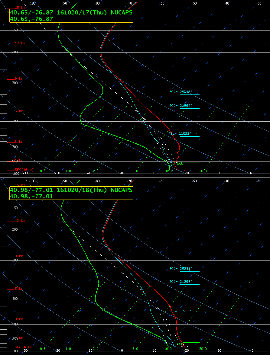
=============== Added 2100 UTC on 20 October 2016 ===============The toggle below shows two soundings, from 1700 and 1800 UTC in central Pennsylvania in the region between Harrisburg and Williamsport (click here to see the Sounding Locations), just east of a slight risk issued by the Storm Prediction Center. The time evolution suggests upward motion (the top of the inversion rises) and a weakening in the cap. Severe Thunderstorm Watch #499 was issued 1945 UTC on 20 October for counties just to the west of these NUCAPS Profile locations — and damaging winds were reported in central Pennsylvania beginning at 2154 UTC.


