Ice Dwindles on the Great Lakes

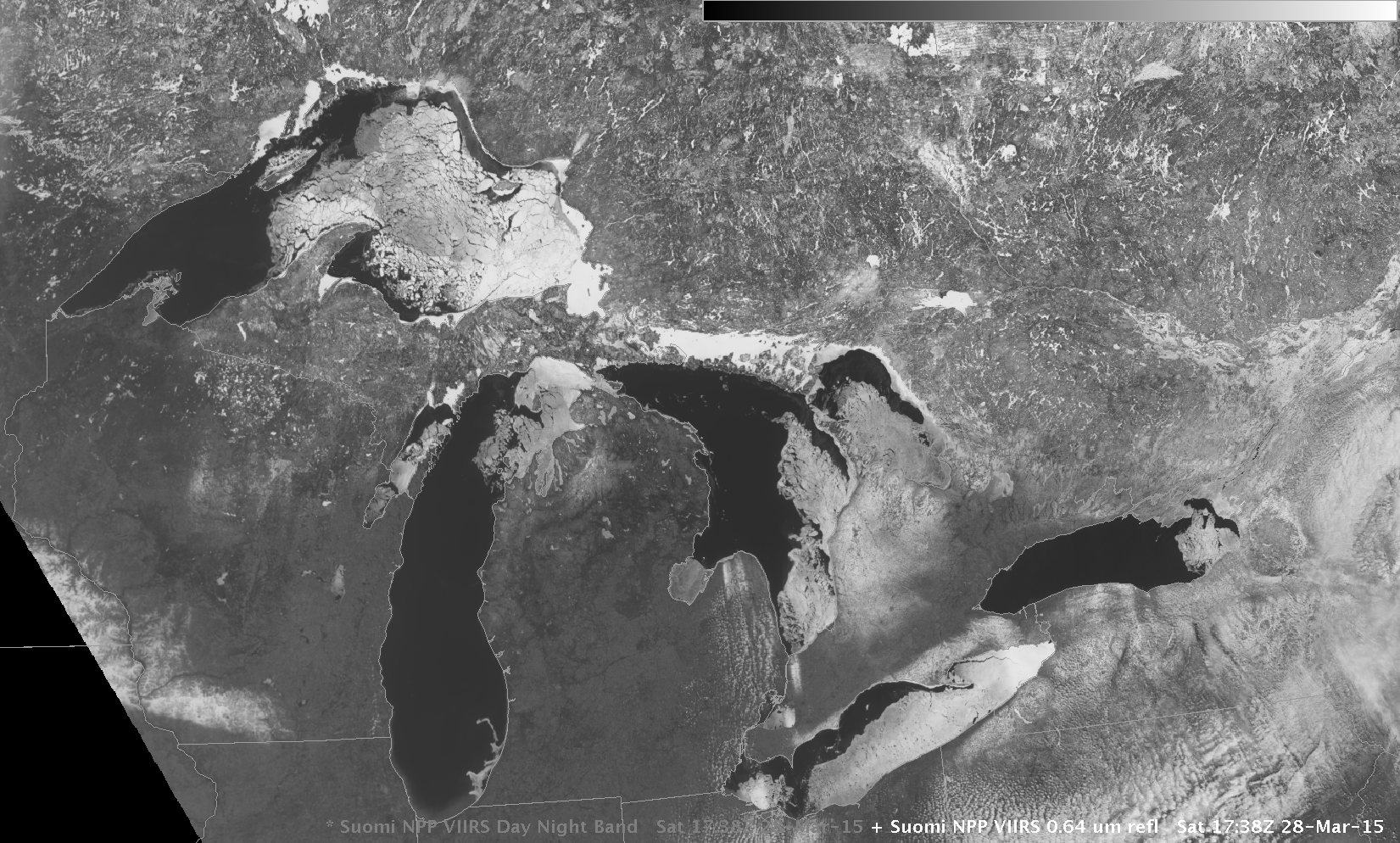
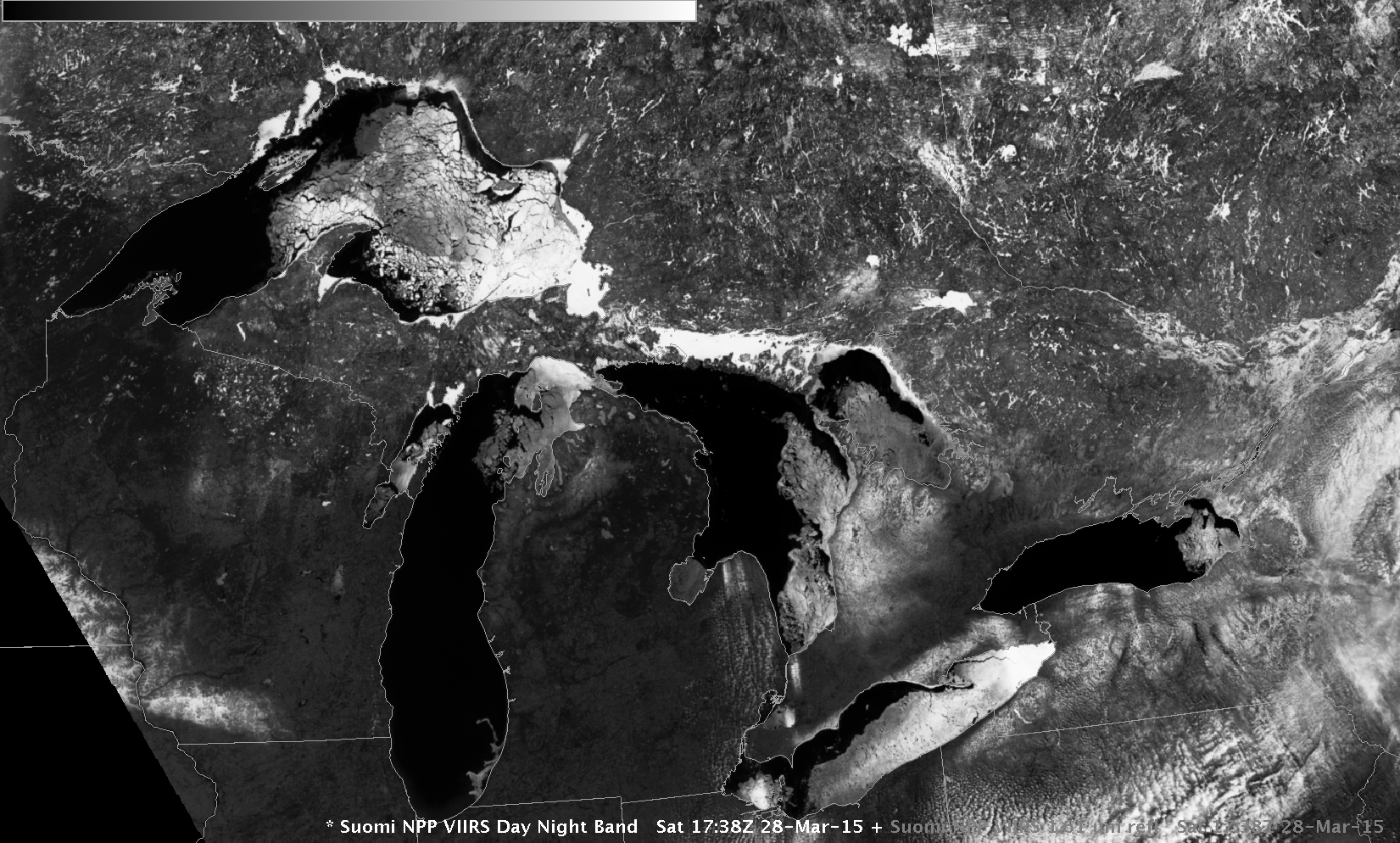
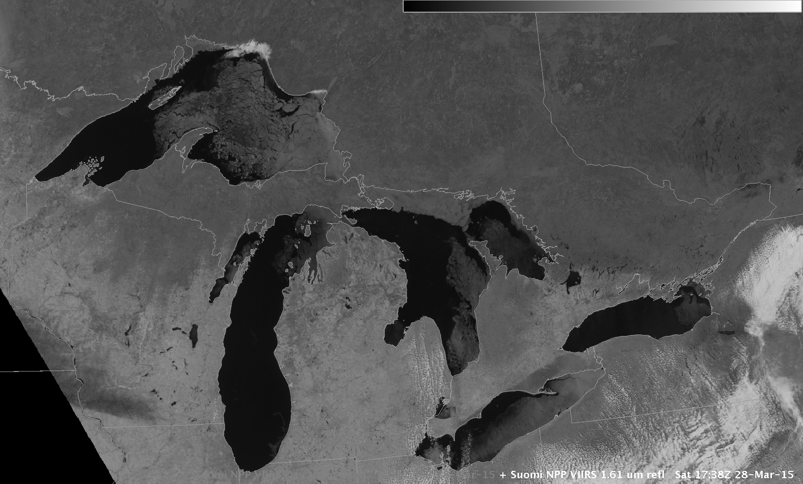
Suomi NPP VIIRS Visible Image (0.64 µm), Day Night Band Visible Image (0.70 µm) and 1.61 µm near-infrared Image (click to enlarge)
Clear skies over the Eastern and Midwestern United States on 28 March allowed the wide swath of Suomi NPP VIIRS to record ice conditions over the five Great Lakes. The visible and Day/Night Band imagery shows good contrast between the dark open waters and brighter melting ice. Ice strongly absorbs 1.61 µm radiation: regions in the near-infrared 1.61 µm imagery that are dark (where radiation is absorbed, not reflected/scattered) include pack ice on the lakes, and snow cover (southeast Minnesota and southwest Wisconsin; southern Ontario bordering Lake Erie; southwestern Ontario near Lake Huron; the Upper Peninsula of Michigan, northern Wisconsin and northwestern Lower Michigan) on land. Regions of clouds comprised of water droplets (extreme eastern Lower Michigan and northern Ohio, much of central Pennsylvania and the Adirondacks of northern New York) are white on all three images.