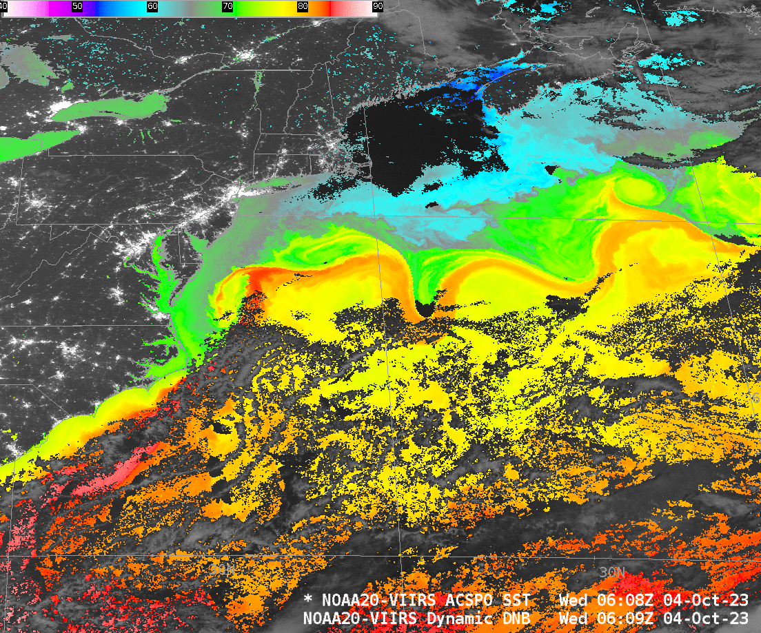
VIIRS views the Gulf Stream

Mostly clear skies over the western Atlantic on 4 October 2023 meant that the Advanced Clear Sky Processor for Oceans (ACSPO) algorithm could produce a near-complete picture of sea-surface temperatures using data from NOAA-20’s VIIRS instrument. The sinuous Gulf Stream is marked as a region of warmest waters, around 85oF off the coast of South Carolina (pink in the enhancement used); once past 70oW Longitude, warmest surface waters in the Gulf Stream are closer to 80oF (orange in the enhancement).
There is a GOES-16 Level 2 Sea Surface Temperature product as well, computed hourly; it is shown in the animation below that brackets the VIIRS SSTs shown above (and here).
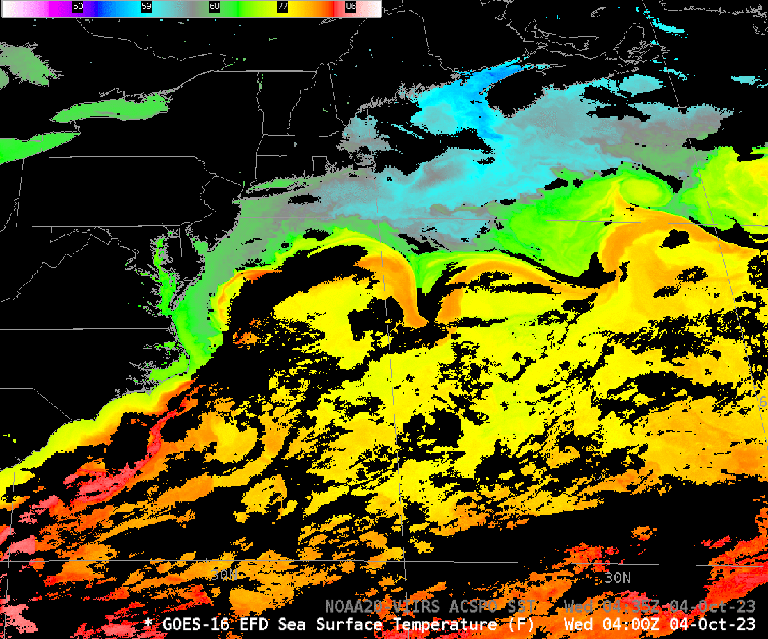
The toggle below compares the higher-spatial-resolution VIIRS SST field with the GOES Level 2 Product.