Convective snow shower possibility over Wisconsin/Illinois

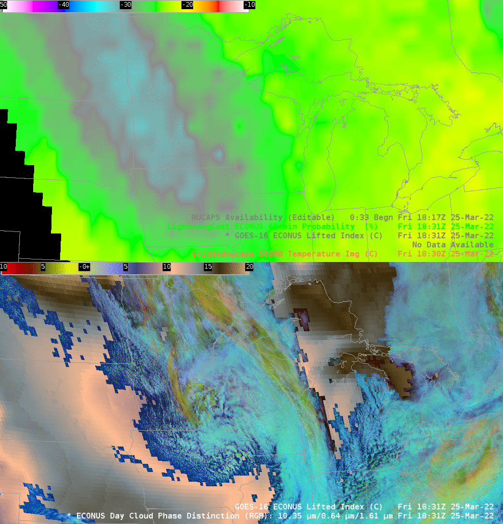
The Storm Prediction Center issued a Mesoscale Discussion (#337 for 2022) at 1918 UTC on 25 March 2022 for southern Wisconsin/northern Illinois discussing the possibility of convective snow showers late in the day on 25 March 2022. The toggle above shows gridded NUCAPS values of 500-mb Temperature over the upper midwest in a toggle with the GOES-16 Day Cloud Phase Distinction RGB (here are the gridded NUCAPS toggled with sounding availability points). A ribbon of cold air — colder than -30o C — is present over central MN, moving southward, and the coldest air overlaps the region in the Day Cloud Phase Distinction where, based on the color, one might infer the greatest vertical development to the clouds.
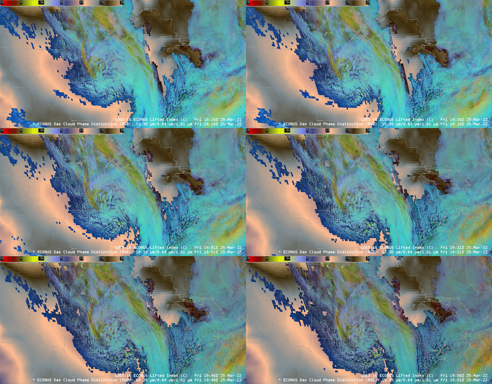
The animation below shows the Day Cloud Phase Distinction plotted over the (clear sky only) Lifted Index. Extensive clouds are preventing the Level 2 Lifted Index from supplying useful imagery where clouds exist (unlike the NUCAPS-derived information above)

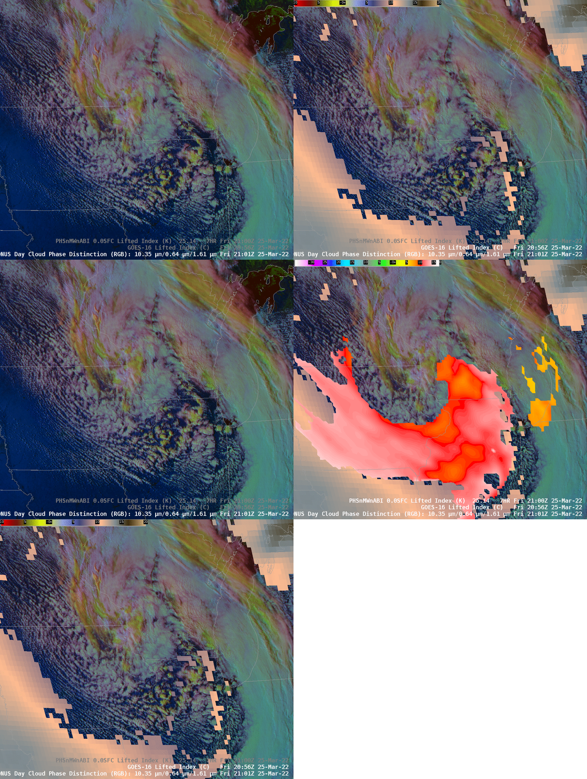
By 2100 UTC, evidence of convection in the Day Cloud Phase Distinction continues to increase over southeast Minnesota/northeast Iowa and southwestern WIsconsin (the yellow/greenish tinge to the RGB). Lifted Index from GOES-16 continues to show coverage suppressed by cloud cover. However, Lifted Index from the Polar Hyperspectral Sounding/Microwave and ABI modeling system (discussed here; imagery available here; these data will be demonstrated at the Hazardous Weather Testbed) shows more coverage, indicating two corridors of weaker stability into Illinois and Wisconsin.

Some of the imagery in this blog post was produced using the NOAA/NESDIS TOWR-S Cloud Instance of AWIPS. Thank you!

