Using NUCAPS data to anticipate freezing rain/ice pellets

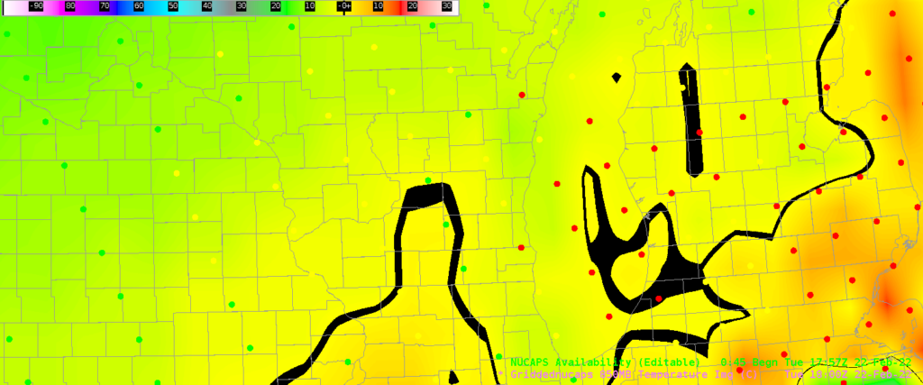
NUCAPS profiles from NOAA-20 provide a widespread swath of thermodynamic information that occurs (over CONUS) when normal radiosondes are not available (for example, around 1800 UTC as above). In addition, NUCAPS provides information in regions away from the sparse radiosonde network. The image above shows NUCAPS sounding availability points over Wisconsin; southern Wisconsin is forecast to receive freezing rain and ice pellets overnight. What do NUCAPS soundings, and gridded NUCAPS fields show?
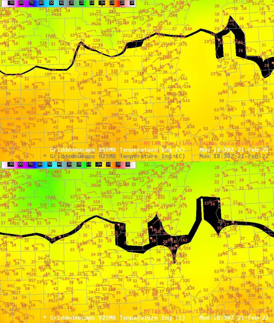
Gridded NUCAPS temperature fields (at 850 mb and 925 mb) are shown below. The color enhancement has been altered so that values around the melting point (0o C) are black. The NUCAPS fields are capably capturing the strength and location of the low-level inversion: note how much farther north the warm air is at 850 mb compared to 925 mb! This information might be useful is diagnosing regions most at risk to accumulating freezing rain. (One might look at gridded dewpoint depressions fields as well to determine where evaporative cooling might occur).
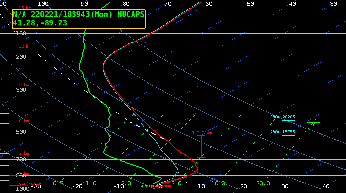
And individual NUCAPS profile near 43 N, 89 W, shown below, shows a very strong surface inversion.
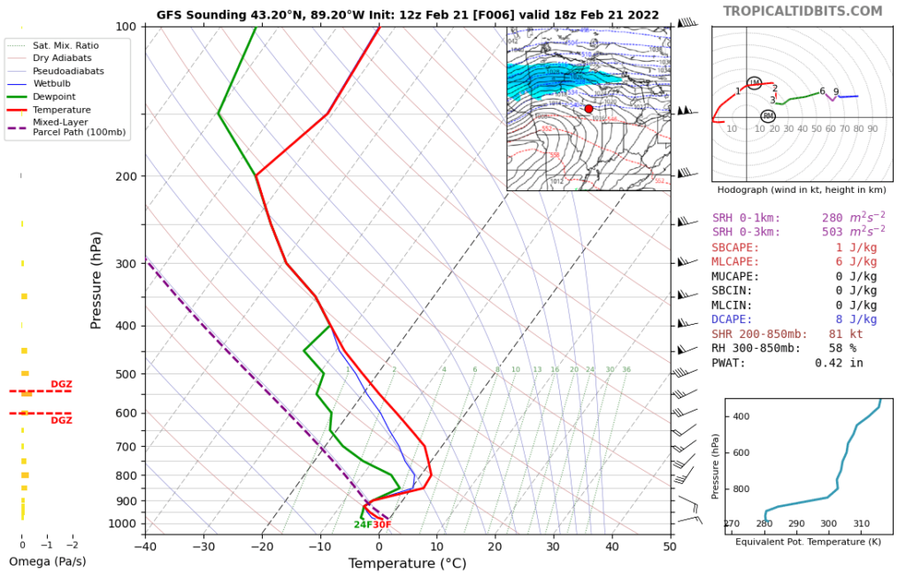
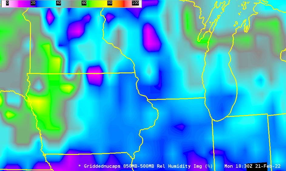
How does the NUCAPS profiles compare with a forecast profile? The GFS 6-h forecast profile, taken from the tropicaltidbits website, shows that NUCAPS is viewing a somewhat dryer airmass than is present within the model. NUCAPS profiles give information about moisture that might be missing (or mis-timed) in numerical model output. The horizontal extent of the dry air in NUCAPS is large, as shown in the gridded NUCAPS 850-500 mb layer relative humidity analysis shown at bottom.
Added, 22 February 2022, 2:22 PM: NUCAPS provided another view of the thermodynamics over southern Wisconsin after noon, as shown below. Thick clouds over eastern Wisconsin prevented the retrieval from converging to a solution there (hence the red points), but three green points near/over eastern Dane County provided useful information. The sounding on the Dane County/Jefferson County border at 43o N, 89o W (shown here) continued to show warm air aloft that would allow for continued freezing rain/drizzle.
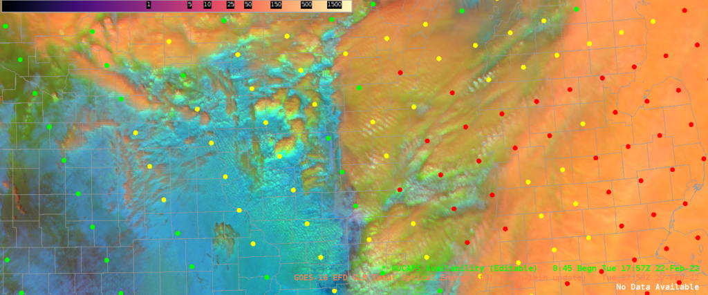
What did the gridded NUCAPS Temperature field at 850 mb look like? As shown below, it continues to show a warm tongue into southern Wisconsin; however, caution in interpreting this field is warranted. Many of the points that were used to create the field were from ‘yellow’ retrievals (i.e., microwave retrievals that might be unable to resolve a low-level inversion) and ‘red’ retrievals. Thus the gridded field might not represent the true values there.
