Convective nowcasting over Wisconsin with NUCAPS
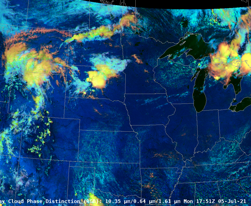
GOES-16 Day Cloud Phase Distinction at 1751 UTC, above, shows two cumulus fields over Wisconsin: a linear cloud field oriented west-southwest-to-east-northeast over the southern part of the state, and a larger field of agitated cumulus over the northern half of the state, with isolated glaciated storms near the border of Wisconsin and the Upper Peninsula of Michigan. Would you expect those cumulus fields to develop during the course of afternoon heating? SPC had much of Wisconsin in a Marginal Risk of severe weather at 2000 UTC on 5 July (link; 1630 and 1300 UTC outlooks were the same), as shown below.

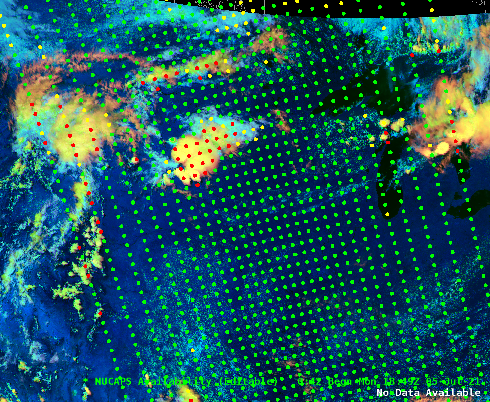
GOES-16 Day Cloud Phase Distinction RGB along with Sounding Availability points from NOAA-20 NUCAPS, 1849 UTC on 5 July 2021 (Click to enlarge)
A benefit of NUCAPS (NOAA-Unique Combined Atmospheric Processing System) profiles (click here for previous blog posts discussing NUCAPS) from NOAA-20 over the contiguous United States (CONUS) is timing: profiles occur between 1600 UTC on the east coast and 2100 UTC on the west coast and thereby sample the atmosphere before the development of diurnal convection. Such was the case over Wisconsin on 5 July 2021. The image above shows the GOES-16 Day Cloud Phase Distinction and the Sounding Availability points from NUCAPS (NOAA-20) at 1849 UTC. The NUCAPS profiles allow a forecaster an independent (independent of models such as NAM or HRRR; see for example, this screen-capture of a 6-h forecast of radar reflectivity from the 1800 UTC/5 July HRRR of convection showing some development over southern WI) estimate of atmospheric stability. How does this diagnosed stability agree with (or not) model forecasts?
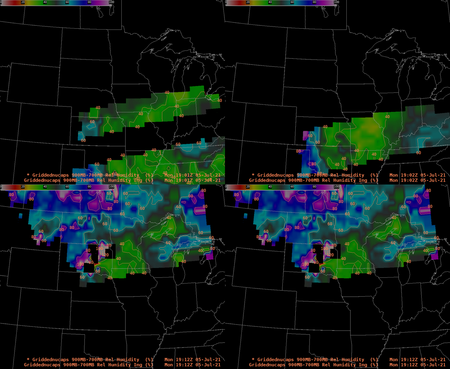
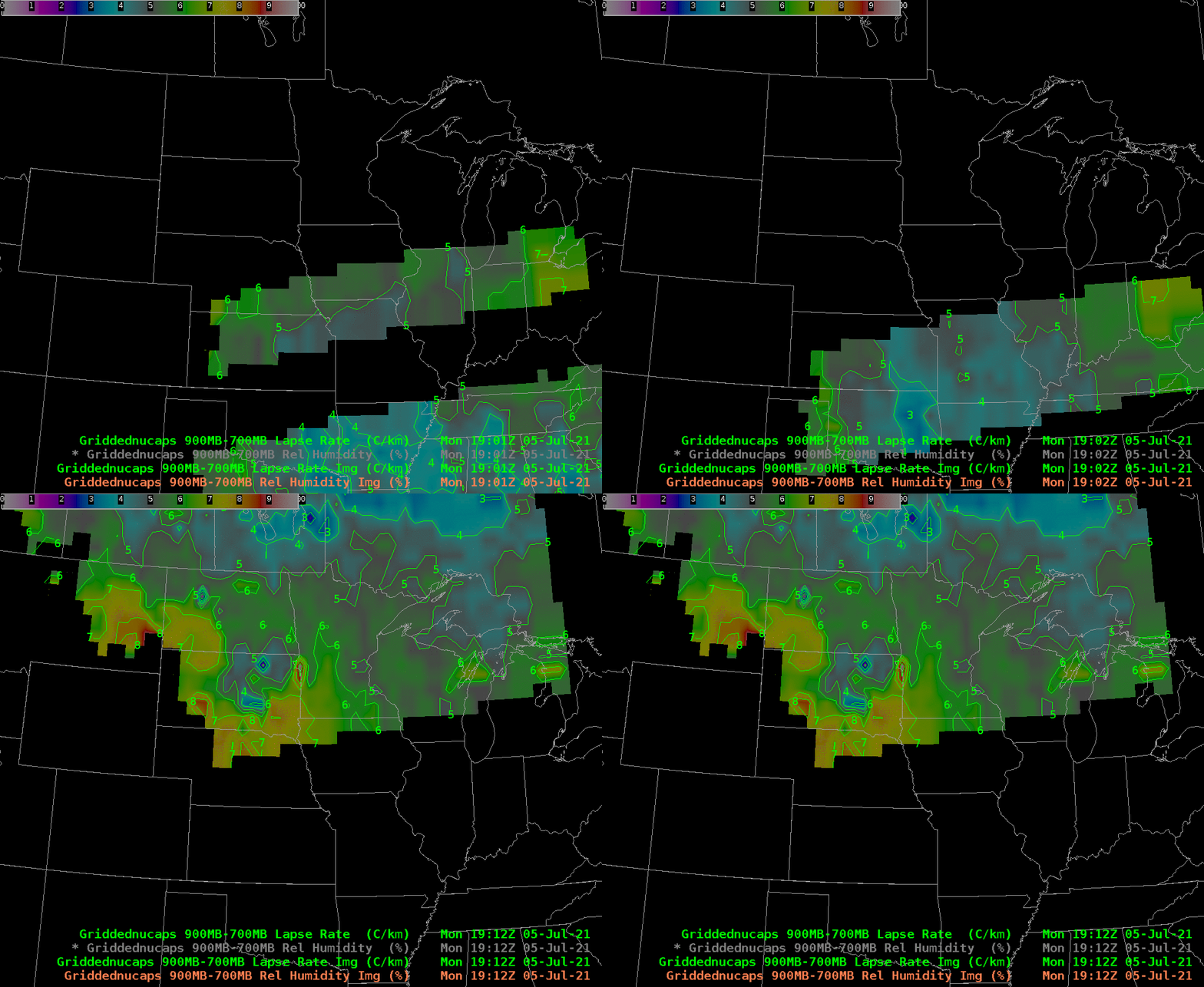
700-900 mb NUCAPS relative humidity fields, below, show a drier atmosphere of over southern Wisconsin than over the northern half of the state. (NWS ITOs note: there are instructions in VLab to modify NUCAPS gridding so that the pieces shown in AWIPS are more contiguous than in this blogpost example!). Lapse rates (also 700-900 mb), below, show weaker stability over northern Wisconsin. The combination of weaker stability and more moisture might push a forecaster to diminish convective concerns over parts of southern Wisconsin, and maintain those concerns over the northern half of the state. (GOES-16 Total Precipitable Water fields at 1851 UTC — link — show two axes of moisture over Wisconsin: one with the southern area of cumulus development, and one over central Wisconsin)

NUCAPS-derived estimates of 900-700 mb relative humidity, 1901-1912 UTC on 5 July 2021 (Click to enlarge)
Convection did not occur with the southern line of cumulus. See the animation below.


