Standing waves upstream of Nova Scotia
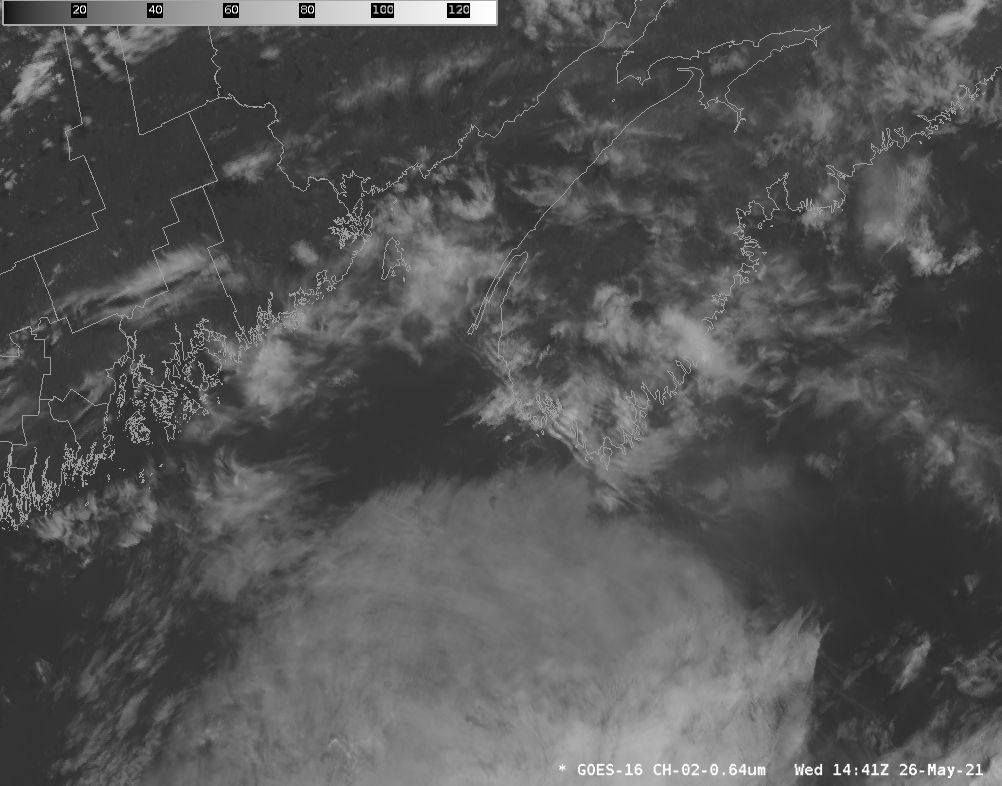
GOES-16 Visible (Band 2, 0.64 µm) imagery, 1441 – 2126 UTC on 26 May 2021 (Click to animate)
GOES-16 visible imagery above (click to animate) shows the development of standing waves upwind of southwestern Nova Scotia. These winds developed in a region of low-level southwesterly (i.e., onshore) flow, as shown in the 1806 UTC image below that includes surface observations. Higher clouds are moving from a more westerly direction, suggesting veering and warm-air advection.
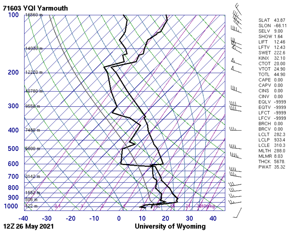
Note the very warm temperatures over interior Nova Scotia in the image below. This suggests a strong inversion such as is necessary to trap energy that is then manifest as the standing waves. Indeed, the Yarmouth, NS sounding at 1200 UTC shows surface temperatures near 12 C with temperatures closer to 20 C between 900 and 950 mb; that works out to be a potential temperature difference of 16.5 K across the inversion.
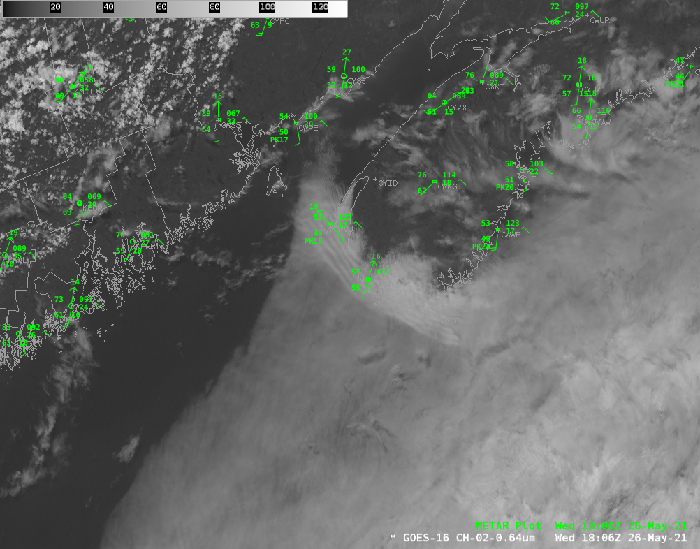
GOES-16 Band 2 Visible (0.64 µm) imagery at 1806 UTC along with 1800 UTC METAR observations. (Click to enlarge)
(Thanks to Richard DiMaio, Lewis University, for bringing this event to our attention!)