ACSPO Lake Surface Temperatures over the Great Lakes

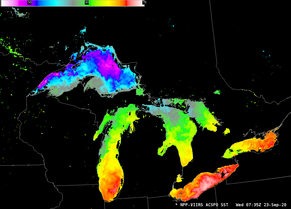
Great Lakes lake surface temperatures, 0735 UTC on 23 September 2020, as well as zoomed-in views of the individual lakes (Click to animate)
Suomi-NPP’s descending pass at ~0730 UTC (shown here, from this site), had an ideal path — moving south from far eastern Upper Michigan to western Lower Michigan — to view all five Great Lakes. Sprawling High Pressure and the attendant clear skies meant that a good basin wide view of the lake temperatures was observed, as shown above. (DB imagery from this pass is also available for a short time at the CIMSS DB ftp site) These ACSPO (Advanced Clear-Sky Processor for Ocean) SST fields are available to NWS offices via LDM fields. The default color bar in AWIPS has been changed so that only temperatures between 45º F and 70º F are shown
Lake Temperatures in the imagery above range, for Lake Superior from 47.5º (east of Minnesota) to 66º (just off southwest Upper Michigan); for Lake Michigan from 57º (east of Sheboygan WI) to 67º (mid-lake, east of Chicago); for Lake Huron from 55º (in northwestern Georgian Bay and also northwestern Lake Huron) to 65º (far southern Lake Huron); for Lake Erie from 63º (western Lake Erie) to 69º (central Lake Erie); for Lake Ontario from 62º (western Lake Ontario) to 67º (eastern Lake Ontario).
This view of the Great Lakes from early in September (also from the CIMSS DB site, processed with CSPP), shows — with a color bar that ranges from 41ºF to 86ºF — much warmer water, especially in Lake Superior where the coolest mid-lake temperatures were in the mid-50s. Storms and vertical mixing since early September have cooled the surface waters. GLERL has a website that shows modeled lake surface temperatures, accessible here.

