Arabian Sea Ship Fire in the VIIRS Day Night Band

VIIRS Day Night Band Visible (0.70 µm) Imagery from Suomi NPP (2056 UTC) and NOAA-20 (2146 UTC) on 6 March 2018 (Click to enlarge)
A large Maersk container vessel caught fire in the Indian Ocean on 6 March 2018 (news report 1, news report 2), killing 4 sailors and necessitating the evacuation of the ship (the MAERSK HONAM).
Suomi NPP and NOAA-20 (which trails Suomi NPP by half an orbit) both passed over the ship fire on 6 March. As a singular light source in the middle of the Indian Ocean, the ship fire was evident in the Day Night Band imagery, as shown above, at 10.5º N and 65.8º E). The ship drifted southward in the 50 minutes between VIIRS scans from the two satellites. (Similar signatures were apparent in the 1.61 µm, 2.25 µm and 4.05 µm imagery from VIIRS on the two satellites).

VIIRS Day Night Band Visible (0.70 µm) Imagery from Suomi NPP (2038 UTC) and NOAA-20 (2128 UTC) on 7 March 2018 (Click to enlarge)
One day later, on 7 March, above, Suomi NPP and then NOAA-20 (50 minutes later) again passed over the still-burning ship, then at 10.1º N and 65.6º E. A faint smoke plume is visible in the imagery from NOAA-20.
The zoomed-out image, below, might give you a better idea of how far away from the India and Africa this ship sits.
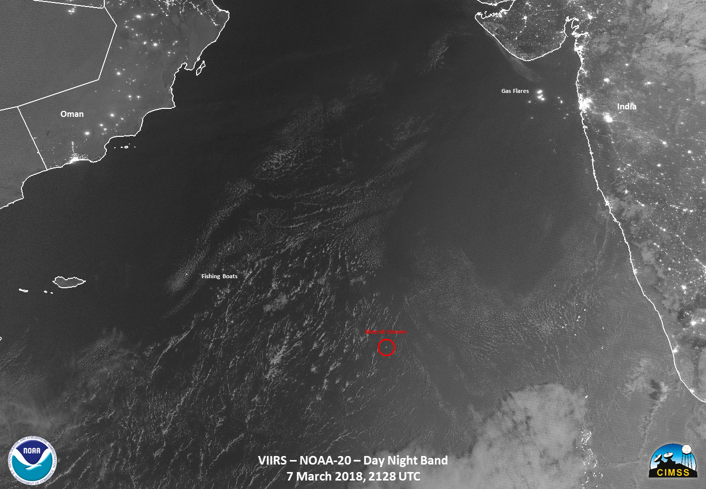
VIIRS Day Night Band Visible (0.70 µm) Imagery from NOAA-20 (2128 UTC) on 7 March 2018 (Click to enlarge)
(Hat tip to William Straka, CIMSS, for the imagery and also to Steve Miller, CIRA, for alerting us to this event)