Changes to the GOES-16 CONUS sector
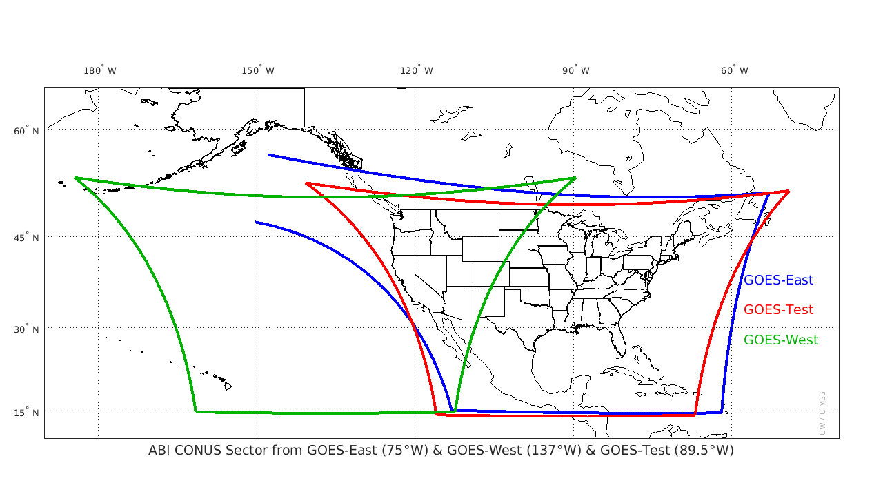
GOES-R CONUS domains for Operational GOES-West Location (137º W Longitude, Green), Check-out Location (89.5º W Longitude, Red) and Operational GOES-East Location (75.2º W Longitude, Blue) (Click to enlarge)
When GOES-16 shifted from its checkout position at 89.5º W Longitude to its position at 75.2º W Longitude (where it will be operational as GOES-East), the domain for the Continental US (CONUS) domain shifted slightly. In ‘Flex Mode‘ (also known as ‘Mode 3‘) of GOES-16 Scanning (and also in the proposed Mode 6), routine CONUS scans occur every 5 minutes. The image above, courtesy Mat Gunshor of CIMSS, shows the GOES-West CONUS scan in green, the GOES-R CONUS scan from the Check-out Location at 89.5º W Longitude in Red, and the GOES-16 CONUS scan domain in blue.
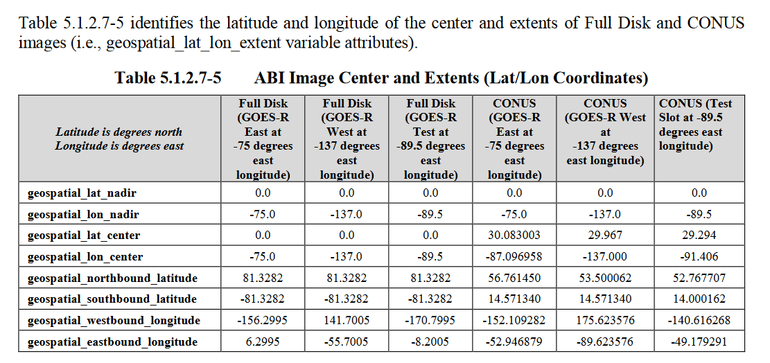
The center point of the CONUS domain, as documented in Table 5.1.2.7-5 from the GOES-R Product Definition and User’s Guide (PUG), shows a shift from 29.24º North Latitude, 91.41º West Longitude (at the check-out location) to 30.08º North Latitude, 87.1º West Longitude (at the operational GOES-East location). As a result, the entire island of Puerto Rico is now in the CONUS sector, and the northern boundary has shifted farther north into central and western Canada, by about 100 miles.
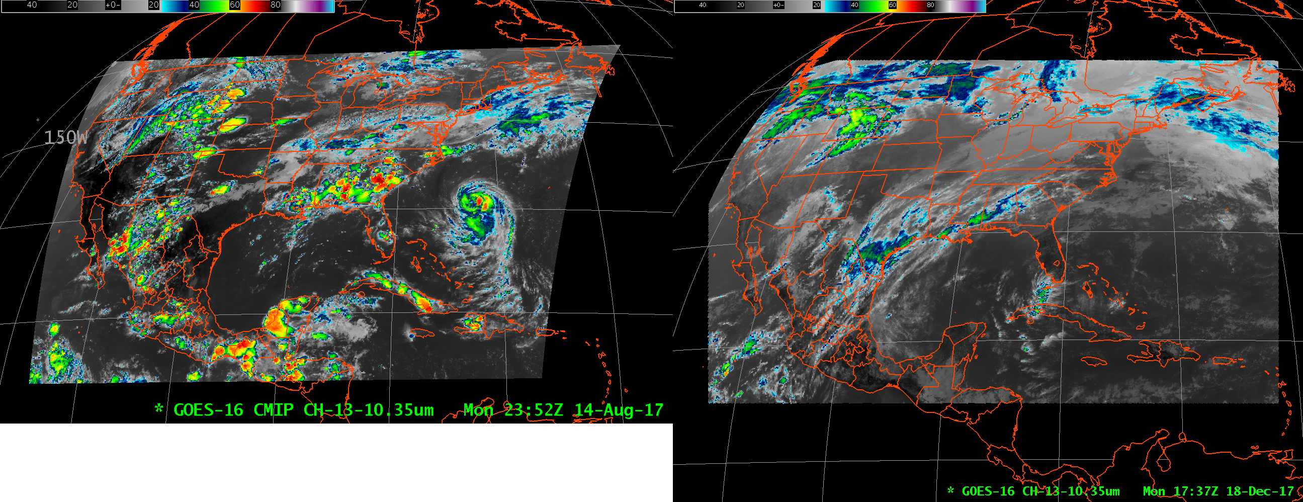
GOES-16 CONUS Imagery from the Test Location (Left) and GOES-16 CONUS Imagery from the Operational GOES-East Location (right) as displayed in 2 different AWIPS