GOES-16 Multispectral views of the eastern United States

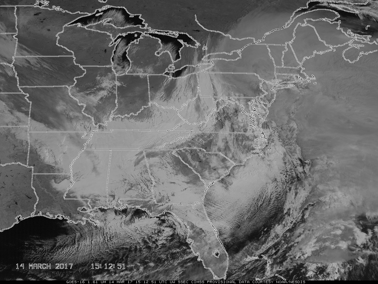
GOES-16 Snow/Ice (1.61 µm) animation, from 1100 UTC on 12 March through 1800 UTC on 14 March [click to play mp4 animation]
The GOES-16 data posted on this page are preliminary, non-operational data and are undergoing testing.
The ABI on GOES-16 includes a Snow/Ice Channel at 1.61 µm and a Cirrus Channel at 1.38 µm. These bands offer different perspectives on the evolution of the atmosphere before and during the strong 13-14 March 2017 winter storm on the East Coast of the United States. The Snow/Ice channel, above, is dark in regions where ice clouds or snow on the ground are present because ice is a strong absorber of radiation with a wavelength of 1.61 µm. Water clouds, in contrast, readily reflect such radiation and appear brighter white. Consider the mp4 animation above (available here as a 150-megabyte animated gif). At the start of the animation, on 12 March, snow is indicated over Tennessee, a dark stripe that erodes on that day under the strong March sun. Cirrus retreating southward over the southeastern United States (cloud signals that are grey in the 1.61 µm imagery) reveal much brighter low-level stratus clouds (made of water droplets). Cirrus contrails are apparent above those low clouds. The Mesovortex over the Great Lakes is bright white — water clouds — and is gradually obscured by high-level cirrus clouds from the west and northwest. Terrain-induced wave clouds are also present over Pennsylvania. Their bright color suggests they are composed of water droplets.
On 13 March, low clouds are moving northward over the Piedmont of North Carolina and Virginia as Cirrus clouds spread northeastward from the Deep South. By 14 March, a well-developed wave cyclone is apparent with a large cirrus canopy outlining a warm conveyor belt.
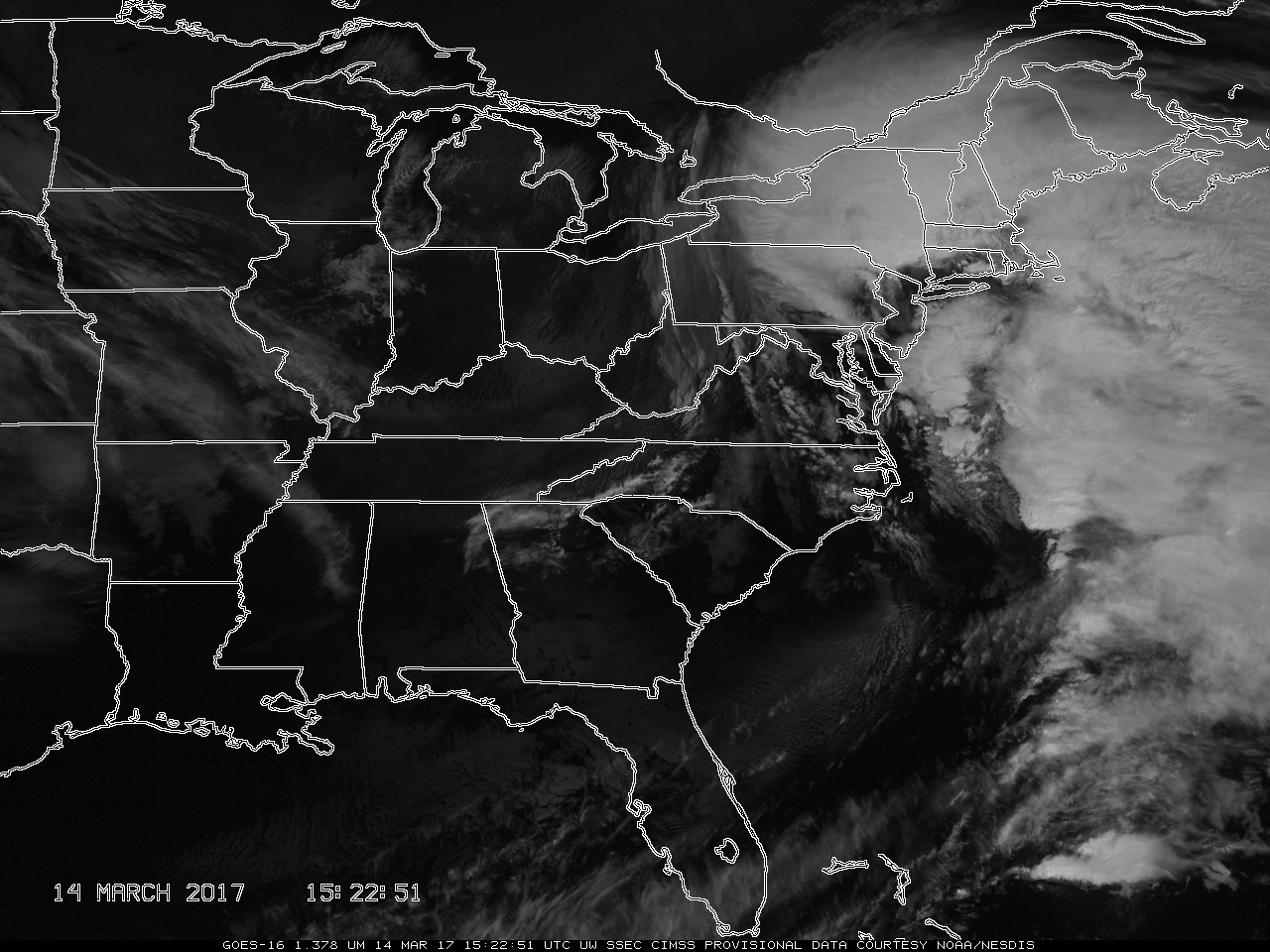
What does the Cirrus Channel, below show? (Click here for a large animated gif.) Strong absorption by water vapor molecules occurs at 1.38 µm. Note, for example, that on 12 March the mesovortex is not apparent in the Cirrus Channel — but the wave clouds over Pennsylvania are. The conclusion is that the atmosphere over the northeast is much dryer than that over the western Great Lakes. On 13-14 March, lake-effect clouds are apparent downwind of Lake Superior in the Upper Peninsula of Michigan and over Wisconsin. The airmass has dried over the Upper Midwest in two days, allowing the Cirrus Channel to view features closer to the surface. In general, the cirrus channel provides outstanding delineation of cloud-top structures over the developing and mature extratropical cyclone.

GOES-16 Cirrus Channel (1.378 µm) animation, from 1100 UTC on 12 March through 1800 UTC on 14 March [click to play mp4 animation]
The Cirrus Channel and the Snow/Ice Channel rely on reflected Solar energy to provide a signal. As such they are useful primarily during the day.
Added: Animations showing the evolution of the three GOES-16 Water Vapor bands during part of the East Coast storm’s lifecycle are available here. A water vapor animation from a CONUS perspective is available here. A better-quality animation centered over the northeast US is available here. Here is an animated gif/mp4 with 6.9 µm brightness temperatures and surface observations. A blog post on this storm is here.

