Oceanography » Observing the oceans from space
|
In this lesson you will learn how to: There are many different space-based sensors, each of which senses specific electromagnetic frequencies. Scientists can use their knowledge of the sensors and of the processes of interest to select the best satellite borne tools to study the oceans. For example, some sensors are best-suited for measuring temperature; others are sensitive to surface roughness, which we use to infer wind speed and direction. We will take some first steps towards learning why scientists select particular instruments to study a given phenomenon. |
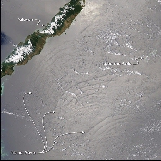 Ocean waves (NASA) click to enlarge |
|
|
Since satellites observe the earth from space, all measurements are indirect. We need ‘surface truth', or carefully obtained, well verified, earth-based observations of the measured quantity to interpret and model the space-based data. Paired satellite- and earth-based observations are used to develop mathematical models relating the physical characteristics of interest and the satellite observations. Comparisons between these models and additional earth-based measurements make it possible to test the accuracy of these models under a range of atmospheric, oceanic or other environmental conditions. We will look at patterns in satellite data linked with specific physical phenomena (such as the presence of the Gulf Stream) and observe how the appearance of a given feature depends on the electromagnetic frequencies used to obtain the observations. We will also look at how these geophysically relevant patterns evolve with time, and how satellites facilitate tracking both natural (e.g. tsunami, seasonal variability), and man-induced (e.g. runoff, shifting land use) changes to an area. |
||
Time requirement
This lesson will take you approximately 40 minutes to complete.