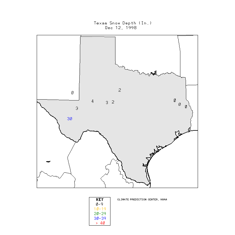
11 December 1998 -- Heavy Snow in Southwest Texas
|
|
Interactive IR and visible roaming image comparison | image fader
|
|
|
Interactive IR and visible roaming image comparison | image fader
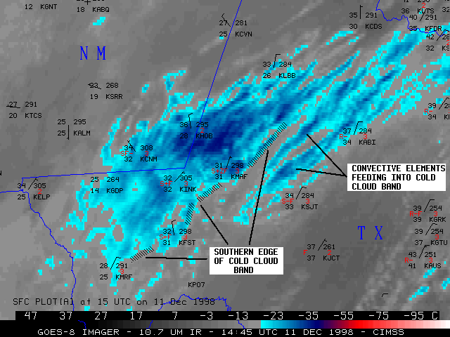
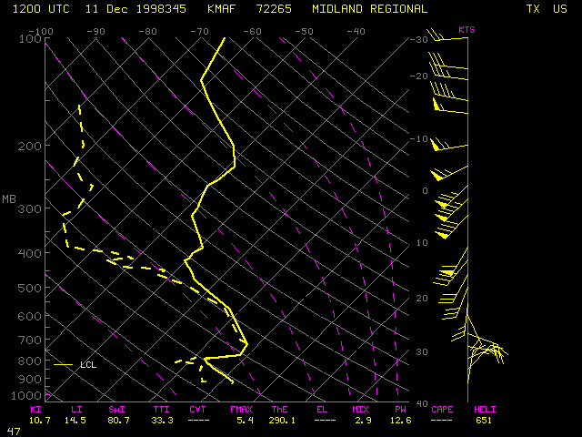
Heavy snowfall was observed over parts of southwest Texas and extreme southeast New Mexico on 11 December 1998. In a span of about 12 hours, Midland, Texas received 9.75 inches of snow, which set a new record for the total snow accumulation during any month / single event / 24-hour period. Snowfall amounts as high as 12 inches were reported at Jal, New Mexico (in the extreme souteastern corner of New Mexico) .
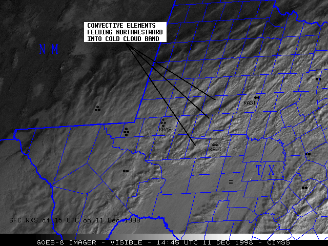
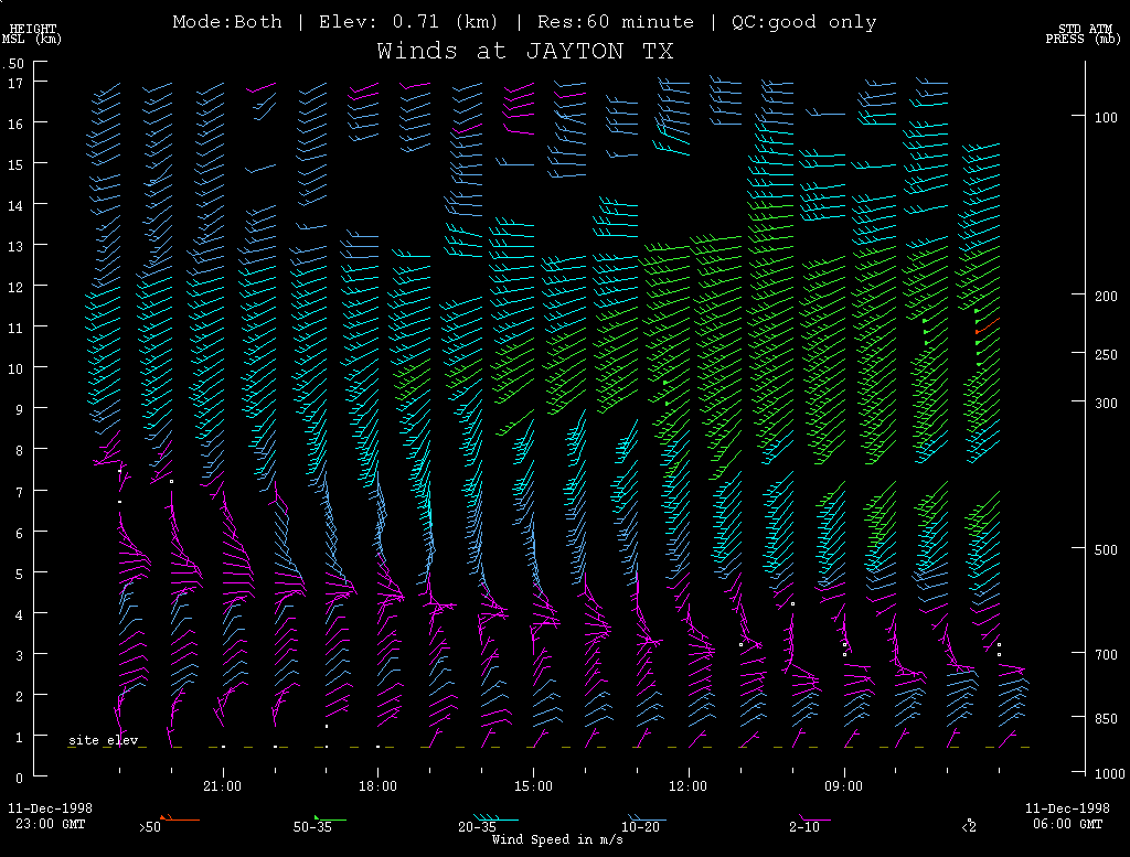
NOAA GOES-8 10.7 micron longwave InfraRed (IR) and visible imagery (above) shows two important satellite signatures that are often indicators of heavy snow events: the southern edge of a cold cloud band associated with a cyclonic shear zone (or "deformation zone") (see Beckman, 1987 and Morrison, 1989), and elongated convective cloud elements that feed into the southern edge of the main cold cloud band. The visible imagery also shows texture and shadowing signatures that indicate the convective nature of the elongated bands between Midland (KMAF), San Angelo (KSJT), and Abilene (KABI) Texas. These were bands of elevated convection that formed within the moist unstable layer above the 700 hPa level (around 3 km). NOAA wind profiler data from Jayton, Texas showed that the depth of the cold easterly to northeasterly low-level flow gradually increased during the day, but remained within the lowest 3-5 km of the atmosphere. Southwesterly flow prevailed in the mid to upper troposphere, with mid-level winds backing to the south and southeast as the cyclonic shear zone approached the profiler site.
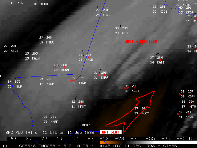
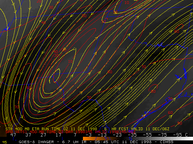
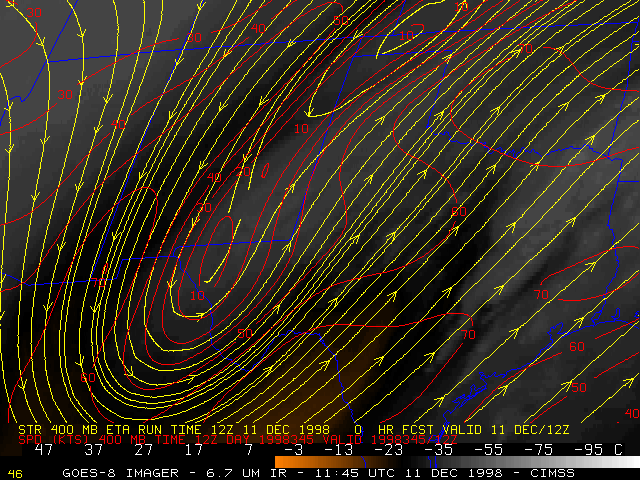
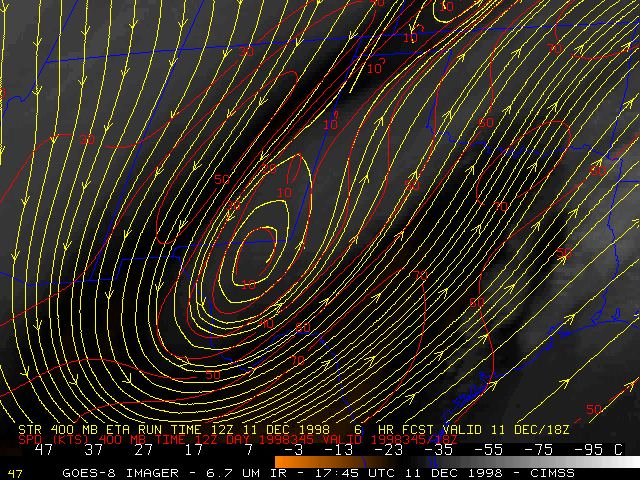
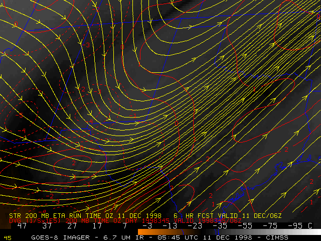
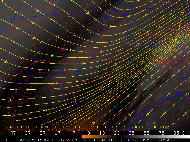
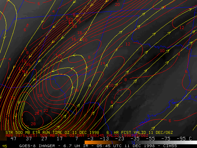
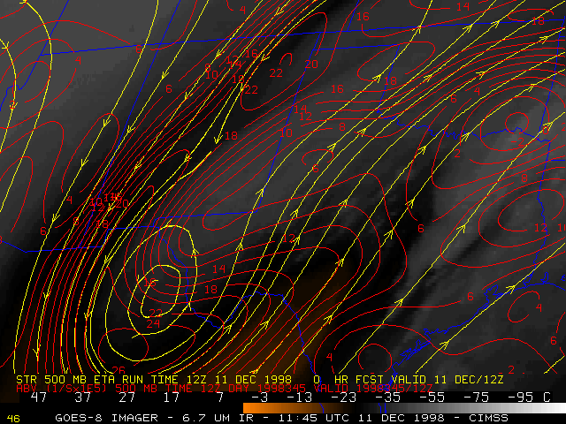
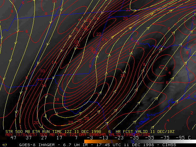
GOES-8 6.7 micron IR (water vapor) imagery (below left) shows another important satellite signature: the intrusion of a mid-level "dry slot" from the Big Bend region into central Texas. This dry slot was associated with a jet streak (400 hPa wind streamlines and isotachs: 06:00 | 12:00 | 18:00 UTC) that was advancing northeastward across the area. Upward vertical motion within the layer beneath the left exit region of the jet (200 hPa wind divergence: 06:00 | 12:00 | 18:00 UTC) helped to enhanced snowfall rates in the region between Midland, San Angelo and Abilene. In addition, studies such as Johnston (1995) have indicated that the southern edge of a heavy show band is often about 100 km (around 1 degree of latitude) to the left of the axis of the dry slot in similar synoptic situations (compare this case to the 14 Dec 1997 heavy snow event over Mississippi/Alabama).
|
|
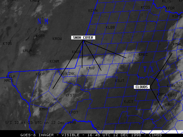
GOES-8 visible imagery from the day after the storm (above right) shows the areal extent of the snow cover that resulted from this system. As the snow pack began to melt during the afternoon hours, the edges (with less snow cover) eroded inward, while those areas with greater snow cover experienced less melting.
It is important to note that this system exhibited no significant surface development (other than the slight upslope component of the north-northeasterly surface winds) -- the forcing that produced the upward vertical motion that led to the production of heavy snow was due to mid-level vorticity advection 06:00 | 12:00 | 18:00 UTC) and warm air advection processes. It is processes such as these that often produce the types of satellite signatures observed above.
