
Satellite Winds

Overview
The idea of using successive satellite observations of clouds to determine wind direction and speed was pioneered by Professor Suomi of the University of Wisconsin-Madison. This module provides an explanation of how this is accomplished. While the concept is simple, the procedure is rather complex.
In fact, it took several decades before satellite derived winds were accurate enough to be incorporated into weather forecasts. The wait was well worth it however and today, all of society benefits from the increased coverage provided by satellite wind technology.
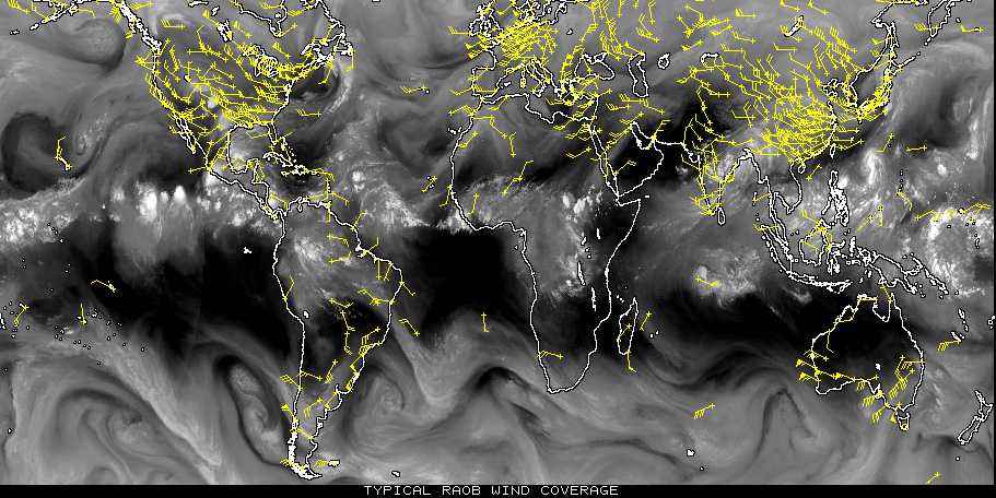
To see what we mean, compare the wind coverage traditional weather balloons provide (top image)
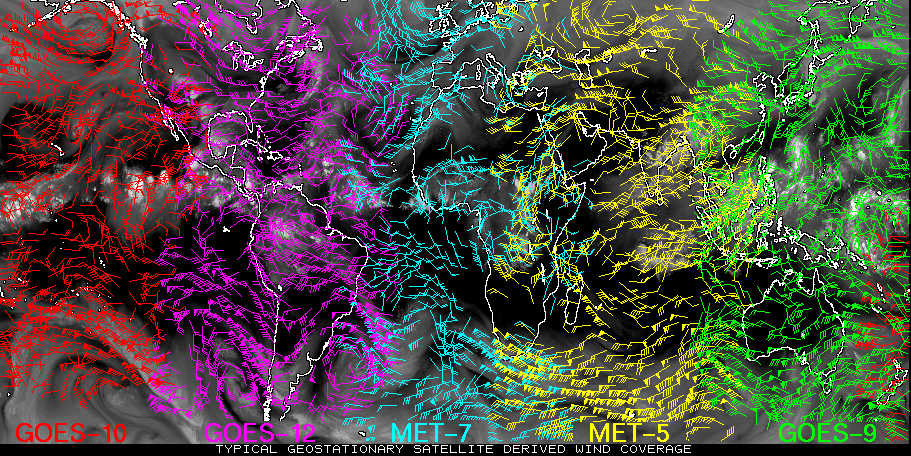
with the increased coverage provided by satellite derived winds from GOES satellites around
the world (bottom image).
Compare wind coverage provided by traditional weather balloons and satellites around world
Satellite Derived Wind Map from GOES Satellites around the World
You will learn (with lots of fun applets !!):
- How satellite images are used to track clouds and derive winds
- Some of the problems and challenges associated with tracking winds from satellites
Let's first look at how we measure the speed of moving objects!!
| Previous Module | 1 / 6 |