
Satellite Images

Overview
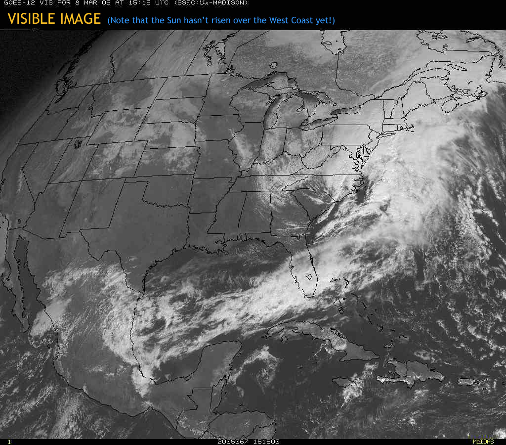
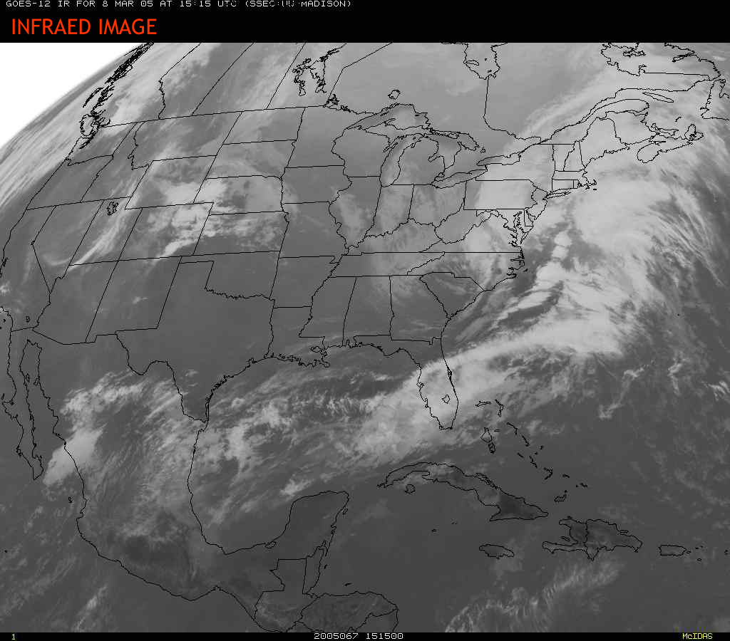
The three most common types of satellite images are:
| Visible Satellite Image | Infrared (IR) Satellite Image | Water Vapor (WV) Satellite Image |
 |
 |
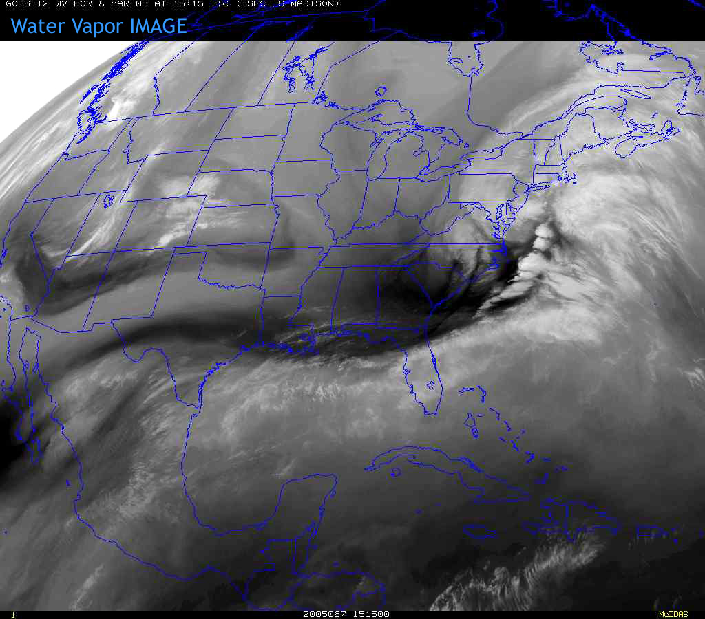 |
The names of these different images refer to what part of the electromagnetic
spectrum the satellite sensors are sampling. It turns out that the atmosphere is transparent to different types of radiation in certain areas of the spectrum. These areas are called atmospheric
windows or channels. Satellite radiometers can "see" in a wide range of electromagnetic radiation windows.
The two most widely used atmospheric windows are the visible (0.6 microns) and infrared
(10 to 12 microns) channels. When we study the upper troposphere we also use the water
vapor channel, which includes radiation between 6.5 and 6.9 microns. Water vapor and high clouds absorb radiation in this spectral region so that the surface of the earth and low clouds are nearly obscured in water vapor images.
Scientist combine information provided from all three types of images to forecast the weather, monitor forest fires, ice flows, ocean currents, and long term climate patterns from the unique global perspective that only satellites can provide.
In this module, you will learn (with lots of fun applets !!):
- the three types of satellite images (visible, infrared, and water vapor)
- how to identify basic cloud types and storm systems in satellite images
- and demonstrate the basic knowledge necessary to interpret satellite observations
| Previous Module | 1 / 15 |