High-Resolution Interferometer Sounder (HIS)
Averaged HIS data
These files contain the up-welling radiance
spectrum measured by the HIS during the "third northbound pass" of
the HIS over the ocean offshore of Wallops Island, Virginia on
29 Sept 1993 UTC. The files contain both the mean and uncertainty in
the mean for each wavenumber sample of the calibrated radiance obtained
during the period 03:47:40 UTC to 03:54:59 UTC on 29 Sept 1993 UTC.
The instantaneous field of view (FOV) on the ground of the HIS is a 2km
circle when the ER-2 is at 20km altitude. The HIS data is nadir viewing
only with a sample time of 6 seconds (without motion compensation)
yielding a 2x3 km footprint for every 6 second sample. The HIS FOV
are overlapping along the ER-2 flight track such that the "coaddition"
of the twelve sample earth views contained in one calibration cycle
is a strip about 2km wide and 12 km long. Each calibration cycle contains
12 earth views, 4 hot blackbody views, and 4 cold blackbody views in a
repeating sequence.
The files contain an average of data from four consecutive
calibration cycles. This sample average views a stip of ocean about
2km wide and 48 km long. The actual linear distance along the
flight track is more than 48 km since no earth data is collected during
views of the calibration blackbodies at the end of each calibration cycle.
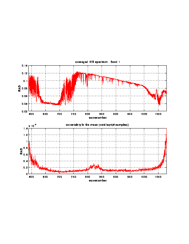
BAND 1 averaged data: ASCII format,
radiances in gif format,
radiances in postscript format,
brightness temperatures in gif format,
brightness temperatures in postscript format.
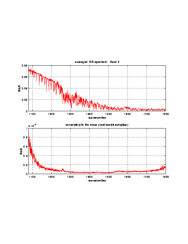
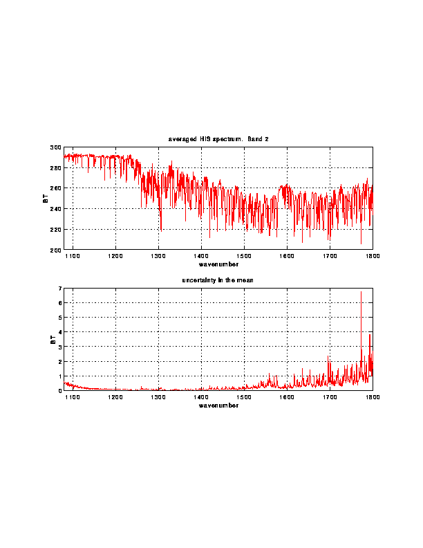
BAND 2 averaged data: ASCII format,
radiances in gif format,
radiances in postscript format,
brightness temperatures in gif format,
brightness temperatures in postscript format.
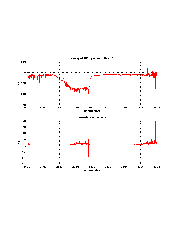
BAND 3 averaged data: ASCII format,
radiances in gif format,
radiances in postscript format,
brightness temperatures in gif format,
brightness temperatures in postscript format.
Window channel temperatures from individual
spectra along the averaging time.
Back to HIS Homepage