21 January 1999 -- Arkansas Tornado Outbreak
60-image Animation (5.3 Mbytes) |
32-image Animation (7.5 Mbytes) |
|
60-image Animation (5.3 Mbytes) |
32-image Animation (7.5 Mbytes) |
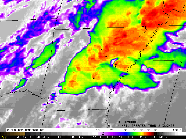
During the afternoon and evening of 21 January 1999, the state of Arkansas experienced its largest tornado outbreak ever recorded during the month of January. Over 30 tornadoes were reported across the state (the strongest tornadoes have been rated at F3 on the Fujita Scale), with 8 fatalities. Baseball to grapefruit-sized hail was also reported at some locations.
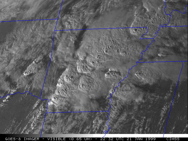
NOAA GOES-8 10.7 micron longwave InfraRed (IR) and visible imagery (above) shows the progression of supercell convective systems across the area. These loops include Rapid Scan Operations (RSO) imagery at 5 to 10 minute intervals during the event. Preliminary locations of tornadoes and hail exceeding 2 inches in diameter are also plotted on the IR imagery. The visible imagery reveals several overshooting tops which appear as subtle texture and shadowing along the anvils of some of the strongest storms.
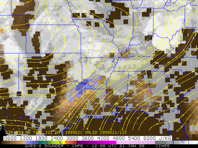
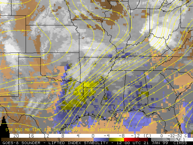
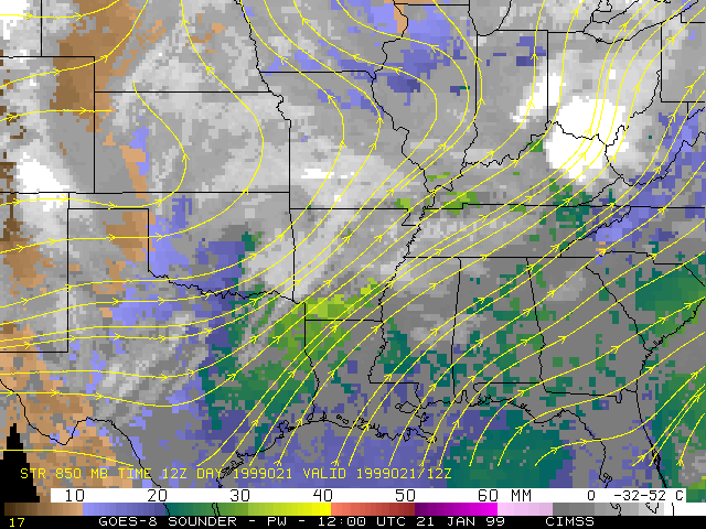
GOES-8 Sounder-derived Convective Available Potential Entergy (CAPE), Lifted Index (LI), and Precipitable Water (PW) products are shown below. The unstable and moisture-rich nature of the air mass feeding northeastward into Arkansas and the southern Mississippi valley region is very evident, with CAPE values exceeding 2000 J kg-g, LI values less than -8 C, and PW values near 40 mm.
|
|
|
