22 June 1998 -- Fires in Florida
|
|
|
|
|
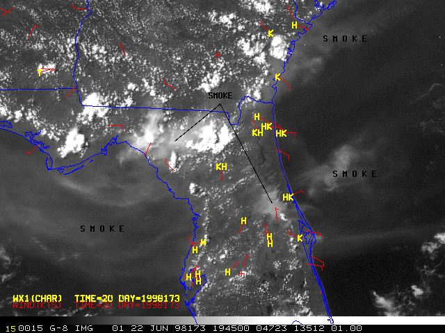
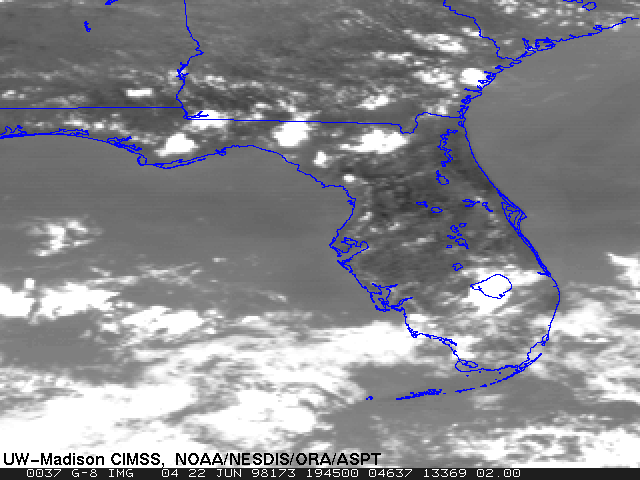
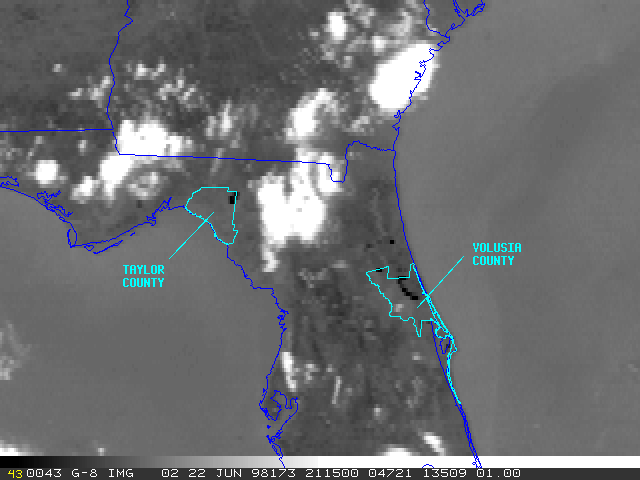
Drought conditions and record heat persisted across much of Florida during June 1998, creating conditions favorable for wildfires. Since late May over 76,000 acres have burned in 39 counties in the state. NOAA GOES-8 visible and 3.9 micron shortwave IR imagery (above) show smoke plumes and fire hot spots over parts of northern Florida on 22 June. The largest fires were in Taylor and Volusia counties. Many of these fires were started by cloud-to-ground lightning strikes.
![]() GOES imagery from the following day (23 June 1998) shows that fires continued to burn in the same areas.
GOES imagery from the following day (23 June 1998) shows that fires continued to burn in the same areas.
|

|
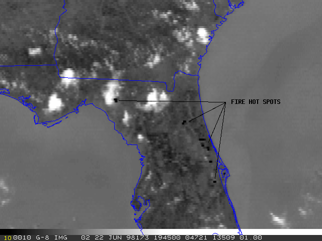
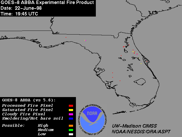
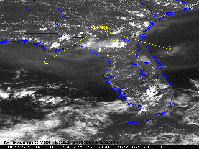
Multispectral GOES-8 data at 19:45 UTC on 22 June 1998 were processed with an experimental version of the GOES-8 Automated Biomass Burning Algorithm (ABBA). The ABBA product (above left) shows numerous fire pixels throughout Florida, which can also be seen as dark hot spots in the 3.9 micron IR imagery (above right). The visible image at this time (below left) shows smoke plumes emanating from the fires, with smoke transport apparent over the Atlantic Ocean and the Gulf of Mexico. The fires and smoke are not identifiable in the 10.7 micron IR image (below right).
|
|
