12 January 1998 -- Arctic Cold Front Moves South Across Texas Panhandle Region
|
|
Interactive dual-image comparison (water vapor and shortwave IR)
|
|
|
Interactive dual-image comparison (water vapor and shortwave IR)
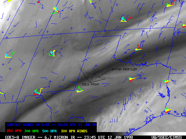
An Arctic cold front moved southward across the Texas panhandle region and eastern New Mexico late in the day on 12 January 1998. GOES-8 6.7 micrometer IR ("water vapor") imagery showed a subtle curved "dry band" that propagated southward and southwestward within the middle troposphere (against the ambient southwesterly flow aloft). This feature seemed to correspond with the leading edge of the northeasterly surface wind shift as shown by the hourly surface reports. Although the depth of the leading edge of the Arctic air mass was rather shallow (less than 1.5 km deep, according to rawinsonde reports and Jayton, TX profiler data), a mid-tropospheric "gravity wave" was created aloft which was sensed as a warm (dry) signature on the water vapor imagery.
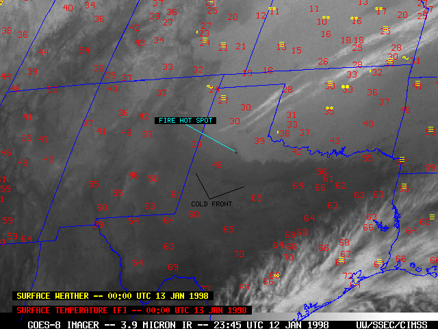
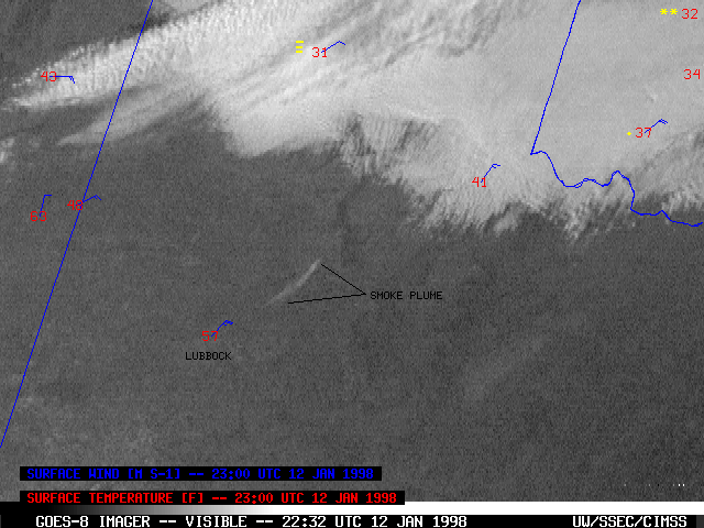
GOES-8 3.9 micrometer (shortwave InfraRed) imagery showed that a deck of stratus clouds followed in the wake of the cold front, as the northeasterly upslope flow invaded northern Texas and eastern New Mexico. Some surface reports of fog and freezing drizzle can be seen along the leading edge of the stratus near the Texas/New Mexico border, where the upslope component of the surface wind was most pronounced. Also evident were a few dark "hot spots" from fires that were burning north of the Lubbock, Texas area. These hot spots were eventually covered by the advancing stratus cloud layer. A smoke plume was seen streaming southwestward on GOES-8 visible imagery prior to the arrival of the stratus deck.