|
|
|
|
|
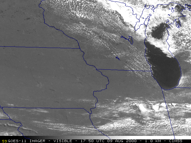
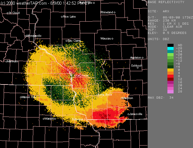
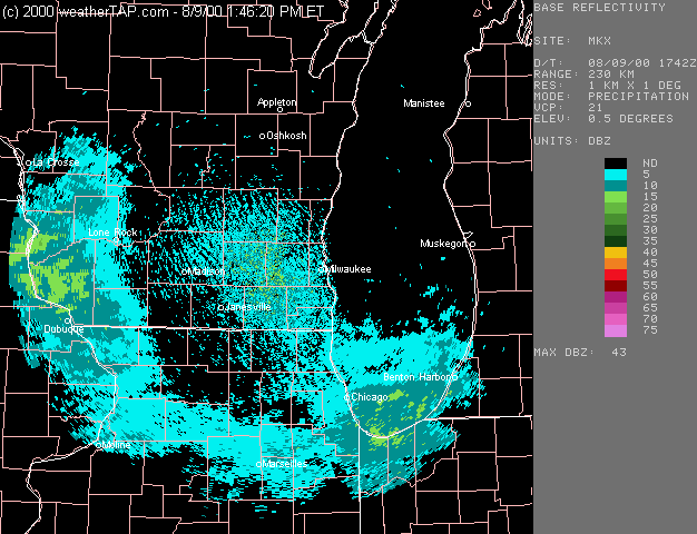
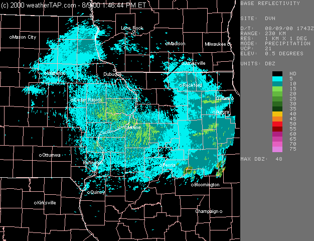
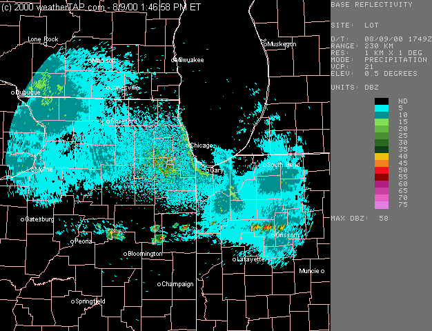
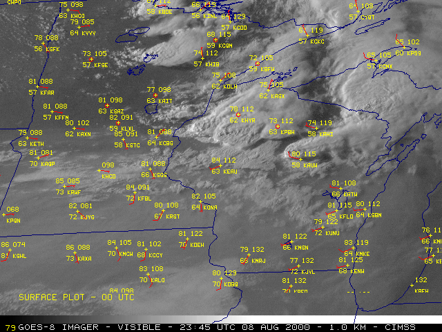
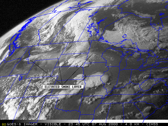
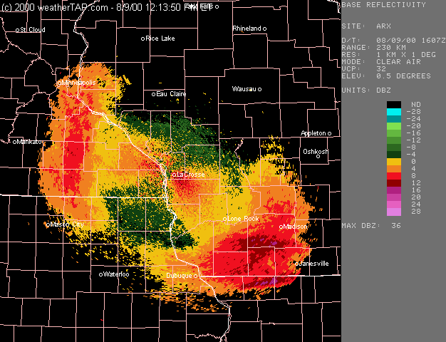
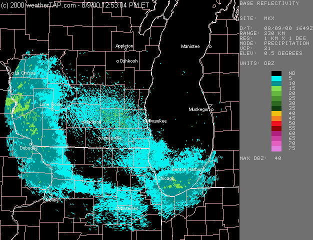
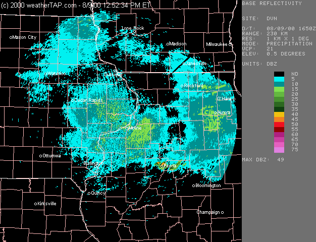
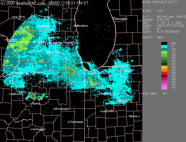
NOAA GOES-11 imager visible channel (above, left) showed cloud-free conditions across northeastern Iowa, southwestern Wisconsin, and northern Illinois during the morning hours on 09 August 2000. However, regional WSR-88D radars (below) were showing 0.5 degree reflectivities of 10-15 dBZ over these apparently clear regions. These semi-circular reflectivity features were generally 100-120 miles [160-190 km] from each radar site, so the radar beam was intersecting these targets (elevated smoke layers from fires in the northern Rockies) at altitudes of 10-15 kft [3-4.5 km AGL]. The northern edge of a thicker, more opaque elevated smoke layer can be seen on GOES-11 visible, sinking southward across central Iowa and northern Illinois, but this boundary was south of the radar reflectivity features.
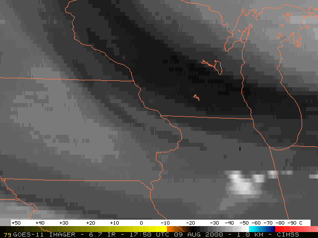
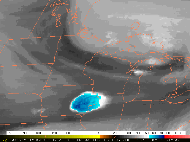
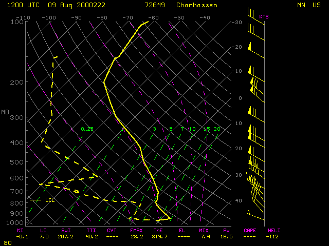
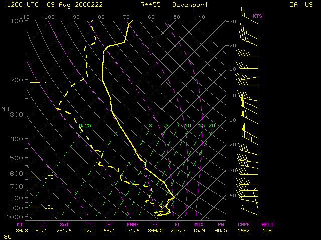
GOES-11 6.7 micrometer IR ("water vapor") imagery (above, right) did show an elongated plume of cooler brightness temperatures (perhaps indicating slightly elevated moisture content), oriented NW-SE across the region where the radar reflectivity features were seen. This could be a thin plume of smoke that acquired some moisture via convective boundary layer pumping over northern Wisconsin the previous afternoon/evening, or over eastern Iowa during the overnight hours (elevated smoke plumes have been detected by GOES water vapor imagery in previous cases). A longer animation of GOES water vapor imagery showed a warming/drying trend, indicative of synoptic-scale subsidence in the wake of a shortwave trough passing through the Great Lakes region; the 12:00 UTC rawinsondes from Minneapolis, Minnesota and Davenport, Iowa showed elevated subsidence inversions that could have been trapping the smoke.
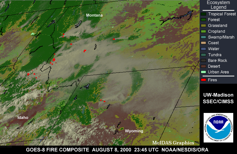
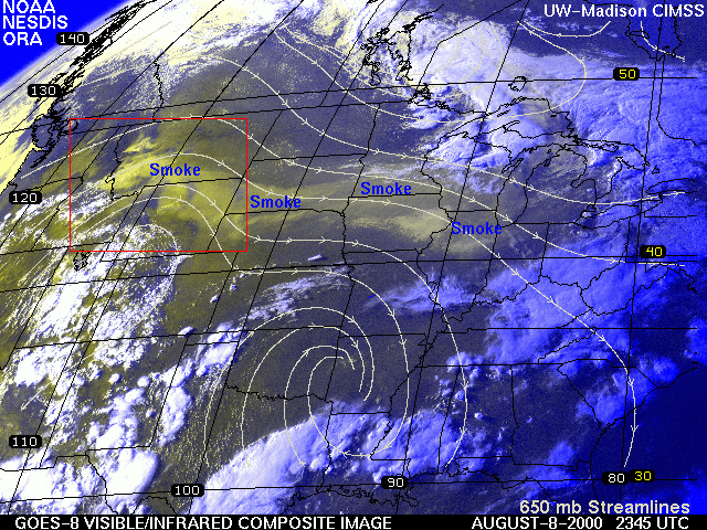
Thick elevated smoke layers could be seen on 07 August ( animation) and 08 August (fire hot spots | visible/IR composite), originating from the large fires in Idaho and Montana and being transported eastward over the northern Plains and Great Lakes regions.
|
|
|
|
(NIDS radar products provided by WeatherTAP)

