|
|
|
|
|
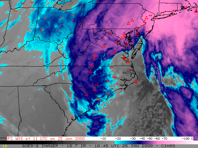
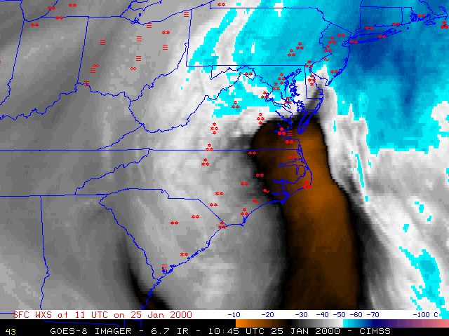
NOAA GOES-8 longwave InfraRed (IR) and "water vapor" imagery (above) shows the hourly development of a significant winter storm that affected much of the east coast of the U.S. during 24-25 January 2000. Snowfall totals of 4 inches or more were recorded in every eastern seaboard state from South Carolina to New Hampshire, and included 24 inches in Montgomery county NC and 20.3 inches at Raleigh NC (a record accumulation for any single event, or any single month). Strong winds were also associated with this storm - wind gusts of 54-74 knots were recorded at bouys off the North Carolina coast - which caused blowing and drifting snow. A loop of 15-minute IR imagery shows the transition from rain to snow across eastern North Carolina and Virgina during the morning hours on 25 January.
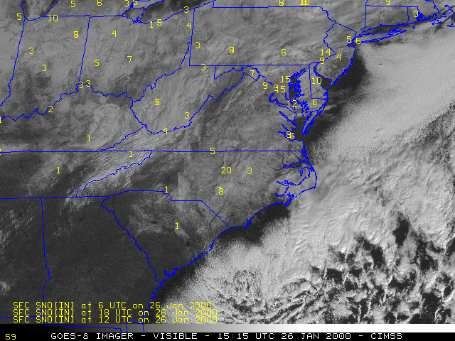
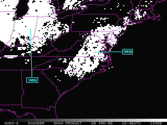
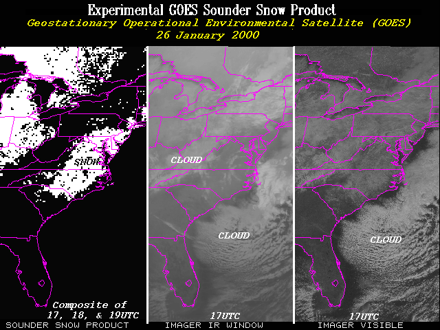
GOES-8 visible imagery from the following day (below left) shows the extent of the snow cover along the eastern seaboard. Surface snow depth (inches) is plotted in yellow on the visible image. An experimental multispectral GOES Sounder snow product (below right) helps to discriminate which of the brighter white regions on the visible channel are cloud cover and which are regions of significant snow cover.
|
|
