26 January 2000 | East Coast Winter Storm | GOES-8 Imager Visible
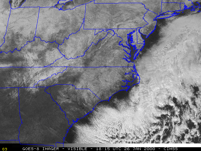
This loop of GOES-8 visible imagery shows the extent of snow cover the day following the major winter storm that affected much of the east coast of the U.S. during 24-25 January 2000. Surface snow depth (in inches) is plotted in yellow on the first image of the loop. Clouds move from image to image, but the snow cover remains stationary.