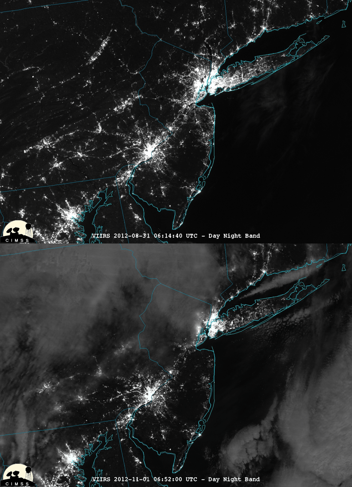
VIIRS Day/Night Band images showing areas of Sandy-related power outages
As seen in other examples posted on this blog, the Suomi NPP VIIRS 0.7 µm Day/Night Band (DNB) is useful for detecting city lights at night. A comparison of “pre-Sandy” (a cloud-free night way back on 31 August 2012) and “post-Sandy” (01 November 2012) DNB images displayed using McIDAS-V (above) showed some of the areas that remained without power in the wake of the landfall of Hurricane Sandy on 29 October 2012 — two areas that stand out are western parts of Long Island, New York and central New Jersey. You can also interactively fade between the before/after DNB images using this Java applet.
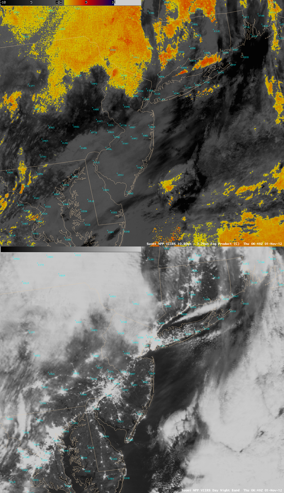
A comparison of AWIPS images of the 01 November DNB data with the corresponding 10.8-3.74 µm “fog/stratus product” (below) showed that those two areas of interest — western Long Island, and central New Jersey — were not obscured by any significant low fog/stratus features (yellow to red color enhancement) or any dense high cirrus clouds (black color enhancement).


