| 1953 |
Verner E. Suomi measured the heat
budget of a corn field for his doctoral thesis from the University of Chicago. Measuring
the difference between the amount of energy absorbed and the amount of energy lost in a corn
field led him to thinking about Earth's heat budget.( A
Man for All Seasons) |
| |
|
| 1957 |
In October, the Soviet Union successfully launched Sputnik I, beginning the space race between
the United States and the U.S.S.R. |
| |
|
| 1957 |
In December, Verner
Suomi and Robert Parent’s radiometer included in payload of Vanguard TV-3, but the
satellite exploded seconds after launch. |
| |
|
| 1958 |
The United States successfully launched its first satellite, Explorer-1, on
31 January 1958. |
| |
|
| 1958 |
Congress passed the Space
Act, creating the National Aeronautics and Space Administration. |
| |
|
| 1959 |
Flat
plate radiometer designed by V.E. Suomi and R.J. Parent for the first Earth Radiation Budget
Experiment (ERBE) flew
on Explorer-7. The flat
plate radiometer (FPR) system was designed to provide a measurement of the global distribution
of reflected solar and longwave radiation leaving the earth. With this experiment, Suomi established
the important role played by clouds in absorbing radiated solar energy, setting the stage for
integration of satellites into the field of meteorology (A
Man for All Seasons) |
| |
|
| 1965 |
Funding from NASA and the NSF established the Space
Science and Engineering Center. |
| |
|
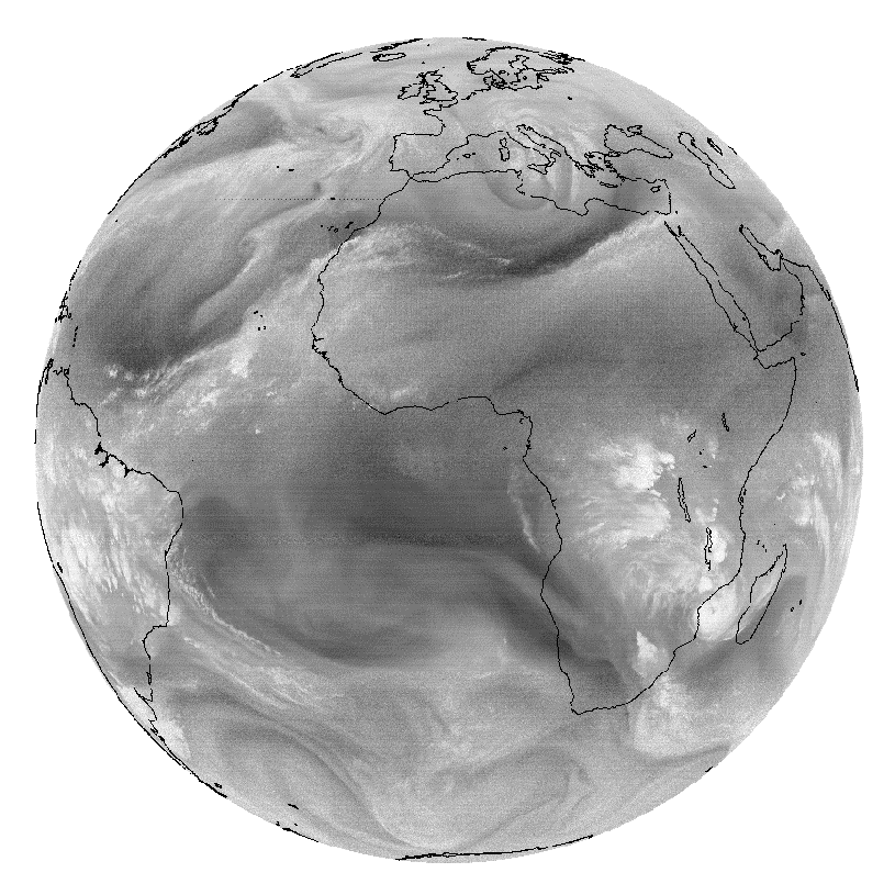
| 1966 |
ATS-I, the first geostationary
satellite, launched
on 6 December 1966 (LST) or 7 December 1966 (UTC). Its payload was Suomi’s Spin
Scan Cloudcover Camera (SSCC). The launch of ATS-I into geosynchronous Earth orbit pioneered
continuous viewing of weather from space. Suomi understood the benefits that could be gained
by observing a
single weather phenomenon at frequent intervals. These kinds of observations were not possible
using the early, low polar-orbiting satellites. |
| |
|
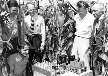
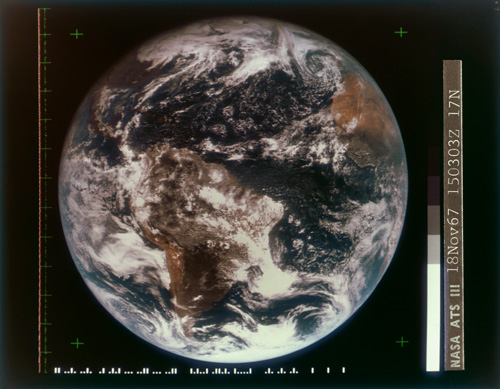
| 1967 |
ATS-III launched on 5 November
1967. It sent the first color images from the Multicolor
Spin Scan Cloudcover Camera (MSSCC). The ATS-III was the only geostationary satellite with
a blue channel which was, and still is, a unique feature. The camera
provided color pictures for approximately three months at which time the red and blue channels
failed. The system continued to provide black-and-white pictures until 11 December 1974. [ATS
site] NASA photo showing scientists
standing around satellite. |
| |
|
| 1968 |
Display software developed at SSEC allowing direct interface with ATS image archive. |
| |
|
| 1970 |
High-quality ATS data disseminated world-wide |
| |
|
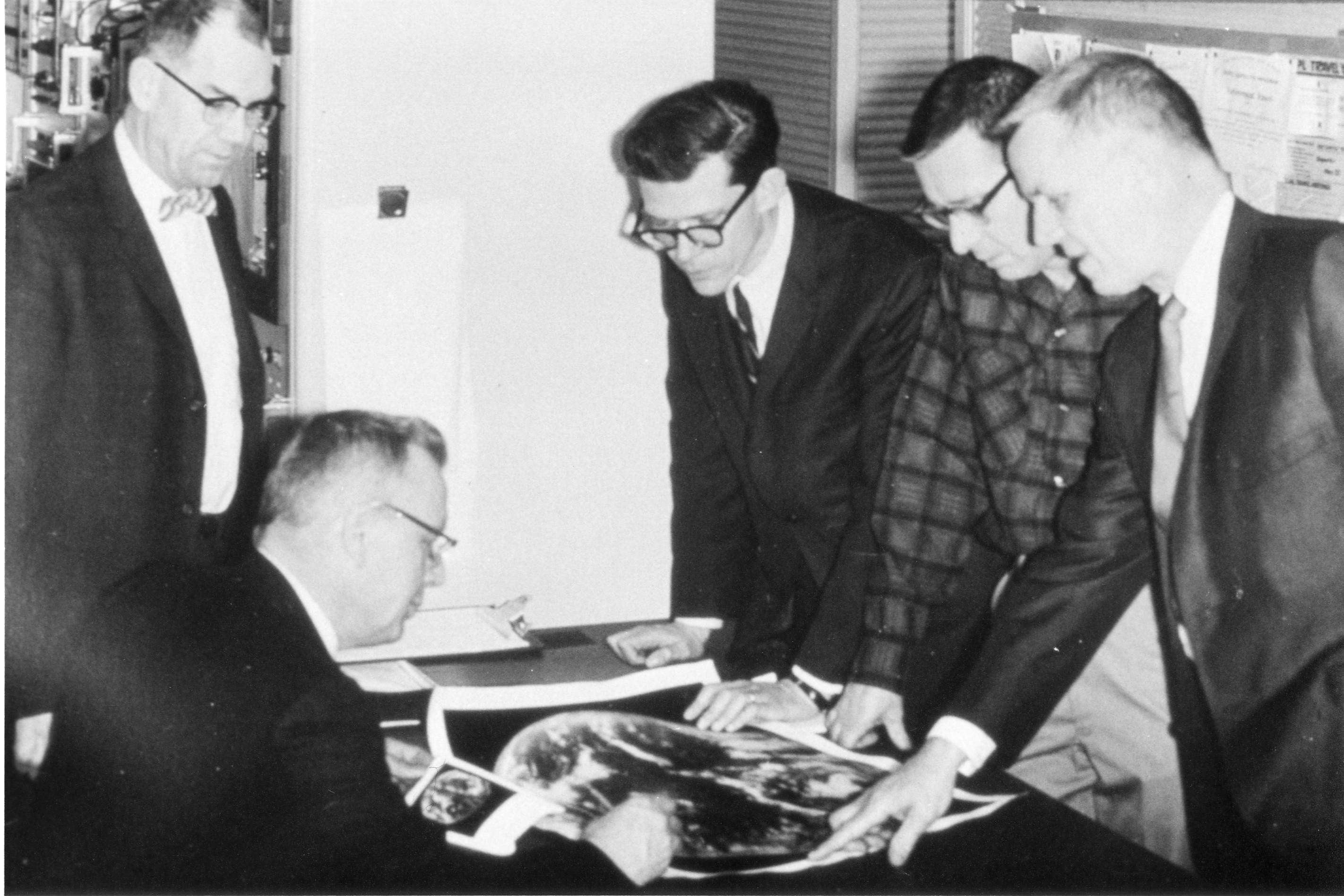
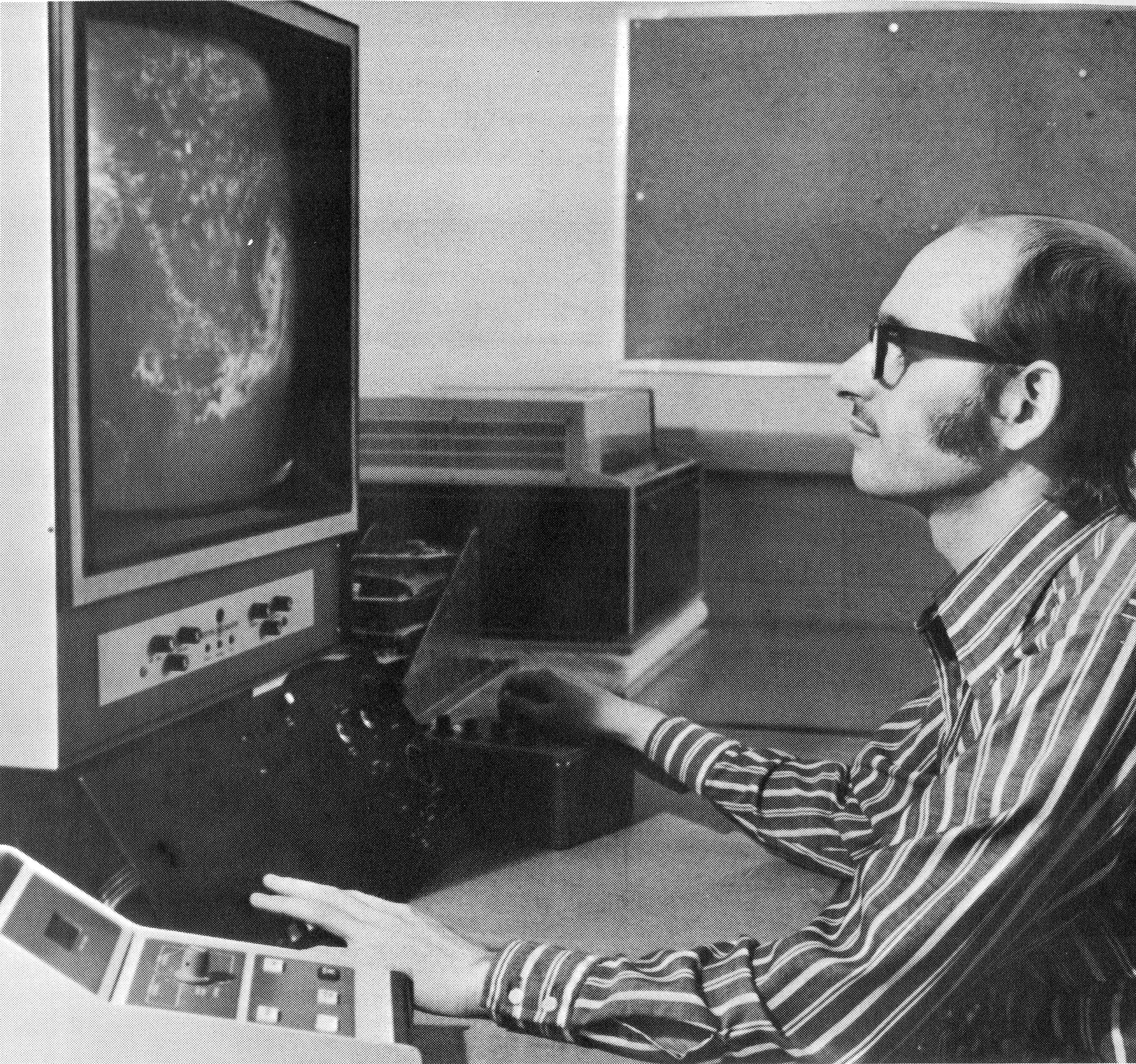
| 1972 |
Introduction of Man-computer
Interactive Data Access System (McIDAS): accurate cloud motion information produced from
satellite images by a prototype McIDAS. (Hibbard: McIDAS complemented Suomi’s Spin-Scan
Camera in geosynchronous orbit, as a system for acquiring, storing, navigating (aligning
images with earth locations) and animating images from his satellites. The combination of
these two inventions enabled people to see animated cloud images, as billions now do via
TV weather programs. An interesting anecdote is that Suomi saw instant replays on football
programs and sought out the technology used for that, as a way to animate satellite images.)
McIDAS was the first interactive meteorology system, combining satellite images with data
from “conventional” sources such as surface observations and rawinsonde balloons.
The system enabled various data analyses, including
estimating winds from time sequences of satellite cloud images (NASA photo). |
| |
|
| 1974 |
Success of the ATS program led to NASA's Synchronous
Meteorological Satellite (SMS) with IR camera, launched on 17 May 1974. |
| |
|
| 1974 |
Global Atmospheric Research Program (GARP) Atlantic Tropical Experiment (GATE), benefitted
from the IR camera that Suomi recommended. |
| |
|
| 1974 |
By applying video-processing capability of McIDAS, nowcasting concept developed emphasizing
mesoscale atmospheric features for better current forecasts. |
| |
|
| 1975 |
SMS-2 launched on 6 February 1975. |
| |
|
| 1975 |
GOES-1 launched on 16
October 1975 (NOAA Photo Library). |
| |
|
| 1977 |
Meteosat provided first
water vapor imager on 23 November 1977. |
| |
|
| 1977 |
GOES-2 launched on 16
June 1977 aboard Delta Launch Vehicle 131 (NOAA Photo Library). |
| |
|
| 1978 |
SSEC adapted videocassette recorder to archive digital satellite data. McIDAS had, as far as
we know (Hibbard) the first archive of satellite images using “slant track” and then
UMATIC video tape drives. |
| |
|
| 1978 |
First GARP Global Experiment (FGGE) planned for 1978-1979. SSEC
was selected to archive satellite wind vectors from cloud heights. Suomi played key organizing
role. |
| |
|
| 1978 |
GOES-3 launched 15 June
1978 (NOAA Photo Library) |
| |
|
| 1979 |
SSEC designated national archive for GOES data. |
| |
|
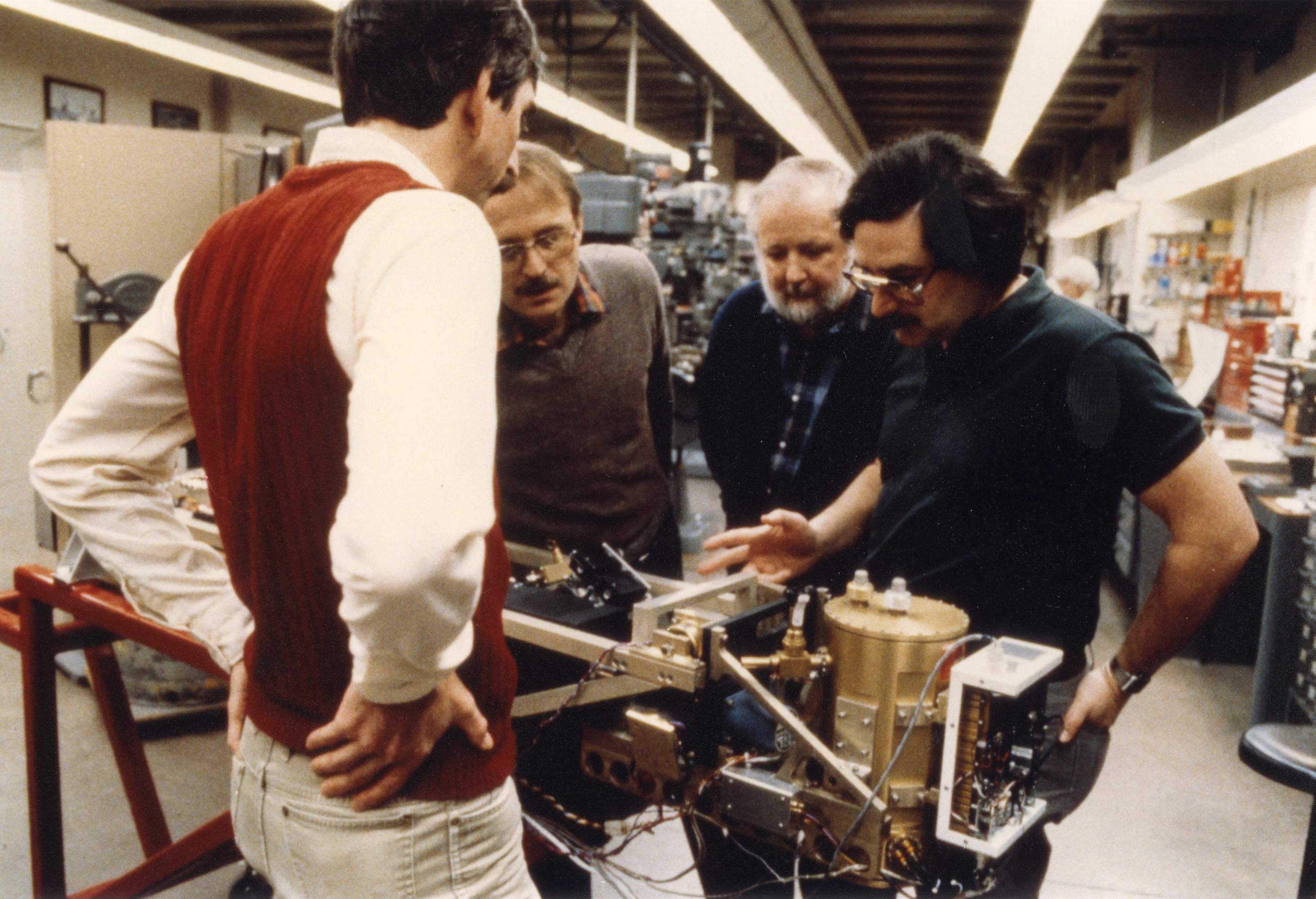
| 1979 |
UW-SSEC led the design of the High-resolution
Interferometer Sounder (HIS), the first hyperspectral sounder for GOES, in partnership
with industry (SBRC/Bomem), NOAA, and NASA. This Phase A design effort proved the feasibility
of this important advance for improving vertical resolution, and was twice very close to being
implemented into operations in the 1980s (as what became the GOES-8 sounder) and 90s (as the
G-HIS modification to the filter radiometer sounder). |
| |
|
| 1980 |
Cooperative Institute for Meteorological Satellite Studies
(CIMSS) founded by Dr. Suomi through a MOU with NOAA and NASA. William L. Smith became
its first director. |
| |
|
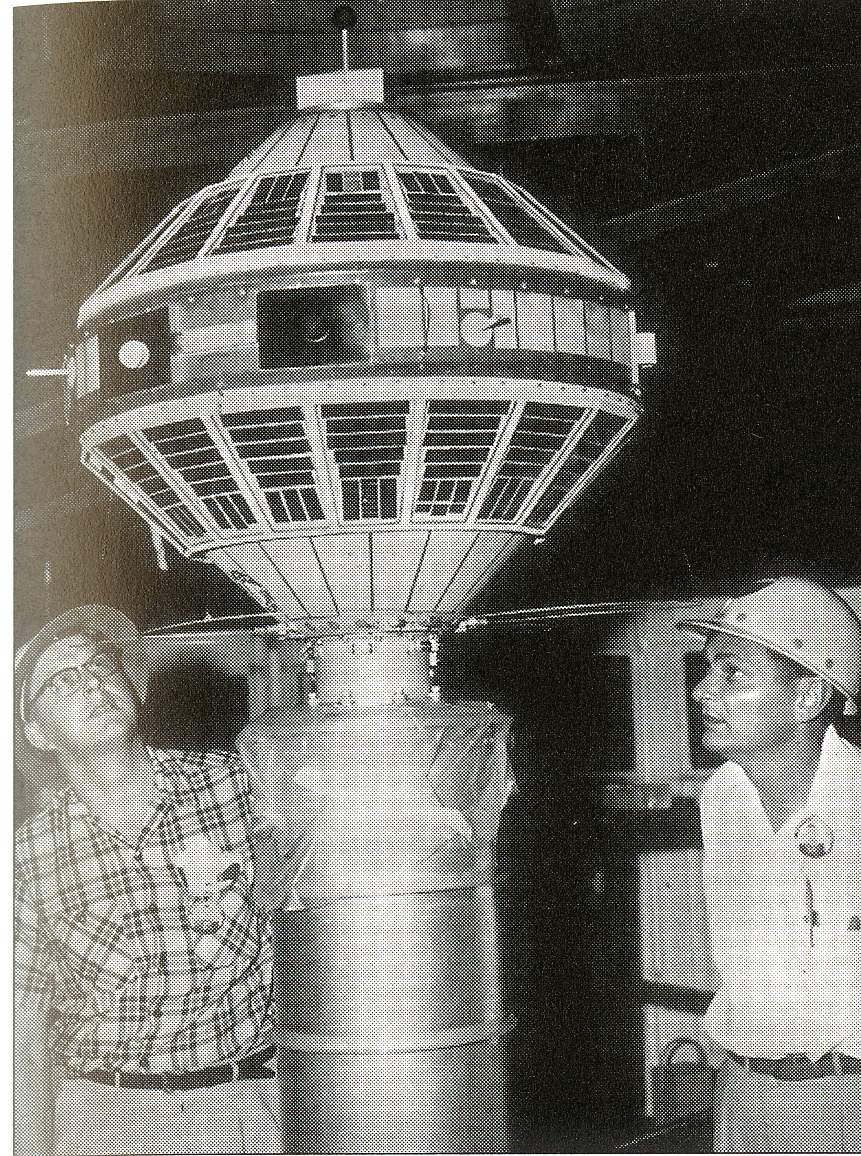
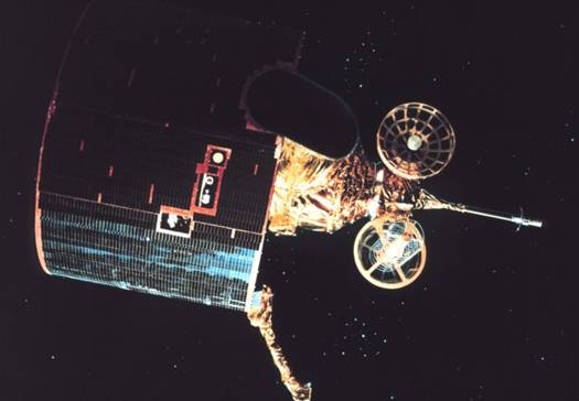
| 1980 |
GOES-4 launched 9 September
1980, was first geostationary satellite to provide continuous vertical profiles of atmospheric
temperature and moisture. The instrument was a modification of the original spin-scan design
with additional detectors for proper spectral bands [Man for All Seasons]. The Visible
Infrared Spin Scan Radiometer (VISSR) Atmospheric Sounder (VAS) became the first geostationary
sounder. Here, a scientist
works on the model satellite before launch. |
| |
|
| 1980 |
McIDAS installations continued to expand, for example, McIDAS support and system provided to
National Hurricane Center, NESDIS’ World Weather Building, and space shuttle launches supported
with real-time weather data by McIDAS. |
| |
|
| 1981 |
GOES-5 launched 22 May
1981 and deactivated in 1990 (NOAA Photo Library). |
| |
|
| 1983 |
GOES-6 launched 28 April
1983 (NOAA Photo Library). |
| |
|
| 1983 |
VAS data incorporated into many new products for the National Weather Service. |
| |
|
| 1986 |
GOES-G did not reach operational orbit. Seconds into the launch
the first stage engine shut down, necessitating destruction (NOAA Photo Library). |
| |
|
| 1987 |
GOES-7 launched 26 February 1987, with additional search and rescue signal detection ability. |
| |
|
| 1988 |
SSEC participated in software and instrument development for next-generation geostationary
satellites. |
| |
|
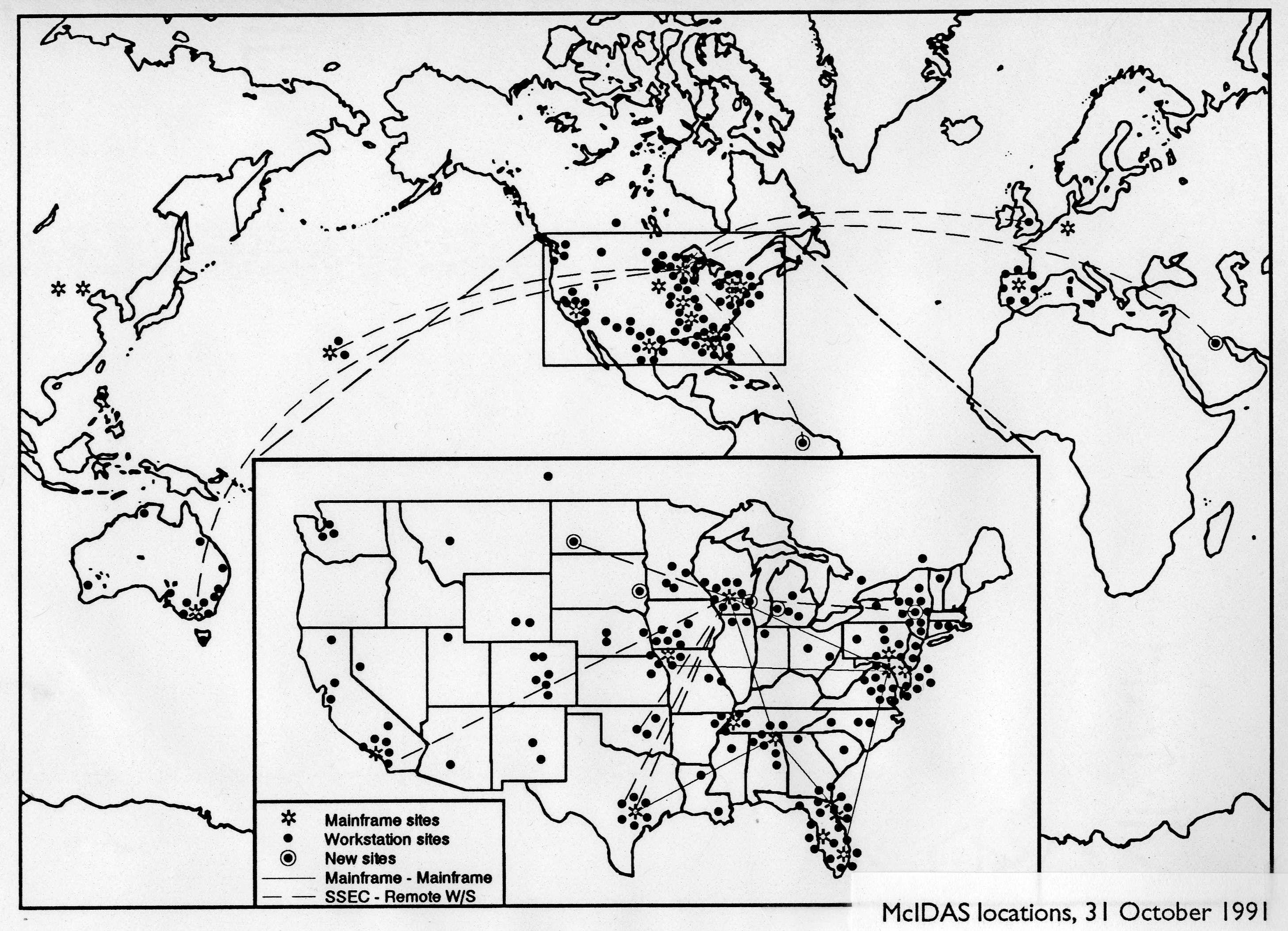
| 1991 |
World-wide network of McIDAS
sites continued to expand. |
| |
|
| 1992 |
VAS cloud products used hourly by the National Weather Service. |
| |
|
| 1994 |
GOES-8 launched 13 April 1994 and is first GOES
launched on a three axis stable platform (NOAA Photo Library). SSEC was very involved with
ingestors, simulations and technical expertise. |
| |
|
| |
While the original spin-scan design is no longer in use in the United States, Suomi's basic
concept was adopted for many satellites and space probes built for NASA, the National Oceanic
and Atmospheric Administration, the European Space Agency, the Japanese Meteorological Agency
and the Chinese National Satellite Meteorological Center (A
Man for all Seasons) |
| |
|
| 1995 |
GOES-9 launched 23 May
1995 and deactivated in July 1998 (NOAA Photo Library). |
| |
|
| 1997 |
GOES-10 launched 25 April 1997. |
| |
|
| 1999 |
Data Center archived Meteosat-7 and Meteosat-5 imagery and old GOES videotape inventory made
available on the web. |
| |
|
| 1999 |
SSEC helped define next generation GOES imager/sounder. |
| |
|
| 1999 |
1999-present: The GIFTS
(Geosynchronous Imaging Fourier Transform Spectrometer) was designed and built to offer
revolutionary new sounding capabilities with a partnership between Utah State Space Dynamic
Laboratory, NASA Langley Research Center, NOAA, and UW-SSEC/CIMSS. Much of the technical
groundwork and the first systems design was performed at the UW. We hope to find a way
to get GIFTS in orbit by 2011. |
| |
|
| 2000 |
GOES-11 launched 3 May 2000. First
official visible channel image from GOES-11 posted on SSEC web site on 17 May. |
| |
|
| 2001 |
GOES-12
launched 23 July 2001 (NASA Photo) and is first GOES to operate a SXI-type instrument. First
GOES-12 visible image released by SSEC on 12 August 2001. |
| |
|
| 2001 |
Data Center added data from China’s polar-orbiting and geostationary satellites. |
| |
|
| 2001 |
New geostationary satellite browser provided imagery for five geostationary satellites with
animation and zoom capability. |
| |
|
| 2001 |
CIMSS and NOAA’s Advanced Satellite Products Team (ASPT) participated in GOES-12 prelaunch
activities and performed the GOES-12 science tests: checked data quality, produced products from
data stream and compared them to those from other satellites, investigated impact of new bands,
posted hourly displays of all 19 sounder channels. |
| |
|
| 2002 |
EUMETSAT launched
SERVI on Meteosat Second Generation (MSG) with 12
channels [Menzel timeline] |
| |
|
| 2004 |
JAMI [Menzel timeline] |
| |
|
| 2006 |
GOES-13 launched
on 24 May 2006 (NASA Photo). First
full-disk image archived by SSEC Data Center on 22 June 2006. |


