
 |
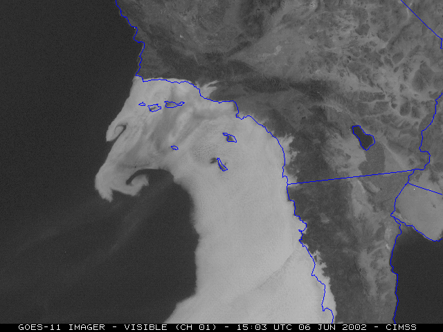 |
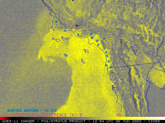
These satellite images show low clouds and fog during the pre-dawn hours that slowly evaporate during the morning, as well as the location of a 10,000 acre wildfire (the bright red dot) that was burning in the Los Padres National Forest on June 6th, 2002. The infrared image on the left has color added to it to help meteorologist easily see the low clouds and fog. Infrared (IR) images are what forecasters use during the nighttime since IR satellite instruments detect the heat emitted by objects and can monitor clouds and weather 24 hours a day. The visible image on the right was created from satellite instruments measuring reflected sunlight and shows how the fog and stratus slowly dissipate during the morning hours. The visible image also shows the wispy southwesterly drift of smoke aloft.
Low clouds and fog at sunrise are fairly common along the coast in southern California. This particular day was unique, however, due to a strong onshore flow associated with an intesifying Catalina Eddy circulation. Fortunately for forecasters, this circulation and onshore push was easy to see in these satellite images.