
4
Cloud Identification

Low Level Clouds - IV
Fog
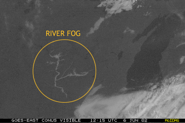
Fog is essentially stratus clouds on the ground. Fog normally occurs at a relative humidity near 100%, and could reduce visibility to less than 1000 metres. Fog is easy to depict on visible satellite images because the land around the fog is darker and warmer while the fog is cooler and milky white. The tops of fog appears smooth in a visible image, while the edges may appear sharp as they conform to the terrain, such as mountains or river valleys.
Seeing Fog Dissipating over Rivers in Satellite Images
Fog usually dissipates from its edges and works its way inward. This is seen in multiple, or time-lapse images as shown below.
| 6 / 12 |