


 Terra TerraThe launch of the Terra satellite marked the beginning of humankinds comprehensive monitoring of solar radiation, the atmosphere, the oceans and the Earths continents from a single space-based platform. Terra is providing the first measurements of the global/seasonal distribution of key Earth and atmosphere parameters, which include: global bio-productivity (land and oceans); land use; land cover, snow and ice; 24-hour global surface temperature; clouds (macrophysics, microphysics, and radiative effects); radiative energy fluxes; aerosol properties and water vapor, fire occurrence, and trace gas levels. There are five instruments on the Terra satellite working together to fine-tune data collection as it is being ingested:
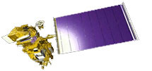
"Terra" is the Latin word for land. The EOS AM-1 satellite was given this name because the timing of the orbit flies the satellite over the Earths largest land masses (the northern hemisphere) in the morning when cloud cover is at a minimum.
Continue to the next page
|