Earth image  HomeAbout the CourseModulesGlossaryReal-time DataGallery
The POES Earth Observing Satellite (EOS) Program continued

Monitoring the Global Environment

Beginning of Module


Created by UW-Madison, 2002

Aqua satelliteAQUA
"Aqua" is the Latin word for “water”. The Aqua mission is named for the large amount of information it will collect about the Earth’s water cycle, including ocean surface water, evaporation from the oceans, water vapor in the atmosphere, clouds, precipitation, soil moisture, sea ice, land ice, and snow cover. Since liquid water covers approximately 70% of the Earth’s surface, one exciting benefit anticipated from AQUA is an improvement in weather forecasting. Aqua hosts three high powered sounders that promise high precision vertical profiles of the Earth's atmosphere.

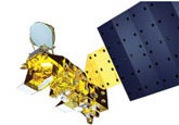
There are six instruments on the Aqua satellite:

  • AIRSAtmospheric Infrared Sounder
  • AMSR-E – Advanced Microwave Scanning Radiometer for EOS
  • AMSUAdvanced Microwave Sounding Unit
  • CERESClouds and the Earth’s Radiant Energy System
  • HSBHumidity Sounder for Brazil
  • MODISModerate-resolution Imaging Spectroradiometer

Technically the spacecraft has eight EOS instruments since there are two identical copies of CERES and the AMSU. Collectively they will gather radiation data from a large portion of the electromagnetic spectrum, ranging from the ultraviolet, visible, infrared and microwave wavelengths. By having multiple types of measurements, scientists can gain a more complete understanding of the Earth/atmosphere system.

The key science topics addressed by Aqua are atmospheric temperature, sea ice cover, deforestation and other changes in vegetation cover, changes in the stratospheric “ozone hole”, weather forecasting, clouds, and natural hazards. Alarm systems using satellite observations to monitor fire, famine, floods and volcanoes are currently under development. The applications are endless.

 Continue to the next page

 Go back to the previous page