LightningCast
The ProbSevere LightningCast model uses images of visible, near-infrared, and long-wave infrared channels aboard GOES ABI to predict the probability of lightning in the next 60 minutes (QuickGuide). LightningCast has been used extensively by NWS forecasters since 2021.

Quick links
Training
“Super dashboard” training
LightningCast Hazardous Weather Testbed training
GRLevelX placefiles (v2.60+ required)
These placefiles are all parallax-corrected with a constant cloud-height assumption of 9 km.
- GOES-East CONUS sector
- GOES-East Meso1 sector
- GOES-East Meso2 sector
- GOES-West CONUS sector
- GOES-West Meso1 sector
- GOES-West Meso2 sector
Publications and presentations
- The Impact of Radar Reflectivity Data in a Satellite-based Lightning Nowcasting Model, WAF (2025)
- NOAA’s ProbSevere LightningCast: Progress and Updates toward Transition-to-Operations (AMS Annual Meeting 2024)
- Applying ProbSevere LightningCast (invited, NWS SOO meeting 2023)
- ProbSevere LightningCast for decision-support services (AMS Annual Meeting 2023)
- NOAA’s ProbSevere LightningCast: Artificial intelligence for nowcasting lightning from geostationary satellites (EUMETSAT 2022)
- ProbSevere LightningCast: A Deep-Learning Model for Satellite-based Lightning Nowcasting, WAF (2022)
- NESDIS Satellite Book Club (2021)
- NWS Southern Region Science Circle (2021)
- Using GOES ABI and Deep Learning to Nowcast Lightning (Monday Jan 11; Joint 2.5), AMS Annual Meeting (2021)
- Lightning Prediction in the Atlantic offshore region, NOAA AI Workshop (2020)
Notebooks
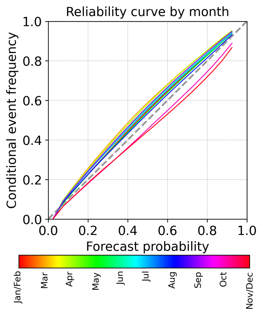
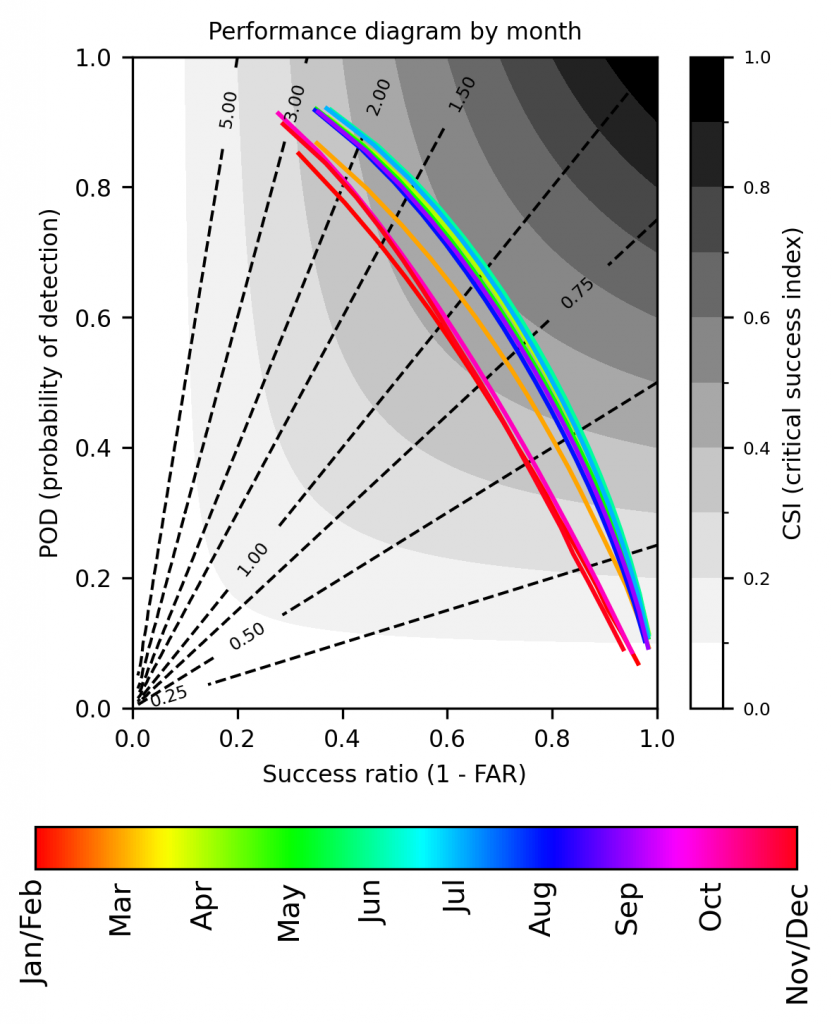
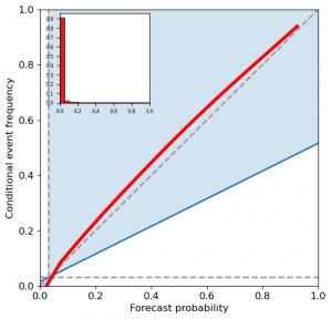
Verification
These verification metrics, for LCv1 (ABI-only predictors) were computed from the GOES-16 CONUS sector, every 10 minutes, for approximately all of 2023.