JPSS Series Learning Module
The Joint Polar Satellite System (JPSS) is the Nation’s newest polar-orbiting operational environmental satellite system, operated by the National Oceanic and Atmospheric Administration (NOAA). JPSS will provide continuity of critical observations for accurate weather forecasting, reliable severe storm outlooks, and global measurements of atmospheric and oceanic conditions.
The JPSS series of 4 satellites follows the successful Suomi NPP polar-orbiting satellite, a NOAA-NASA demonstration spacecraft launched in 2011 – providing high-resolution imagery from the Visible Infrared Imaging Radiometer Suite (VIIRS) via 22 bands.
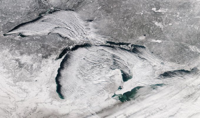
This winter scene of lake-effect clouds and snow across the Great Lakes Region was acquired by the VIIRS instrument on the Suomi-NPP satellite in December 2018.
Suomi-NPP is the first Earth monitoring satellite to be named after a scientist, Dr. Verner Suomi, a high school science teacher who went back to college to earn his PhD and become an internationally renown trailblazer in satellite meteorology at the University of Wisconsin-Madison.
One reason that VIIRS can provide such stunning high resolution imagery of Earth is that it rides on polar-orbiting satellites flying fairly close to Earth. You can gain insight on how the Suomi-NPP and JPSS Satellites orbit Earth and collect data from this video:
You can also view a simple schematic of weather satellite orbits from NOAA SciJinks.

