11 August 1999 | Salt Lake City Tornado | GOES-10 Imager 10.7 Micrometer IR
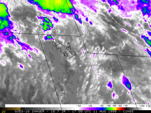
This loop of GOES-10 10.7 micrometer InfraRed (IR) imagery shows the development of convection across the Great Basin region during the late morning and early afternoon hours on 11 August 1999. The Salt Lake City F2 tornado and 1.5 inch diameter hail were reported around 18:45 UTC. Coldest cloud top temperatures in the vicinity of Salt Lake City were -45 to -50 C (green to yellow enhancement). (Salt Lake City is located at the center of the image, near the southeastern edge of the Great Salt Lake)
