11 August 1999 | Salt Lake City Tornado
|
|
|
|
|
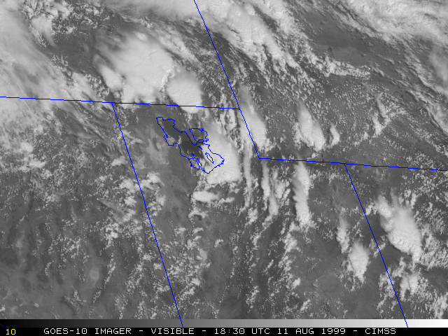
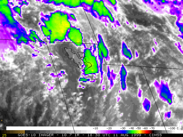
A tornado moved through downtown Salt Lake City between 18:45 and 18:55 UTC on 11 August 1999. The tornado damage was rated as F2 on the Fujita scale, and was responsible for 1 death (the first recorded tornado death in the state's history) and dozens of injuries. Hail up to 1.5 inches in diameter was also reported from this storm. NOAA GOES-10 visible and InfraRed (IR) imagery (above) show the development of convection across the region during the late morning and early afternoon hours. Coldest IR cloud tops in the vicinity of Salt Lake City were around -45 to -50 C (green to yellow enhancement), which was close to the tropopause temperature as indicated on the 12:00 UTC Salt Lake City rawinsonde report.
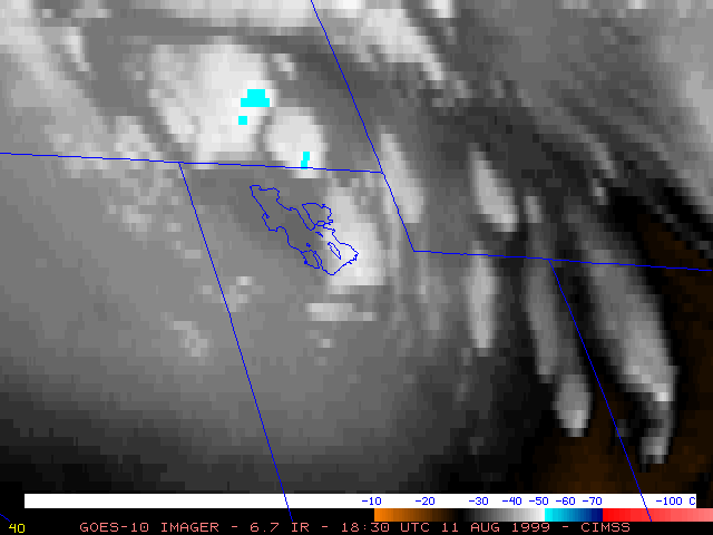
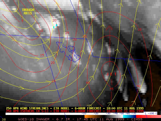
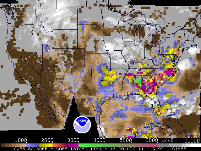
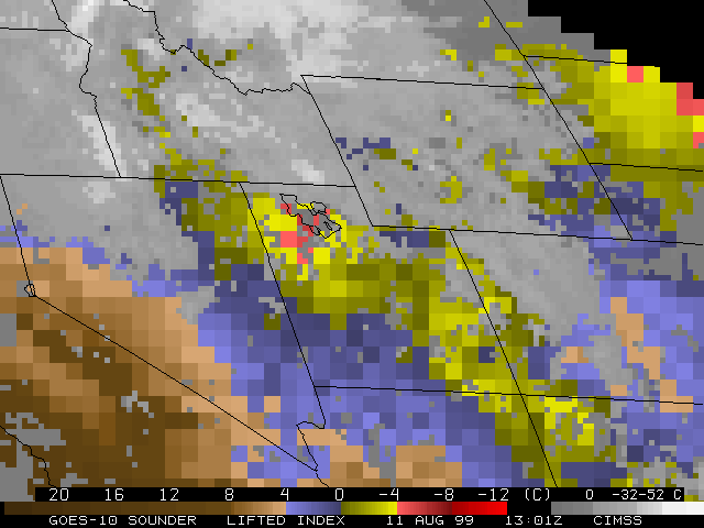
GOES-10 6.7 micrometer IR ("water vapor") imagery (below left) shows that the axis of an upper-tropospheric shortwave trough was approaching northwestern Utah, with a jet streak moving northward over eastern Utah. GOES-8 water vapor winds depicted an upper-tropospheric vorticity maximum over northern Utah, to the northwest of the cyclonically-curved upper level jet streak. The strong dynamics assocated with this upper level trough may have played a role in the development of the severe convection that moved through the Salt Lake City area. GOES-10 Sounder-derived Lifted Index (LI) at 13:00 UTC (below right) reveals that the air mass across northern Utah was already becoming unstable during the morning hours; Sounder-derived Convective Available Potential Energy (CAPE) had increased to over 1000 J kg-1 by 18:00 UTC. GOES Sounder total precipitable water also showed that a pool of significant moisture (greater than 20 mm) was in place across northern Utah that morning.
|

|
