21 July 1998 -- Transverse Cirrus Bands and Turbulence Over the Northern Plains
|
|
|
|
|
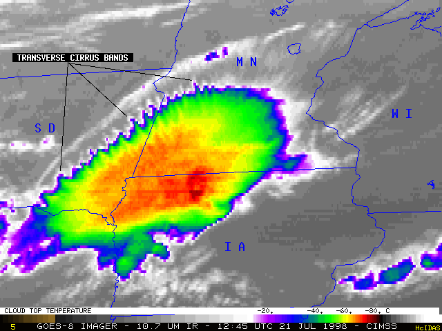
A Mesoscale Convective System intensified over southeastern South Dakota early in the morning on 21 July 1998. As this system moved rapidly eastward across Minnesota and Iowa, NOAA GOES-8 imagery revealed a series of transverse cirrus bands forming along the northern periphery of the storm. Such transverse cirrus bands are often satellite signatures of high-altitude turbulence; several reports of moderate turbulence were received from aircraft flying between 33,000 and 39,000 feet across eastern South Dakota, southern Minnesota, and northwestern Wisconsin as these cloud bands formed.
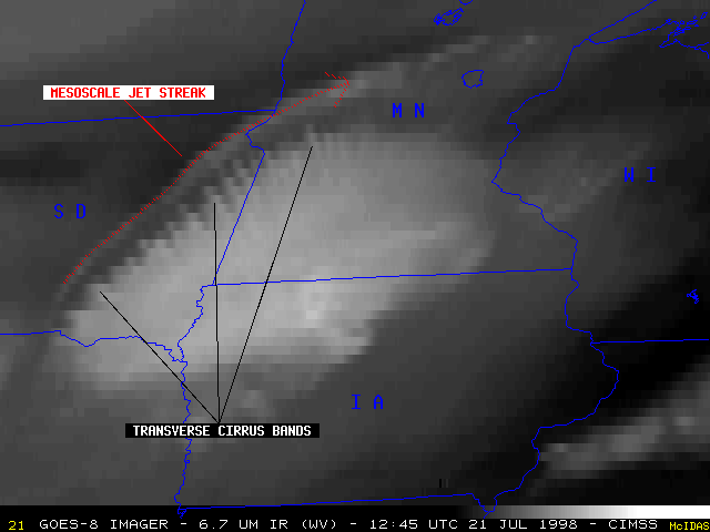
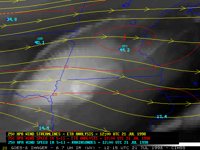
ETA model analyses and rawinsonde reports suggest that high-level storm outflow induced an anticyclonically-curved mesoscale jet streak along the northwestern edge of the system. Wind speeds from the Aberdeen SD (ABR) and Minneapolis MN (MPX) rawinsones were 4-5 m s-1 faster than the ETA analysis at the 250 hPa level (around 34.000 feet). GOES-8 imagery also revealed a smooth cirrus cloud filament along that edge of the system, which often indicates a jet streak axis. Vertical and horizontal turbulence associated with this mesoscale jet streak were likely responsible for the formation of the transverse cirrus bands.

|
