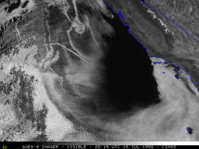
15 July 1998 -- Ship Condensation Trails Off the California Coast
|
|
|
|
|
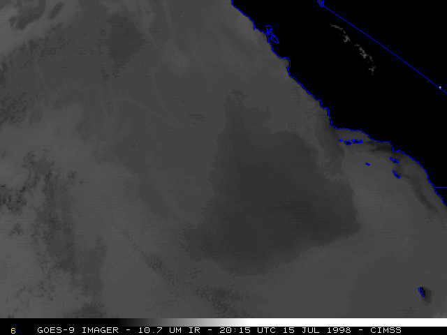
NOAA GOES-9 imagery revealed several ship condensation trails ("ship tracks") off the California coast on 15 July 1998. These ship tracks were confined to the low-level marine boundary layer, along with the other stratocumulus clouds offshore; these features became distorted as they were carried southward by the northerly wind flow within this layer. There was not much temperature contrast between the condensation trails and stratocumulus cloud tops, which made ship track detection difficult using conventional 10.7 micron longwave IR imagery (above).
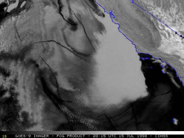
GOES-9 3.9 micron IR and fog product imagery (below) shows these ship tracks very well, due to cloud droplet size differences between the condensation trails (small cloud droplets) and the surrounding stratocumulus cloud deck (large cloud droplets). This imagery also reveals some ship tracks within the southernmost cloud deck, which were not apparent in the visible imagery.

|
|
