29 March 1998 -- Tornado Outbreak in Minnesota and Wisconsin
GOES-8 Imager Products:
|
|
|
|
|
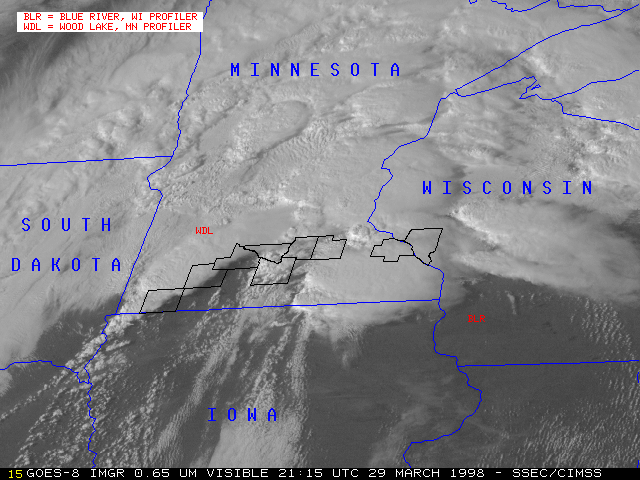
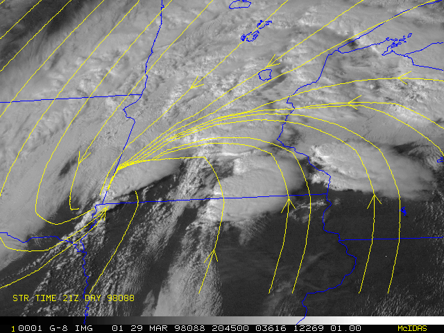
An outbreak of strong convection occurred on 29 March 1998 across southern Minnesota and central Wisconsin. These storms produced several tornadoes, most notably at Lismore/Wilmont/Leota F2) in southwestern Minnesota and at Comfrey/Hanska/Courtland (F3/F4, 1 fatality) and at Nicollet/St. Peter/Le Center (F3, 1 fatality) in southcentral Minnesota. This marked one of only seven occurrences of tornadoes in Minnesota during the month of March. A tornado was also reported near Maxville, Wisconsin. In addition, large hail was reported with these particular storms (hailstone diameters up to 4.5 inches in Minnesota and 1.75 inches in Wisconsin).
Synoptic conditions: A surface low was deepening in extreme southeastern South Dakota, with a warm front extending eastward across southern Minnesota into central Wisconsin. The air mass within the warm sector to the south of this front was very unstable, as surface temperatures reached around 80 F along with dewpoints in the low 60's F. The warm front served as the low-level focus for convective activity.
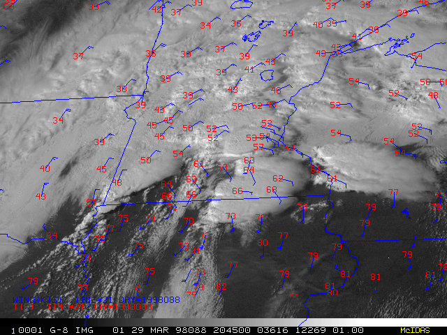
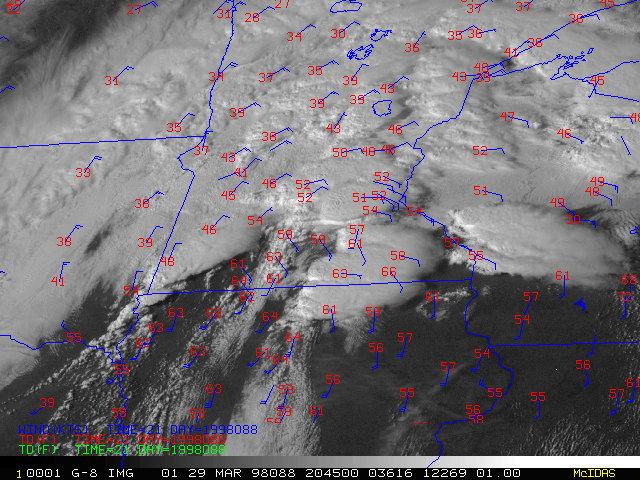
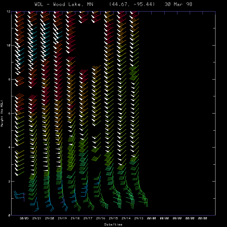
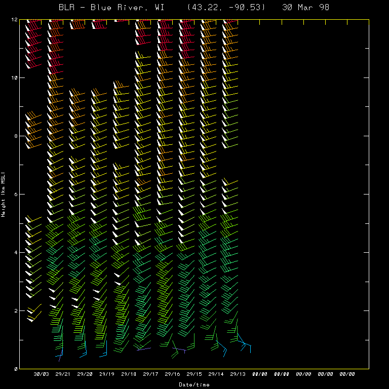
Strong middle and upper-level winds were also advancing over the region -- wind profiler data at Wood Lake, MN and Blue River, WI showed 50 knot winds as low as 2.5 - 3.0 km, as well as strong low to mid-level wind shear (veering and increasing speed with height) that aided in the development of supercell convection.
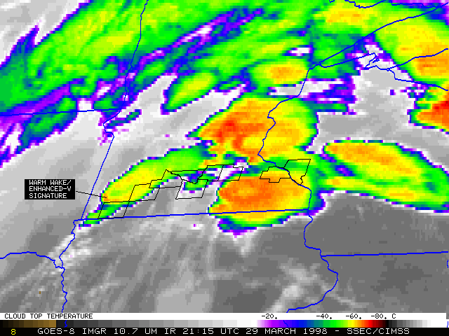
GOES-8/GOES-10 satellite features: The GOES-8 visible and 10.7 micron IR images above show the convection developing from 19:15 UTC (1:15 PM CST) to 23:45 UTC (5:15 PM CST). Counties containing tornado reports are outlined in black. On the 15-minute interval GOES-8 IR loop a pronounced warm wake/enhanced-V cloud top signature was evident on the 21:15 UTC image, while the 5-minute interval GOES-10 IR loop shows such a signature as early as 20:55 UTC. The first tornado in extreme southwestern Minnesota was reported around 21:23 UTC.
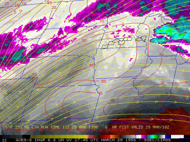
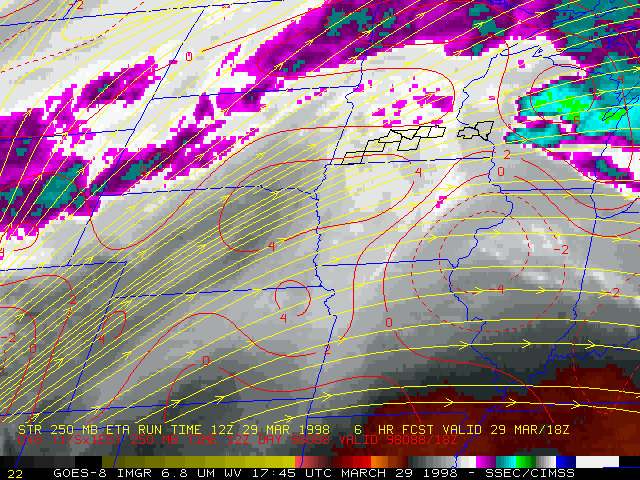
A loop of GOES-8 6.7 micron IR (water vapor) show the axis of a strong (55-60 m s-1) upper level jet streak moving toward southern Minnesota, as well as diffluence and divergence aloft over parts of the upper Midwest region.
|
|
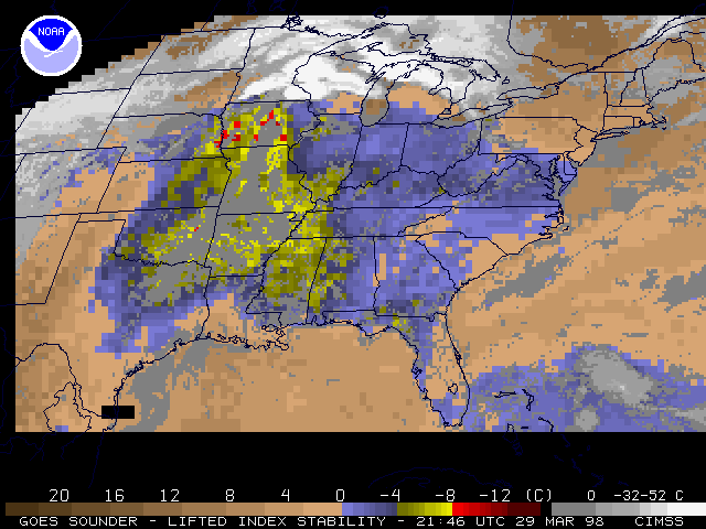
GOES-8 sounder derived Lifted Index (LI) and Total Precipitable Water (TPW) are shown above. An axis of instability (LI values as low as -8 C) existed across extreme eastern Nebraska into Iowa. Convection over that particular region was suppressed due to strong mid-level capping during the day. LI values of -4 to -5 C can be seen in extreme southern Minnesota, just south of the east-west warm front that acted as a focus for supercell convection.
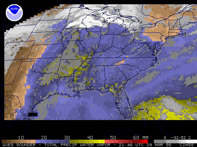
A large pool of 25-30mm TPW values existed across much of the eastern U.S.. Some TPW values greater than 30 mm could be seen feeding northward into the surface warm front which stretched across southern Minnesota into central Wisconsin.
Address any questions or comments to Scott.Bachmeier@ssec.wisc.edu or to Rhett.Grauman@ssec.wisc.edu