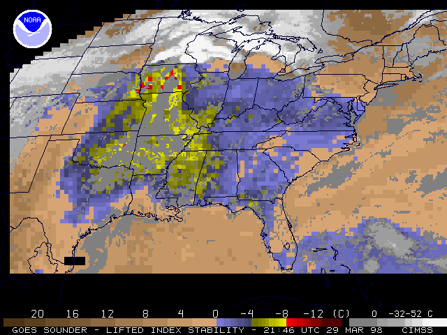
29 March 1998 -- GOES-8 Sounder Lifted Index
Tornadoes in Minnesota and Wisconsin
(this 11-image Java animation sequence will take a minute or two to load...)

(this 11-image Java animation sequence will take a minute or two to load...)

This loop of hourly GOES-8 Sounder Lifted Index product shows that an axis of instability (LI values as low as -8 C) existed across extreme eastern Nebraska into Iowa. Convection over that particular region was suppressed due to strong mid-level capping during the day. LI values of -4 to -5 C can be seen in extreme southern Minnesota, just south of the east-west warm front that acted as a focus for supercell convection.