20 March 1998 -- F3 Tornado in Northern Georgia
GOES-8 Imager Products:
|
|
|
|
|
|
During the early morning hours on 20 March 1998 a squall line with embedded bow echoes was moving northeastward across Alabama and Georgia. As the squall line was beginning to show signs of weakening, new convection rapidly intensified along the trailing edge of the line. This new convection moved across northern Georgia, where it produced an F3 tornado around 11:30 UTC which killed 12 people in Hall and White counties.
The loop of GOES-8 10.7 micron IR imagery and surface wind reports (above left) shows that a core of cold cloud top temperatures (-51 to -54 C, yellow enhancement) began to appear with the developing convection around 09:45 UTC. The cloud top temperatures with these newly-developing storms were significantly warmer than the cloud top temperatures associated with the preceeding squall line (-60 to -70 C), but cold enough to indicate convection with organized, energetic updrafts which reached heights near the tropopause (around -53 C according to the Peachtree City GA rawinsonde).
The primary concern with this squall line was damaging outflow winds and large hail, due to the mainly unidirectional (southwesterly) flow across the region. As the intensifying cell approached northeastern Georgia, the surface winds backed from southwesterly to southeasterly at Gainsville (GVL) and Athens (AHN) around 11:00 UTC -- with stronger southwesterly mid and upper-tropospheric winds advancing over the region, a wind profile with low-level veering and increasing speed with height was created.
The loop of GOES-8 6.7 micron IR (water vapor) images (above right) shows that an elevated "moisture plume" was moving northeastward across Alabama and approaching the western edge of the squall line. The GOES-8 6.7 micron brightness temperatures within this plume were 242 - 245 K (-28 to -31 C), which was around the 425 hPa (6.5 - 7.0 km) altitude on the Birmingham, AL (BMX) and Peachtree City, GA (FFC) rawinsonde profiles. Both rawinsonde profiles showed moist layers around 400 hPa (7.2 km); these moist layers were near the top of deep (100 hPa) elevated conditionally unstable dry layers which contained strong (>50 knot) winds.
A loop of ETA model wind analyses suggests that this moisture plume might be a reflection of the upper portion of a mid-level (700-500 hPa) jet streak that was moving across northern Georgia -- the axis of stronger winds at these levels nearly aligns with the axis of the moisture feature on water vapor imagery. These stronger mid-level winds feeding into the region could have enhanced the speed shear with height. Upper-tropospheric winds showed diffluence over the region.
Also evident on the water vapor loop is a small lobe of vorticity that moves from northern Alabama across extreme northwestern Georgia and into eastern Tennessee. This vorticity feature did not appear to be well-analyzed by the ETA model.

|

|
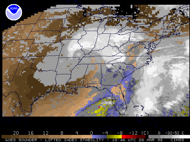
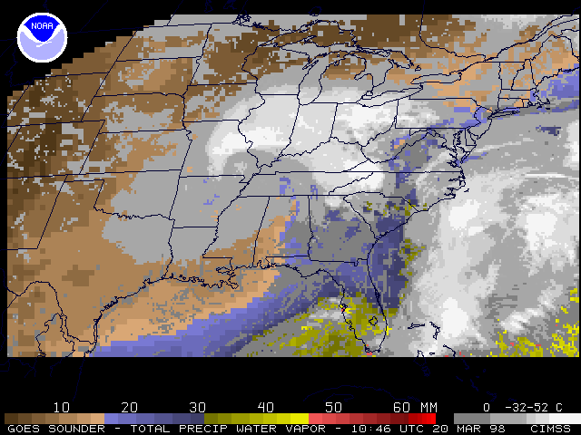
As the main squall line began to collapse, sufficient breaks in the cloud field allowed the GOES-8 Sounder to show a region of weak instability (Lifted Index of -4 C) and residual moisture (Total Precipitable Water around 30 mm) just south of the re-developing convection in northern Georgia (see the 10:46 UTC images above).
Address any questions or comments to Scott.Bachmeier@ssec.wisc.edu