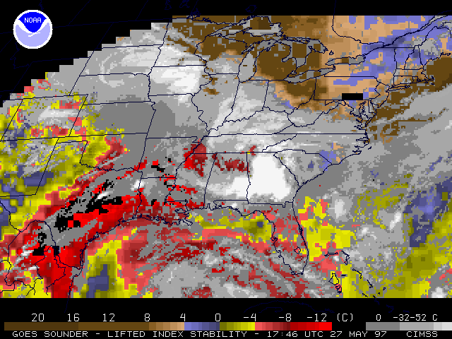
GOES-8 sounder derived lifted index (left) shows the degree of instability across eastern and southern Texas prior to the development of tornadic supercells on 27 May 1997. Earlier in the day, the Storm Prediction Center had flagged the northeast Texas region as having a moderate risk of severe thunderstorms, and a tornado watch was issued. A southwest-to-northeast swath of lifted indices as low as -12 (dark red) to -15 (black) increased in areal coverage during the morning and afternoon hours, leading up to the development of convection around 17:00 UT (noon CDT). Several tornado warnings were then issued, including one for the killer tornado which hit Jarrell, Texas. Further analysis of GOES-8 sounder data for this case has been completed by NOAA/NESDIS/ASPT (Gary Wade) and NOAA/NESDIS/FPDT (Don Gray).
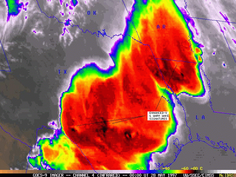
A GOES-9 infrared image (right) shows the large region of cold thunderstorm tops (red = -60 C, black = -80 C) a few hours later, as new convection expanded along the SW-NE oriented axis of instability. Enhanced-V and warm wake signatures are apparent in conjunction with the strongest updraft regions in Texas and Louisiana.
Additional satellite images and discussion for this case can be found at CSU/CIRA and Johns Hopkins University. The Austin/San Antonio National Weather Service office has compiled a weather summary and preliminary tornado damage survey.