|
|

 (- Fade between GOES Sounder LI and PW images at 12:00 UTC -)
|
|
|
(- Fade between GOES Sounder LI and PW images at 12:00 UTC -)
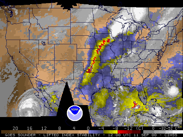
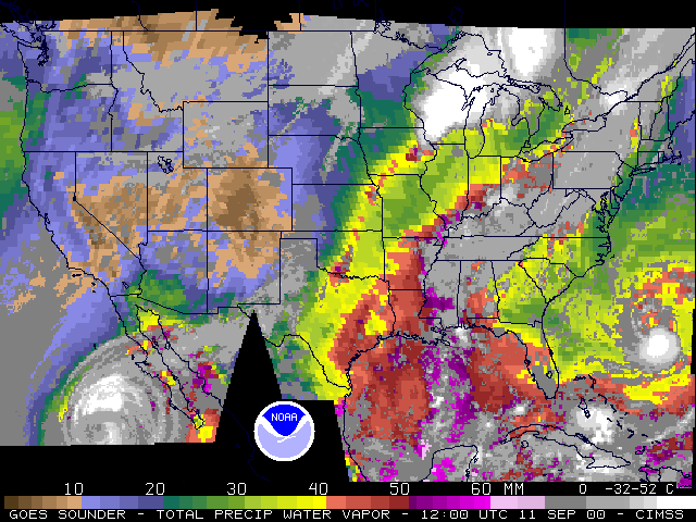
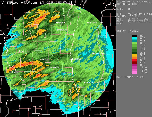
NOAA GOES sounder-derived Lifted Index (LI) and Precipitable Water (PW) products (above) showed an elongated axis of instability and moisture extending from Texas, Oklahoma and Kansas into Iowa on 11 September 2000. The northern portion of this axis (which corresponded to a pre-frontal wind shift line) was feeding northeastward into a region of ongoing strong to severe convection over the western Great Lakes region (GOES-8 animations: visible | IR). As noted in the Hydrometeorological Prediction Center operational excessive rainfall potential outlook that afternoon, high PW values (greater than 40 mm / 1.6 inches), convective outflow boundary interactions, and "training" of thunderstorm cells created a favorable environment for heavy to excessive rainfall (3 to 5 inches) across parts of southern Wisconsin and northern Illinois (verified by radar and cooperative observer reports).
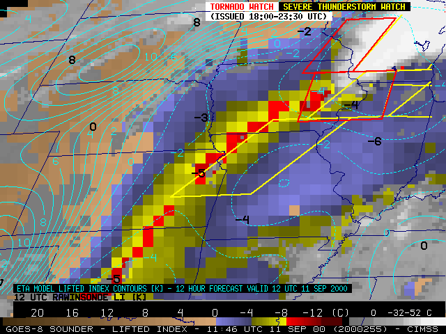
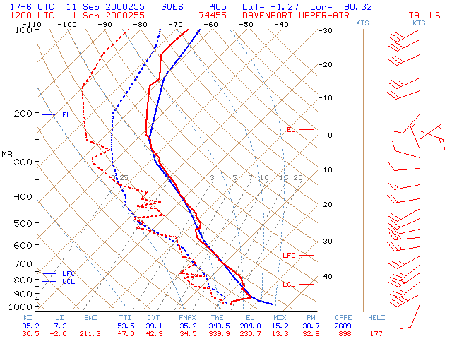
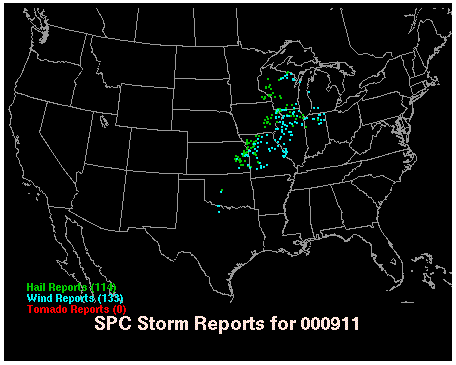
The axis of instability was resolved better by the GOES Sounder than by numerical models or the rather coarse rawinsonde network (below, left). Hourly GOES Sounder retreivals also allowed important trends in temperature and moisture to be monitored between rawinsonde launch times (below, right). The axis of instability and moisture persisted during the day, as a surface cold front and an upper-level shortwave trough approached the region from the northern Plains. This prompted the National Weather Service Storm Prediction Center (SPC) to issue several Severe Thunderstorm and Tornado Watches later during that afternoon and early evening (below, left). Numerous reports of large hail and damaging winds accompanied the resulting convection later in the day across the central U.S. and western Great Lakes region.
GOES-8 Sounder Lifted Index (LI) |
Davenport IA (12 UTC) |
