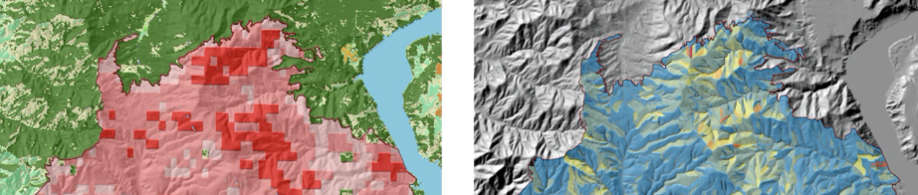
Researchers at the Space Science and Engineering Center at the University of Wisconsin – Madison are studying ways to rapidly generate near real-time wildland fire burn scar maps during the first 60-days after ignition. The purpose is to bridge the gap between significant fire scarring of the landscape, with its associated debris/mud flow risk, and the current availability of maps, which are often delayed until well after a fire is 80% contained. National Weather Service forecasters need information about the burn scars displayed in their forecasting software system (AWIPS) sooner, so they will have the situational awareness to potentially issue flash flood and debris flow warnings in a more timely manner. This site hosts information about these projects.